Hurricane Lorenzo Sets Off Weather Pattern Change Next 2 Weeks
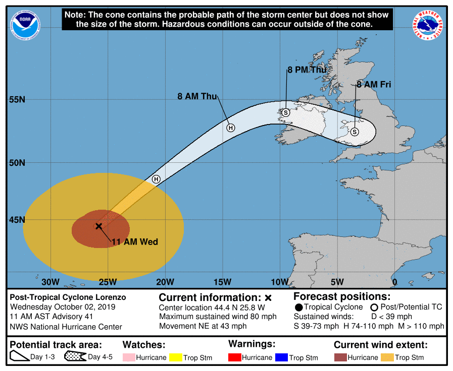
Sometimes it takes a big system to disrupt the upper air pattern particularly a stubborn one that has been in place for a few months. Hurricane Lorenzo is just such a system as it now moves away from the Azores and heads toward Ireland & Great Britain. It has become an extratropical cyclone (a non tropical storm) and as the satellite photo shows, Lorenzo no longer looks like a tropical cyclone. None the less strong winds and heavy rains are forecast for Ireland on Thursday with Met Erieann forecasting the potential for damaging wind gusts and we agree with this assessment of what to expect.
LORENZO SATELLITE

The National Hurricane Center’s forecast is for Lorenzo to track to the northwest coast of Ireland and then track east or east southeast into Wales and Southern England before weakening. Lorenzo then sets off a chain reaction across Europe and Asia disrupting the upper pattern across the Northern Hemisphere. This means that the big heat ridge in the Southeast US finally goes away after today.
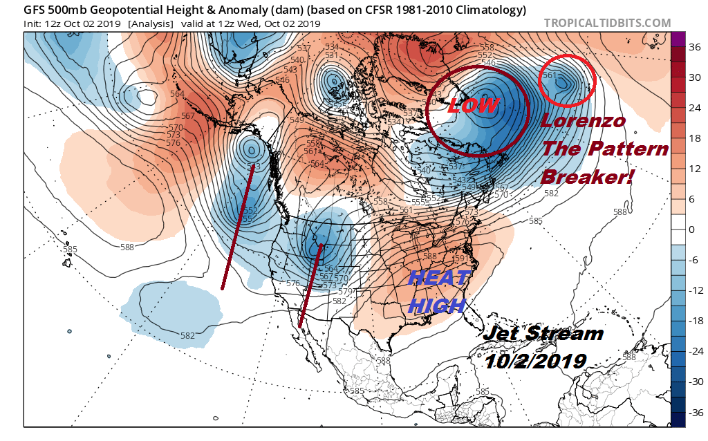
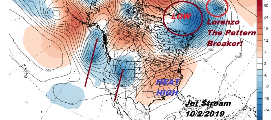
The heat ridge this morning is sitting there and you can see Lorenzo in the upper right of the jet stream map rotating around a strong upper low off the southern tip of Greenland. To our west we have the remnant trough of the weekend snow storm in Montana and another trough off the west coast. Watch what happens across the Northern Hemisphere over the next 10 days.
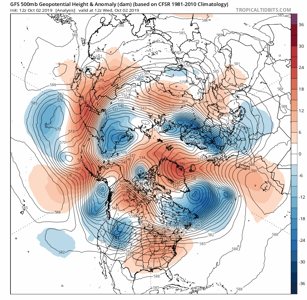
The dominant southeast upper high is gone. Gradually the entire upper air pattern shifts eastward with a series of troughs moving from west to east. Energy from Siberia begins to move into North America pushing the trough further to the east. This has several important ramifications. The first and obvious one is that the super hot days like today are done. Second it means that traffic is allowed to move from west to east and that means cold fronts will finally begin to move along and move deeper into the US. The third is much needed rain. After an unusually dry September we will now have opportunities for rain events going forward. In between weather fronts will be shots of cool dry air getting the feeling of autumn into the Northeast US as well as the Middle Atlantic. The endless days of 90 degree plus highs will be coming to an end in the Southeast US. We will see the first effects on Thursday with temperatures in many areas from Eastern Pennsylvania to Southern New England not out of the 50s! This will be a big change from today’s record breaking highs in the lower 90s.
MANY THANKS TO TROPICAL TIDBITS FOR THE USE OF MAPS
Please note that with regards to any tropical storms or hurricanes, should a storm be threatening, please consult your local National Weather Service office or your local government officials about what action you should be taking to protect life and property.


