Record High Temperatures Possible Today Late Thunderstorms Possible
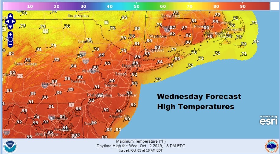
Summer is making its final stand today with hot and humid conditions that could set records. New York City for example has not seen a 90 degree high temperature in the month of October since 1941. We are looking at a thin layer of low clouds this morning that will burn off quickly to lots of sunshine at least into midday or early afternoon. The launching pad was set this morning with lows that were mostly in the mid 60s to lower 70s so if you have access to a beach or a pool it might get some use.
SATELLITE

REGIONAL RADAR

The regional radar shows rain and some heavier showers skimming across upstate New York and this is the east west frontal boundary that will be moving through late today and this evening with the chance for some showers and thunderstorms though i’m not expecting widespread activity from this.
LOCAL RADAR NEW YORK CITY

LOCAL RADAR PHILADELPHIA


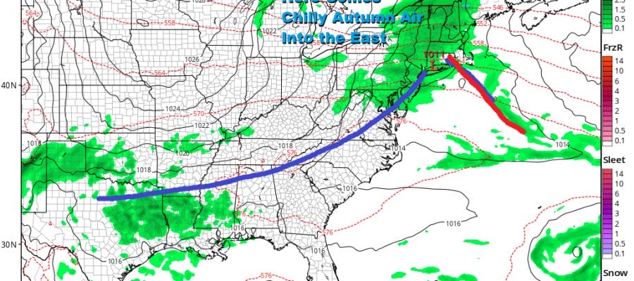
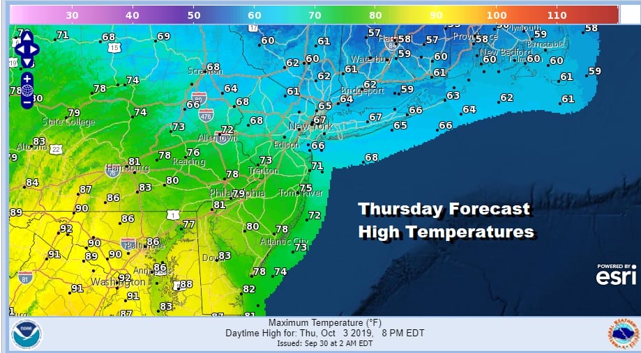
Thursday brings another front and it also brings for some areas a 30 degree change in temperatures. Some areas will see highs just into the 60s verses the highs near or over 90 today. The temperature spread Thursday is wide from north to south.
There is a second front that will be moving through Thursday evening so look for clouds and some showers before the front passes. Then we start to dry out into Friday morning and we are set for the arrival of nice cool air from Eastern Canada and the Great Lakes.
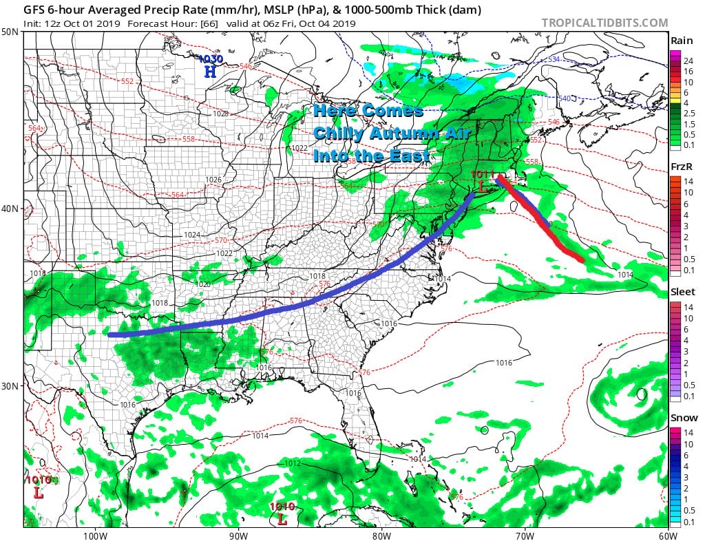
Sunshine returns for Friday with highs in the 60s and then we head into a very chilly night into Saturday morning with lows in the 30s inland and 40s along coastal areas and warmer urban areas. Saturday will be very cool with some sunshine. Highs will be in the upper 50s and lower 60s.
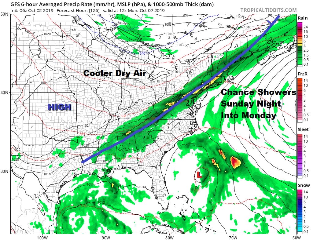
Sunday we will see the high move offshore as the next cold front approaches. We will see sunshine giving way to arriving clouds Sunday with highs in the 60s to near 70. It looks like we could see widespread showers Sunday night into Monday morning as the next cold front passes followed by cooler drier air for next week. Much of next week looks cool and dry for now with another front arriving late in the week. The upper high in the east is gone. The pattern is evolving and changing thanks to Hurricane Lorenzo and we will explore where this all takes us later today.
MANY THANKS TO TROPICAL TIDBITS FOR THE USE OF MAPS
Please note that with regards to any tropical storms or hurricanes, should a storm be threatening, please consult your local National Weather Service office or your local government officials about what action you should be taking to protect life and property.


