Humidity Relief On The Way
Watching Thunderstorms For This Evening & Tonight
We anxiously await the passage of a cold front to our west that will usher in a nice cool dry air mass. That dry air will start to arrive during the day Friday and then be solidly with us through Sunday. Ahead of it though sunshine has boosted temperatures up to near 90 in many locations and that has set us up for the chance for thunderstorms. As of 2pm we do not have any severe thunderstorm watch posted. The risk remains marginal for our area tonight. That means there could be some isolated severe thunderstorms in the mix of whatever develops so keep an eye to the sky. The chance increases this evening as the front nears.
SATELLITE

REGIONAL RADAR

Regional radar at the moment shows some thunderstorms in Northern Pennsylvania near the NY state border. Other showers and possible thundertorms are in Western Pennsylvania but so far the local radars aren’t showing much at all.
LOCAL RADAR NEW YORK CITY

LOCAL RADAR PHILADELPHIA 

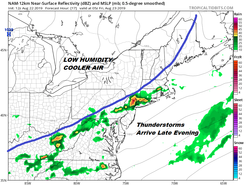
Right now I’m thinking there could be some scattered thunderstorms that develop going into this evening and then there will be a line of thunderstorms that come in from the west late this evening and last into the early morning hours. The front is moving slowly. It will temporarily get hung up over us which means we could see clouds and even a few linger downpours into daybreak Friday.
The front will drop southward during the day Friday which will lead to decreasing clouds and increasing afternoon sun from north to south. Temperatures will be topping out Friday in the upper 70s to lower 80s with a freshening wind from the north and then to the northeast. The humidity nosedives Friday night as temperatures head into the 50s with lower 60s in the warmer urban centers and along the coast.
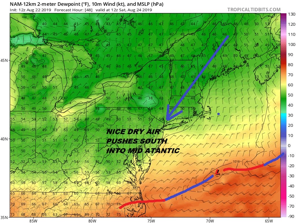
The front pushes well south into the Carolinas allow all this Canadian dry air push well south into the Middle Atlantic states. Dew points in the low 50s reach down into Virginia. Our area gets into the heart of the dry air. Saturday we will see lots of sunshine, a nice northeast breeze and most places won’t get out of the 70s for highs.

Sunday we have a slight dilemma thanks to the high moving into the Gulf of Maine and a northeast to east flow develops. This in and of itself isn’t a big deal however there will be a weak upper trough overhead which may mean a few clouds develop to mix with the sun but I still think it will be a nice day. Could there be a spot isolated rain shower? I can’t rule it out completely but lets say that 99 percent of you won’t see a thing. The flow off the ocean and the high where it is will keep temperatures in the low to mid 70s for highs with humidity remaining very low. Overall it will be a very good weekend indeed.
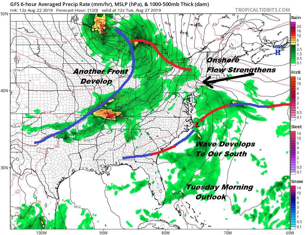
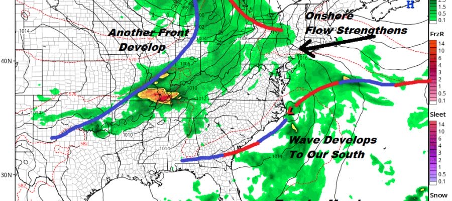
Humidity begins to slowly come back Monday as the onshore flow strengthens. We have the old front with a wave developing to our south and another front coming in from the west. We will get a bit squeezed here with arriving clouds on Monday with highs just in the low to mid 70s. We may see some rain ro showers Monday night into Tuesday as the wave moves northeastward. The wave will be developing off the Carolinas where sometimes these waves can acquire tropical characteristics if they sit around long enough. However it seems this system will be moving along and there won’t be much time for such a transition to occur. Next week brings that cold front from the west through here on Wednesday with another push of dry air headed our way possibly in time for the Labor Day holiday weekend. We will speculate more on this over the weekend and next week.
MANY THANKS TO TROPICAL TIDBITS FOR THE USE OF MAPS
Please note that with regards to any tropical storms or hurricanes, should a storm be threatening, please consult your local National Weather Service office or your local government officials about what action you should be taking to protect life and property.


