
Humidity Plus Heat Sunday Through Tuesday
More Bad Hair Weather!
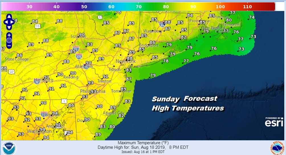
The soup continues today though today it will be hot soup. As usual in these high humidity air masses we start the day with low clouds and then gradually see some sunshine develop followed by pop up showers and thunderstorms. Such is the pattern of action today. Winds will be from the southwest which is a change from the east winds of the last few days. This means temperatures head higher as highs reach the upper 80s to lower 90s. This is going to be a very uncomfortable day indeed so do whatever it takes to stay cool and comfortable
SATELLITE

REGIONAL RADAR

Not much is happening on the radar this morning other than on the extreme ends with downpours in Eastern North Carolina as well as some showers and thunderstorms in Northwest Pennsylvania and parts of Western NY. We are quiet for now on the local radars though an isolated shower cant be ruled out.
LOCAL RADAR NEW YORK CITY

LOCAL RADAR PHILADELPHIA 

On to the week ahead which will start off with us in a steam bath for Monday with sunshine and clouds, Monday will be hot and humid as highs will reach the upper 80s and lower 90s and we may push a few spots up to 94 or 95 for the highs. Again with all this heating some pop up showers or thunderstorms are possible but they will be scattered in nature.
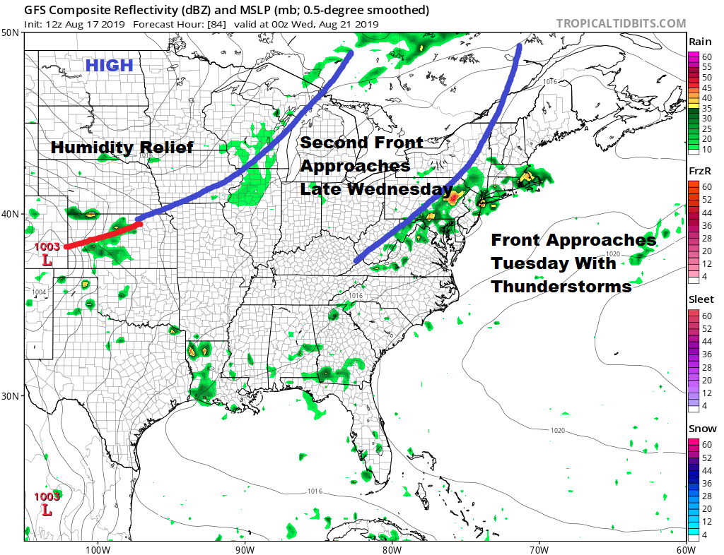
Our weather fronts are still on course for Tuesday and for Wednesday night/early Thursday which gives us two shots for thunderstorms here. Tuesday will be hot and humid with some sun and highs in the upper 80s to lower 90s with a good chance for some late day thunderstorms. Wednesday will be still be humid because we will have to wait for the second front to pass for some real relief. Highs Wednesday will be in the 80s. It may be another instance of how much is left for this front to work on but we will include the chance for a shower or a thunderstorm and that front does get hung up a bit on Thursday which at the very least will mean some clouds around.
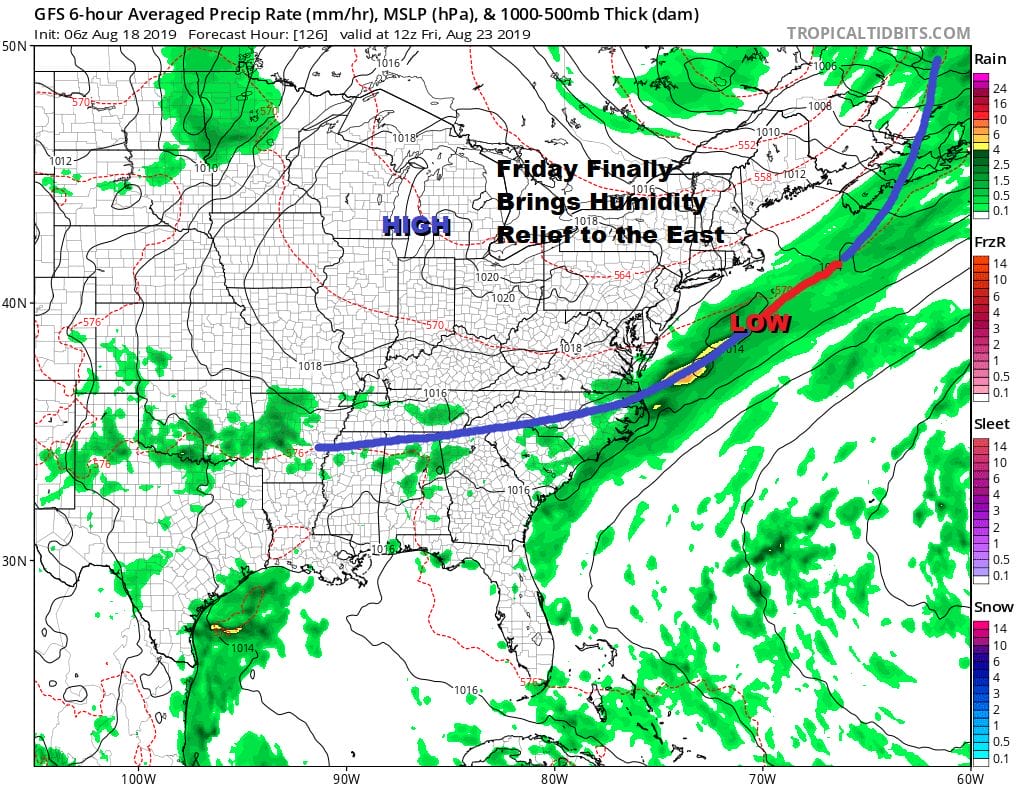
Finally some real humidity relief will begin to arrive as early as late Thursday but for sure by Friday as the front settles southward and a nice little high builds in to finish off the week with some sunshine. Temperatures will be trending down toward the end of the week. Highs on Thursday will be in the low to mid 80s with highs Friday in the upper 70s to lower 80s but by Friday the humidity should be gone for at least a day or two…possibly through next weekend before the next round of warmer more humid conditions begins.
MANY THANKS TO TROPICAL TIDBITS FOR THE USE OF MAPS
Please note that with regards to any tropical storms or hurricanes, should a storm be threatening, please consult your local National Weather Service office or your local government officials about what action you should be taking to protect life and property.


