Pop Up Thunderstorms Otherwise High Humidity Heat Sunday Through Tuesday
A few areas have seen some pop up scattered downpours or thunderstorms during the afternoon. They come and go rather quickly but if you were “lucky” enough to get one the result was the steam bath that was left behind. Temperatures are into the 80s, humidity levels are very high. Truly the dog days of August pattern is with us. There could still be some pop up thunderstorms between now and sunset before the atmosphere settles down to a warm and humid night with most lows in the upper 60s to middle 70s.
SATELLITE

REGIONAL RADAR

Regional radar is showing a line of severe thunderstorms moving across Upstate NY to Northwest Pennsylvania. We have already seen numerous severe thunderstorm warnings there and a watch is up for Northwest Pennsylvania. For everyone else it is scattered pop up thunderstorms that are still dotting the regional and local radars. The southern part of that line of storms in NYC is going to reach down into the Catskills and we might see parts of the Hudson Valley north of Route 84 into Northwest Connecticut get clipped by it before it weakens and falls apart later this evening.
LOCAL RADAR NEW YORK CITY

LOCAL RADAR PHILADELPHIA 

Sunday we will see the wind go to the southwest which means that temperatures rise with already high humidity. Pop up scattered thunderstorms are possible but no widespread activity is forecast. Highs will reach the upper 80s and lower 90s. There will be clouds to start the day but we should break out to sunshine a bit faster on Sunday now that the onshore flow disappears tonight.
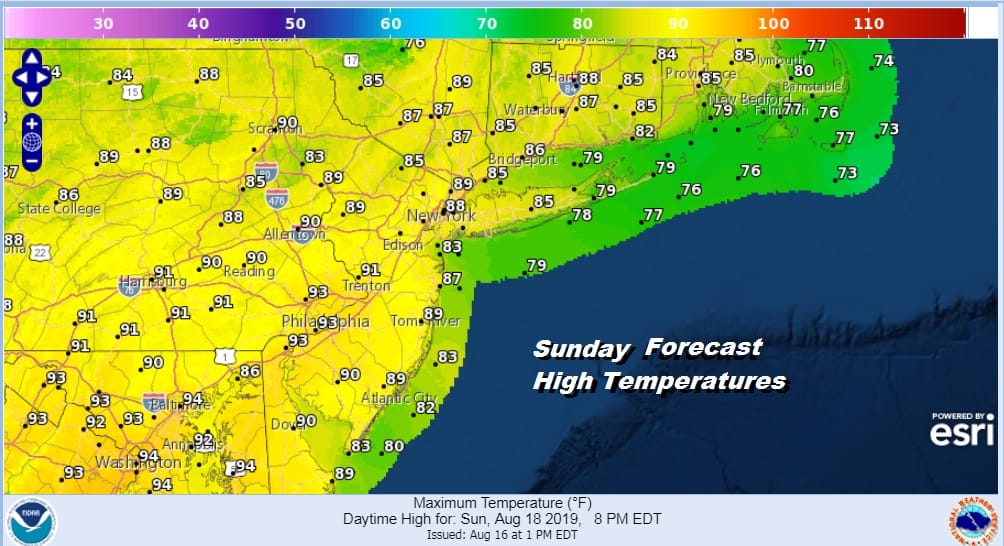
There is no change in the outlook for next week. A weak upper trough on Monday will turn the winds more westerly which means it is going to be hot with sunshine along with the odd pop up shower or thunderstorms. Highs will reach the low 90s and a few spots could push it to 94 or 95 with high humidity.

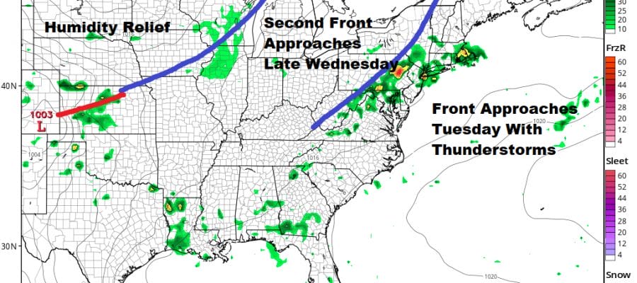
Tuesday brings the first of two cold fronts. This front front will bring the chance for thunderstorms late in the day into Tuesday evening and some of these thunderstorms could be on the strong side. We will evaluate any severe weather risks tomorrow. Tuesday’s highs will be a little lower than Monday’s with highs in the upper 80s to lower 90s.
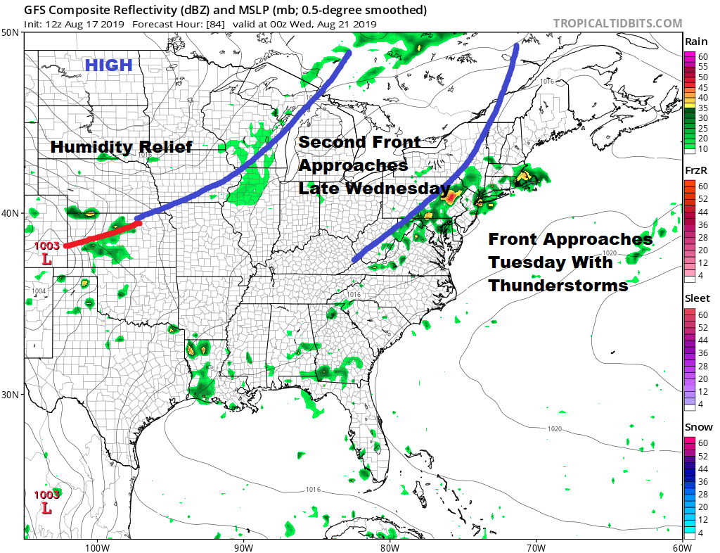
Front number 2 will approach for Wednesday with another shot for showers and thunderstorms late in the day or Wednesday night. That second front may get briefly hung up into Thursday before it pushes offshore and then we look to see whether that next high will be strong enough to push in with humidity relief for the end of the week.
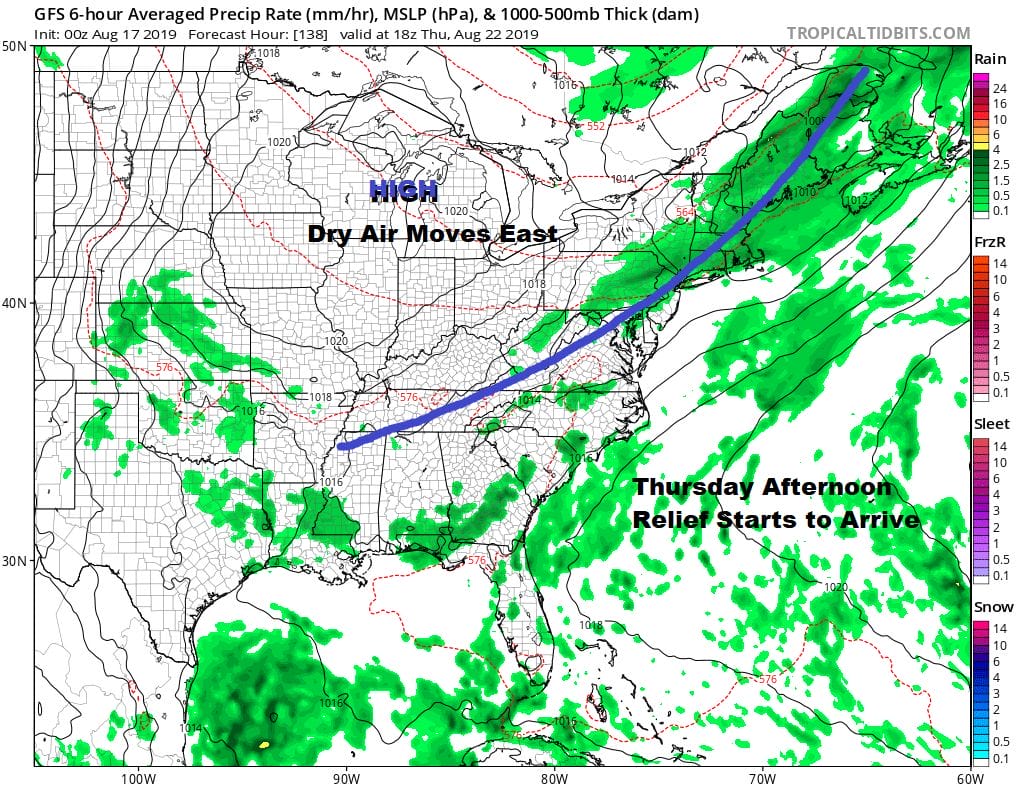
The front is struggling through Thursday afternoon and that might leave us with a lingering shower or thunderstorm threat and then we should finally see the humidity drop somewhat Thursday night into Friday. How long that dry air lasts remains to be seen as another system approaches which could bring the humidity back at some point next weekend.
MANY THANKS TO TROPICAL TIDBITS FOR THE USE OF MAPS
Please note that with regards to any tropical storms or hurricanes, should a storm be threatening, please consult your local National Weather Service office or your local government officials about what action you should be taking to protect life and property.


