
Heavy Rain Overnight Sunday Slow Improvement Monday
Heavy Rain Overnight Sunday Slow Improvement Monday
We have been experiencing rain and some waves of heavy rain. This will continue overnight and through Sunday. The satellite picture shows lots of Gulf of Mexico Moisture being drawn up the East Coast. Low pressure is moving up the Appalachians on a frontal boundary. The low will pass close by on Sunday as the front then eases through. Temperatures have been in the upper 40s and lower 50s and they will probably hold there overnight and on Sunday.
US SATELLITE

REGIONAL RADAR

The regional radar shows more heavy rains building across Virginia moving northeastward and this area should be passing through overnight and Sunday morning. Local radars below show some breaks in between each wave and when it is not raining we will just have drizzle and fog in between.
LOCAL RADAR NEW YORK CITY

LOCAL RADAR PHILADELPHIA


So far about a quarter to a half inch of rain has fallen and the forecast for up to 2 inches of rain seems reasonable. Rain will begin to shift offshore Sunday night and weather conditions should begin to improve during Monday with clouds giving way to some sunshine. Temperatures Monday will be in the 40s.
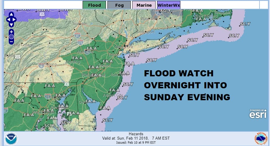
FLOOD WATCH CONTINUES ACROSS ALMOST ALL OF NEW JERSEY SOUTH
INTO SOUTHEASTERN PENNSYLVANIA OVERNIGHT & SUNDAY
The counties of Northeastern New Jersey have been added to the flood watch which now covers all of New Jersey except the northwestern counties. The watch continues for Southeastern Pennsylvania, most of Delaware, Maryland, and Northeast Virginia.
 GET JOE A CIGAR IF YOU LIKE

FiOS1 News Weather Forecast For Long Island
FiOS1 News Weather Forecast For New Jersey
FiOS1 News Weather Forecast For Hudson Valley


