WARM HUMID CONDITIONS INTO THURSDAY
HEAVY DOWNPOURS THURSDAY WITH COLD FRONT
MICHAEL WILL PASS SOUTHEAST OF NJ LONG ISLAND FRIDAY MORNING
WEATHER PATTERN CHANGE TO COOL AUTUMN WEATHER
While Hurricane Michael strengthens and heads to the Florida Panhandle on Wednesday we will be still sitting in the same warm humid air mass. Wednesday we should see more sun that we have seen in the last several days. Humidity levels will be high and temperatures will reach into the 80s in many locations. If you like this type of weather, enjoy it because big changes are coming on Thursday., Low clouds are on the satellite loop tonight much like the last several nights but we have no rain showing up anywhere close on the radar.
EASTERN SATELLITE

REGIONAL RADAR

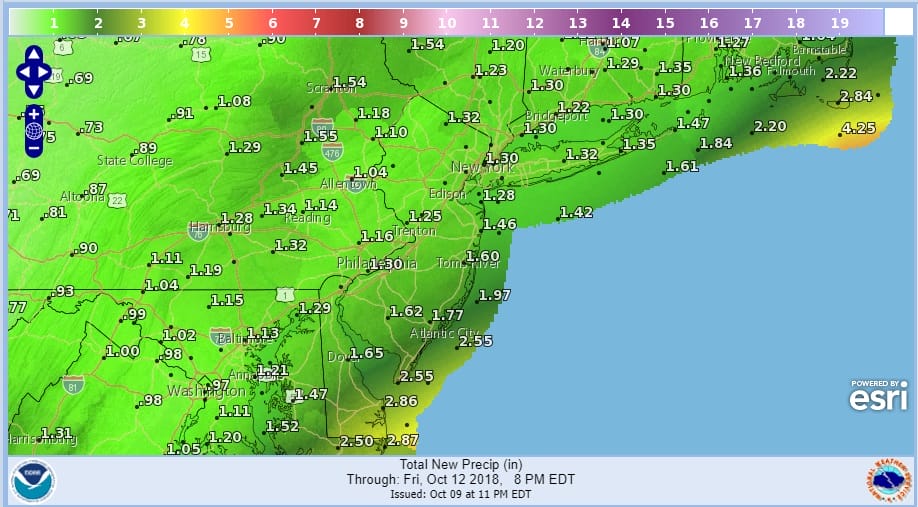
Thursday starts the process of the big pattern change across North America that may lock in for awhile. The heat and humidity will go away but we will have showers and thunderstorms on Thursday with some locally heavy downpours. 1 to 2 inches of rain is likely with some locally higher amounts possible.
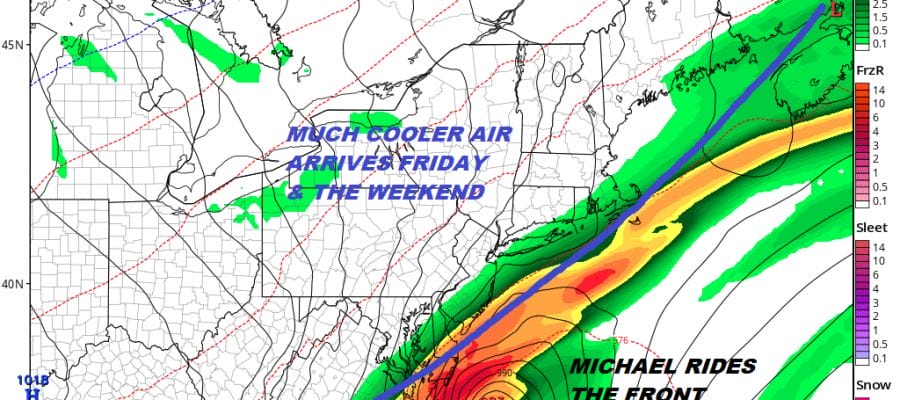
Michael will likely make a close enough pass to graze Southernmost New Jersey with some additional rain early Friday but that should be as far north as it gets. Then as the cold front it is riding pushes further south a nice big high slowly builds in with very cool Canadian air.
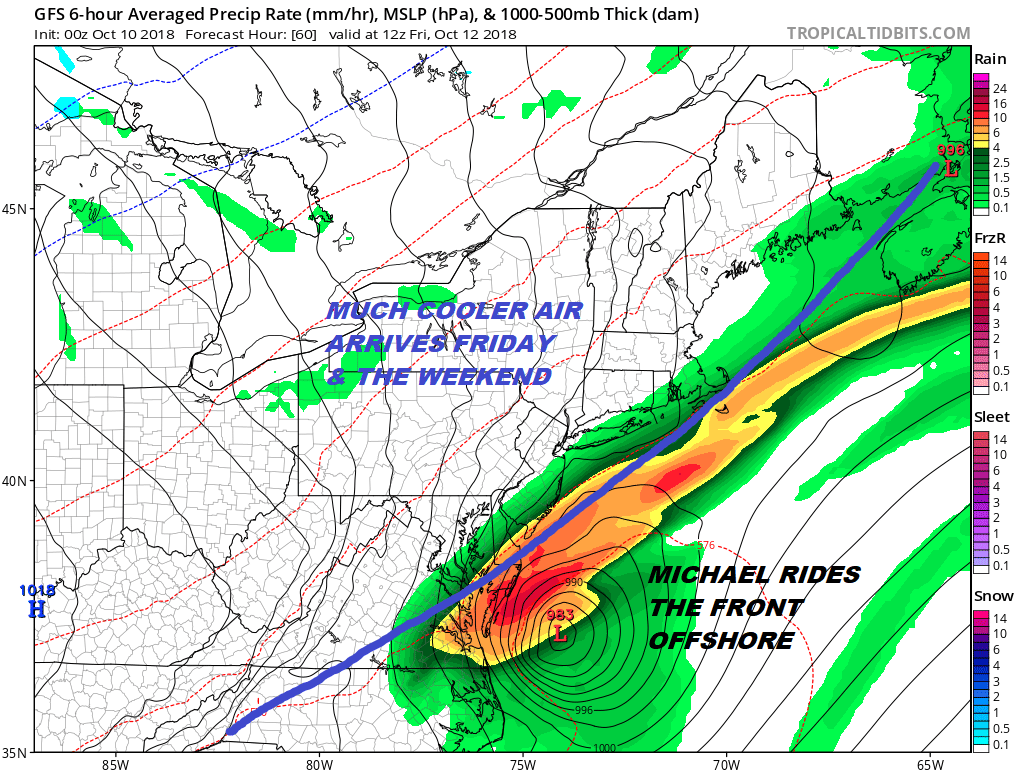
Unlike some of the brief cool shots of air this one is significant because it is coming with a big wholesale pattern change across all of North America. The ridge along the East Coast is gone and the pattern flips with an upper high in the west and a strong trough controlled by a Canadian vortex in the East.
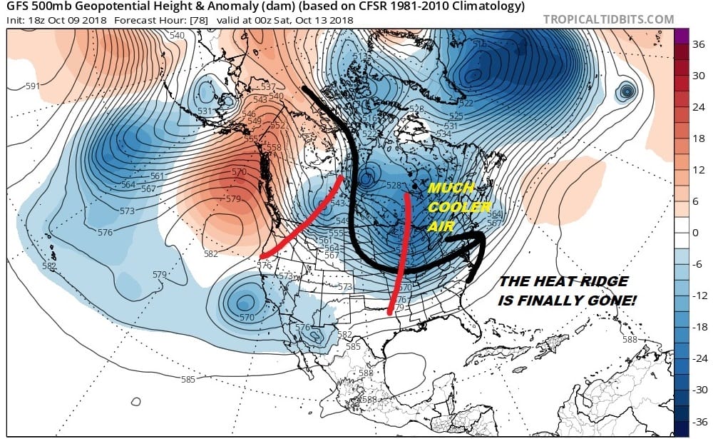
This pattern looks to have staying power in the long range as once this upper trough pulls out another one comes right in to replace it early next week. The long range looks cool overall for the next couple of weeks. If you love Autumn then it appears that your time has finally arrived.
HURRICANE MICHAEL IS STRENGTHENING RAPIDLY TONIGHT. HERE IS THE LATEST ON MICHAEL. ADDITIONAL COVERAGE CAN BE FOUND ON MY NEW PATREON PLATFORM
SUBSCRIBE TO PATREON FOR A WEATHER EXPERIENCE FREE OF ADS, EXCLUSIVE VIDEOS FOR MEMBERS ONLY AND MUCH MORE…STARTS AT $2 A MONTH..MESSAGE ME AT ANY TIME

MANY THANKS TO TROPICAL TIDBITS FOR THE USE OF MAPS
Please note that with regards to any tropical storms or hurricanes, should a storm be threatening, please consult your local National Weather Service office or your local government officials about what action you should be taking to protect life and property.
LATEST JOESTRADAMUS ON THE LONG RANGE


