Heatwave Length Depends On Backdoor Cold Front

Heatwave Length Depends On Backdoor Cold Front
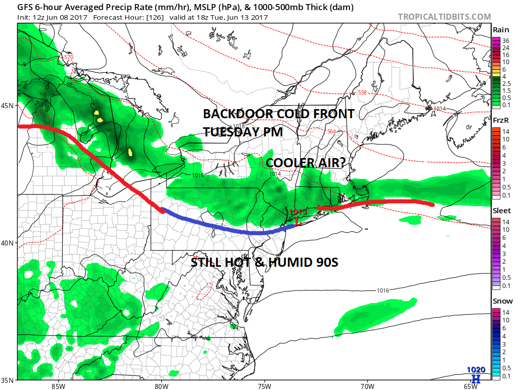
The well telegraphed heatwave remains on course for early next week however there are some complications that have developed. Specifically it has to do with a backdoor cold front dropping down from upstate New York. We call them backdoor cold fronts because rather than come in from the west, they come in from the north or northeast which is the reverse of the normal pattern. They usually impact only the bottom of the atmosphere as they tend to be shallow cool air masses with a marine influence. This is especially evident in the spring as the ocean water remains cold relative to the heating land temperature. We have certainly seen our fair share of ocean air this spring.
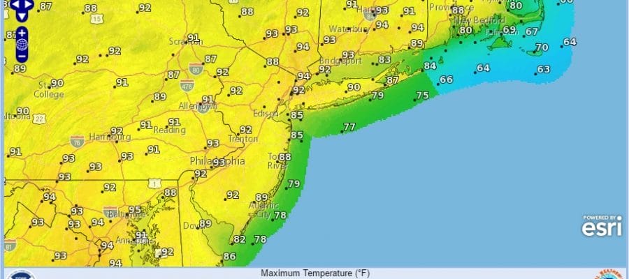
Sunday will be the first day of 90 degree temperatures for some areas but not all. Monday will I believe be the hottest day of this stretch with highs of 90 to 95.

Tuesday becomes the first day in question with the timing of the backdoor front. The GFS has it sitting right across NYC & Long Island and across Central New Jersey Tuesday afternoon. If this is right, areas to the north will might get to 90 early in the day before dropping off a bit. South of the front though in Central & Southern New Jersey, Souheastern Pennsylvania southward into Maryland, it should make low to mid 90s. Then there is the question of scattered thunderstorms as well. However bear in mind the European and the late afternoon GFS are a bit slower than the GFS was earlier which means Tuesday will be hot for much of the area before the backdoor front slips south.
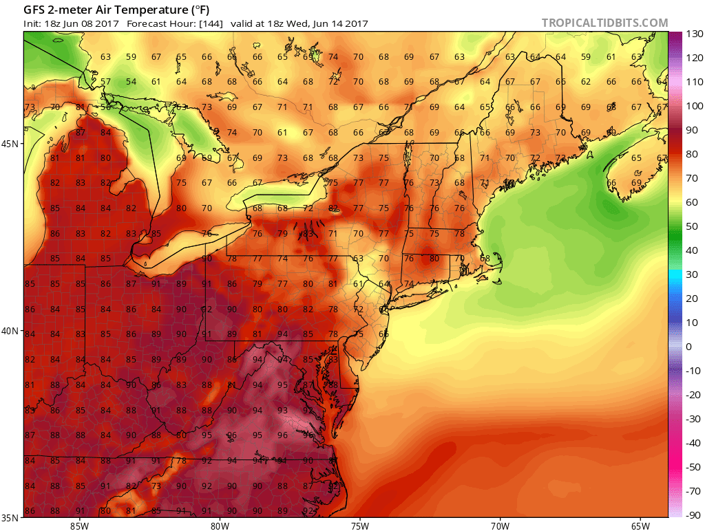
Either way the front does slip south and you can see the temperature changes for Wednesday with highs in the cooler upper 70s to lower 80s across much of the area. 90s get pushed southward into Virginia and North Carolina. After that a stronger front comes in from the west at the end of next week with the chance for downpours and thunderstorms. In sum, this heatwave will be short and only 3 days. By the old 5 day standard for heataves, this one would not even register.
MANY THANKS TO TROPICAL TIDBITS FOR THE WONDERFUL USE OF THE MAPS

GET JOE A CIGAR IF YOU LIKE!
LANDSCAPE COMPANIES FOR YOUR SPRING SUMMER FALL NEEDS
LONG ISLAND ROCKLAND COUNTY Connecticut

![]()

ROCKLAND COUNTY TRI STATE SNOW REMOVAL JOHNSTOWN PA


FiOS1 News Weather Forecast For Long Island
FiOS1 News Weather Forecast For New Jersey
FiOS1 News Weather Forecast For Hudson Valley
NATIONAL WEATHER SERVICE SNOW FORECASTS
LATEST JOESTRADAMUS ON THE LONG RANGE
Weather App

Don’t be without Meteorologist Joe Cioffi’s weather app. It is really a meteorologist app because you get my forecasts and my analysis and not some automated computer generated forecast based on the GFS model. This is why your app forecast changes every 6 hours. It is model driven with no human input at all. It gives you an icon, a temperature and no insight whatsoever.
It is a complete weather app to suit your forecast needs. All the weather information you need is right on your phone. Android or I-phone, use it to keep track of all the latest weather information and forecasts. This weather app is also free of advertising so you don’t have to worry about security issues with your device. An accurate forecast and no worries that your device is being compromised.
Use it in conjunction with my website and my facebook and twitter and you have complete weather coverage of all the latest weather and the long range outlook. The website has been redone and upgraded. Its easy to use and everything is archived so you can see how well Joe does or doesn’t do when it comes to forecasts and outlooks.
Just click on the google play button or the apple store button on the sidebar for my app which is on My Weather Concierge. Download the app for free. Subscribe to my forecasts on an ad free environment for just 99 cents a month.
Get my forecasts in the palm of your hand for less than the cost of a cup of Joe!
![]()


