DOWNLOAD MY NEW FREE JOESTRADAMUS WEATHER APP FOR ALL DEVICES
THE APP IS ABSOLUTELY FREE TO ALL BUT CONSIDERING SUBSCRIBING TO PATREON FOR A WEATHER EXPERIENCE FREE OF ADS, EXCLUSIVE VIDEOS FOR MEMBERS ONLY AND MUCH MORE…STARTS AT $2 A MONTH..MESSAGE ME AT ANY TIME
Gloom Doom Clouds Drizzle Fog Better Friday Cold Weekend
Overnight rains have come and gone on schedule and today we sit with a warm front to south, a low to the east and an onshore flow which this time of year is almost never a good thing. Lots of clouds are around and temperatures are in the rather raw 40s with an ocean wind. It looks to be the kind of day where we will sit in the gloom and doom. Some spots might get lucky with the occasional brightening of skies but that should be about it as far as sun is concerned.
EASTERN SATELLITE

REGIONAL RADAR

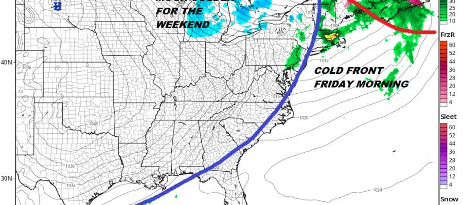
It is quiet on the radar scene as well. Outside of some pacthy light rain or drizzle that might develop e should be okay. It is just another day in the Maritimes. Then tonight a warm front approaches and moves through or at least attempts to move through. Clouds drizzle and patchy fog will be around with temperatures holding in the 40s or even rising into the 50s. Friday morning other than a passing shower or two, clouds will move out and we should see some sunshine develop for the afternoon. Highs could reach 60 before cold air moves in for the weekend.
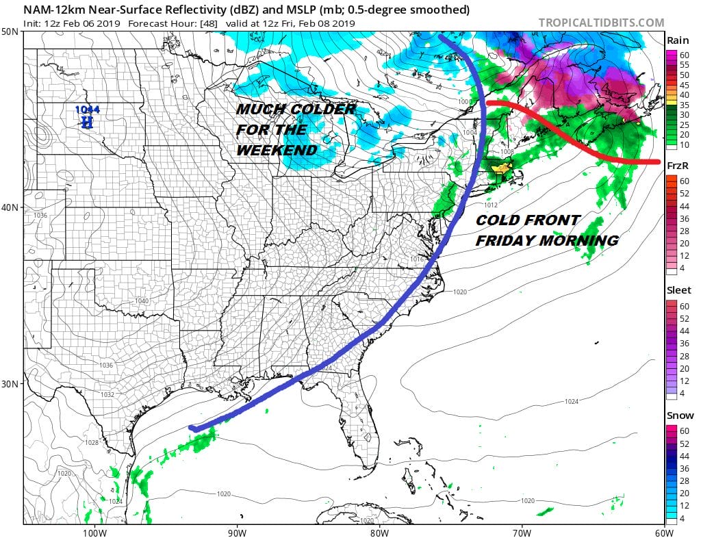
The first of two highs coming down from Canada will play through into Sunday separated by a front and weak wave in between Sunday night into Monday morning. There is a chance for a period of snow or flurries Sunday night that perhaps whitens the ground or a bit more. Otherwise we spend the weekwnd with temperatures in the 30s and nights in the teens and lower 20s. There is a chance all the snow dries up west of the mountains in Pennsylvania and we see little if anything from this.
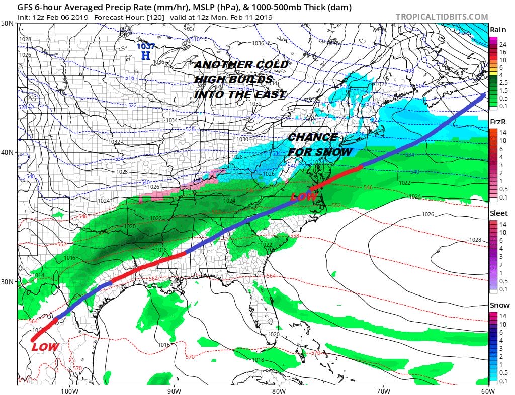
We then set things up for a stronger storm to come out of the Southern Plains and make the turn toward the Great Lakes. There really is little hope here for snow lovers. Monday will be dry with sunshine. Highs will be in the 30s. Then look for arriving clouds Tuesday with snow developing later in the day

It will be a matter of how long you hold on to the cold air before a change to sleet and rain takes place. Does it last for an hour or two and you get a coating to a couple of inches before you lose it or does it perhaps last a solid 4 to 6 hours and you put down several inches or a bit more before it changes to sleet and then a soaking rain? I would lead to the former idea at the moment given the model tendencies to over do cold air lately in situations with highs to the north. Besides this will be a short term problem for next week.
MANY THANKS TO TROPICAL TIDBITS FOR THE USE OF MAPS
Please note that with regards to any tropical storms or hurricanes, should a storm be threatening, please consult your local National Weather Service office or your local government officials about what action you should be taking to protect life and property.


