
Frozen Northeast Continues Snow Possible Thursday Coast
Frozen Northeast Continues Snow Possible Thursday Coast
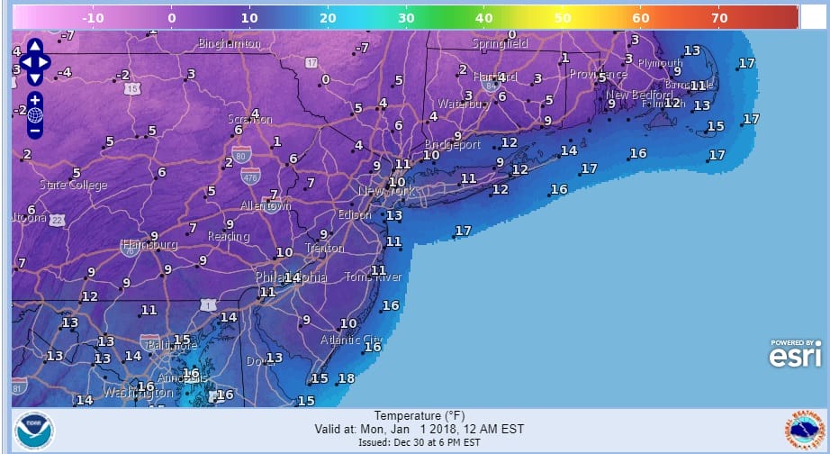
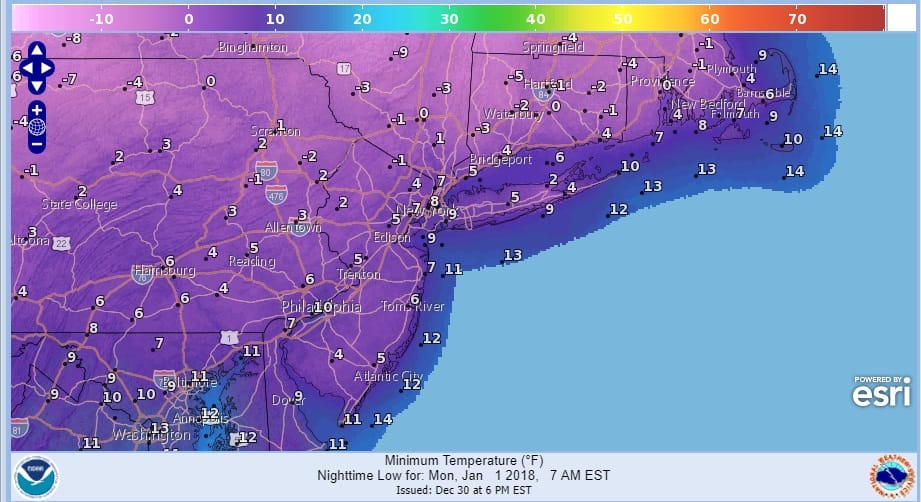
We begin the next round of Arctic air for the already frozen Northeast with temperatures this morning starting out in the single digits and teens and we are pretty much staying in the teens this morning. Your midnight temperatures when the ball drops are above. Your morning low temperature forecast for Monday is below and we will be down in the low single digits to below zero.
The satellite loop this morning shows a couple of weak upper air disturbances moving through today with clouds. We have some around this morning and there are likely to be a few more from time to time today. Winds will be picking up and temperatures will be holding in the teens with wind chills below zero. The odd snow shower could pop up but other than that we have no snow issues here until midweek.
SATELLITE LOOP

REGIONAL RADAR

Monday and Tuesday will be brutally cold with highs in the teens and lows in the single digits to below zero with ineffective sunshine both day. Plain and simple forecast really!. Then we turn our attention to a storm that is going to develop off the Florida East coast and ride northeastward up the coast and just offshore. This system is going to become a major Atlantic Ocean coastal storm. The problem is that the surface low starts out off the Florida East Coast which is going to mean for an offshore track and a sharp western edge of accumulating snow which might reach the coast or just barely inland.
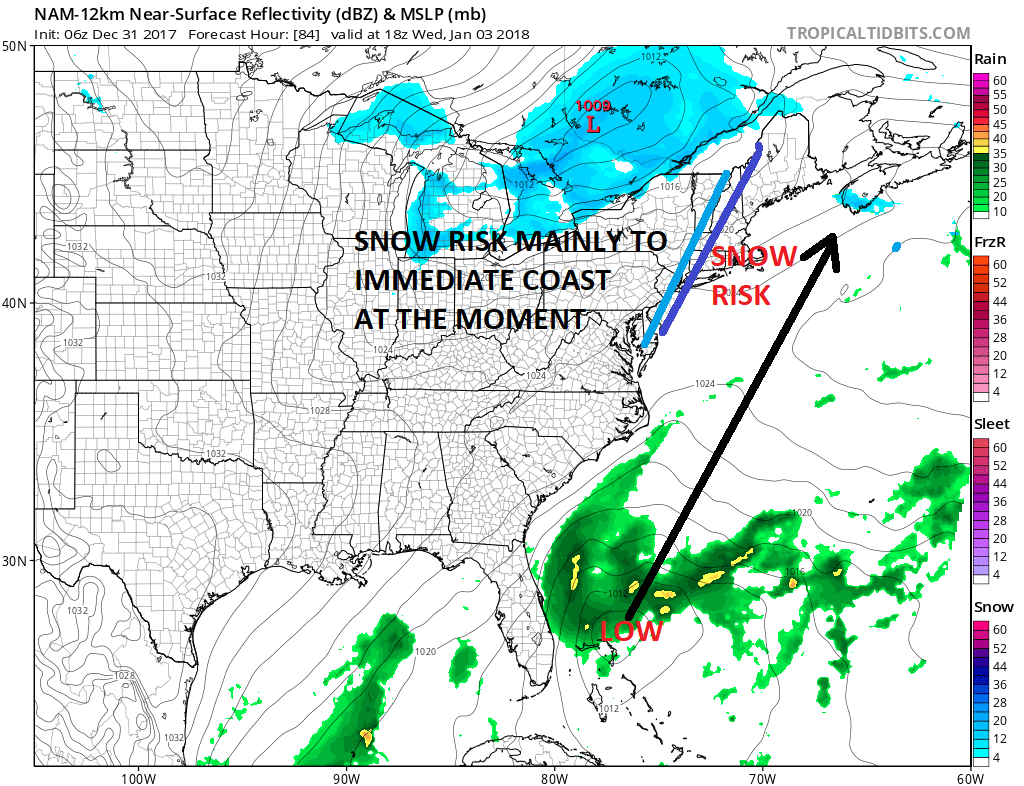
The question of a major Atlantic Ocean storm is not the issue. There will be one. The issue is track plain and simple. I would say at this point that the risk for heavy snow has increased for Southeastern New England for sure..and I think the risk for some heavier snows extends south to Long Island and Connecticut eastward. On the map above the light blue line mught be the back edge of accumulating snow and the darker blue might be the back edge of 4 inches or more. i’M JUST GUESSING HERE AT THIS POINT. Models will continue to wobble in both directions. The European model is furthest west with all this with the GFS furthest east but not that far off.
Regardless of snow another bitter cold air mass follows with temperatures heading to the single digits to below zero for Friday and Saturday. This will be one of the coldest weeks in decades across the Northeast.
 GET JOE A CIGAR IF YOU LIKE

FiOS1 News Weather Forecast For Long Island
FiOS1 News Weather Forecast For New Jersey
FiOS1 News Weather Forecast For Hudson Valley


