
DOWNLOAD MY NEW FREE JOESTRADAMUS WEATHER APP FOR ALL DEVICES
THE APP IS ABSOLUTELY FREE TO ALL BUT CONSIDERING SUBSCRIBING TO PATREON FOR A WEATHER EXPERIENCE FREE OF ADS, EXCLUSIVE VIDEOS FOR MEMBERS ONLY AND MUCH MORE…STARTS AT $2 A MONTH..MESSAGE ME AT ANY TIME
Fog Showers Improvement Friday
Cold Weekend Chance Snow Sunday Night
We are struggling this evening with a cold front to the west and a warm front to our south that is having a very tough time moving northward. Low pressure from last night is offshore keeping an onshore flow here. We are sitting in lots of clouds and some patchy dense fog is beginning to develop in some areas. This could be an issue overnight so be careful on your travels.
EASTERN SATELLITE

REGIONAL RADAR

It has been a solid overcast all day and that continues with the regional radar showing showers to the west in Pennsylvania. The bulk of those should pass north and east of the coast by a fair distance but areas in Northeast Pennsylvania and Northwest New Jersey to the Hudson Valley and into Northern Connecticut might get clipped by these later this evening.
LOCAL RADAR NEW YORK CITY

LOCAL RADAR PHILADELPHIA


Friday morning the cold front passes and while there could be a passing shower around daybreak, afterwards gusty northwest winds take over with some developing sunshine. Temperatures should briefly reach the 50s and then start to ease later in the day and by Saturday morning under clear skies we will be in the upper teens to mid 20s. Saturday looks nice with less wind but cold with sunshine and highs mostly in the 30s.
CHANCE FOR SNOW SUNDAY NIGHT INTO EARLY MONDAY
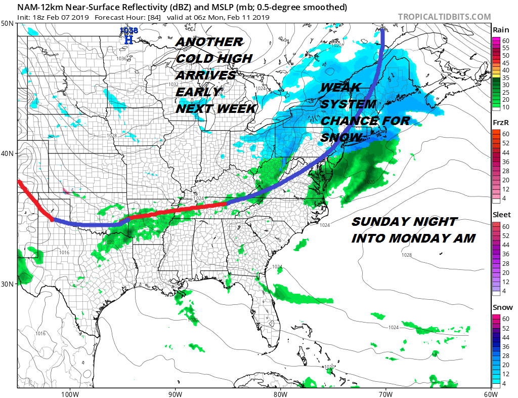
Sunday high pressure slips offshore and another cold high starts to make its way toward us from Central Canada. The system in between is a weak cold front with a bit of a wave on it. Snow could be developing Sunday evening as the system moves across Pennsylvania. This area of snow if it holds together could produce a coating to an inch or so in some areas before it moves out Monday morning. Then we sit back and wait for system number 2 for later Tuesday.
You can read more on the second system for Tuesday by going to the latest JOESTRADAMUS long range post.
MANY THANKS TO TROPICAL TIDBITS FOR THE USE OF MAPS
Please note that with regards to any tropical storms or hurricanes, should a storm be threatening, please consult your local National Weather Service office or your local government officials about what action you should be taking to protect life and property.


