
FLOODING RAINS CONTINUE INTO THE EVENING
VERY WARM HUMID CONDITIONS TONIGHT & WEDNESDAY
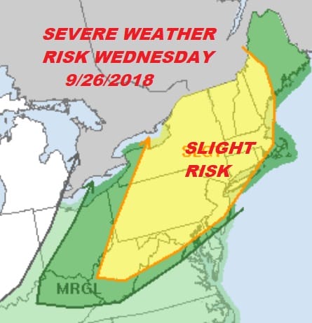
SEVERE WEATHER THREAT LATE WEDNESDAY & WEDNESDAY EVENING
The one two punch of the warm front cold front combination continues with flooding rains going on for the evening commute. So far rainfall amounts have been on the order of 4 to 5 inches in and around NYC & Northeast New Jersey into Southern Westchester and Southwest Connecticut.
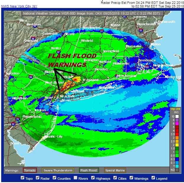
We have a growing area of 4 inch plus rains in the areas in red and more rain is forecast through the evening before we finally see the rain pull away to the northeast. This is not going to be a fun evening commute by any means.
EASTERN SATELLITE

REGIONAL RADAR

The rain shield borders the warm front which has pushed the afternoon heavy rain north of Long Island and much of Central and South Jersey. Temperatures there have risen into the 70s. The local radar shows more heavy rains moving through so look for rainfall amounts to go higher and a large area will join the 4 inch plus zone.
LOCAL RADAR NEW YORK CITY

LOCAL RADAR PHILADELPHIA


Warm humid conditions overnight will likely produce some dense fog in some areas. Then Wednesday is all bad hair for sure with very warm humid conditions with temperatures in the 80s. The stage is set for the cold front to arrive late in the day and in the evening. The atmosphere will be very unstable, dew points will be in the 70s so the table is set for strong to severe thunderstorms in the late afternoon and evening. The Storm Prediction Center has a slight risk for severe but don’t be shocked if we wake up tomorrow morning to an enhanced risk.
Better weather comes in Thursday with clouds and some sun. The southern end of the front stall with a little wave on the front. This could produce clouds and a couple of showers late Thursday night into early Friday before weather conditions improve after that.
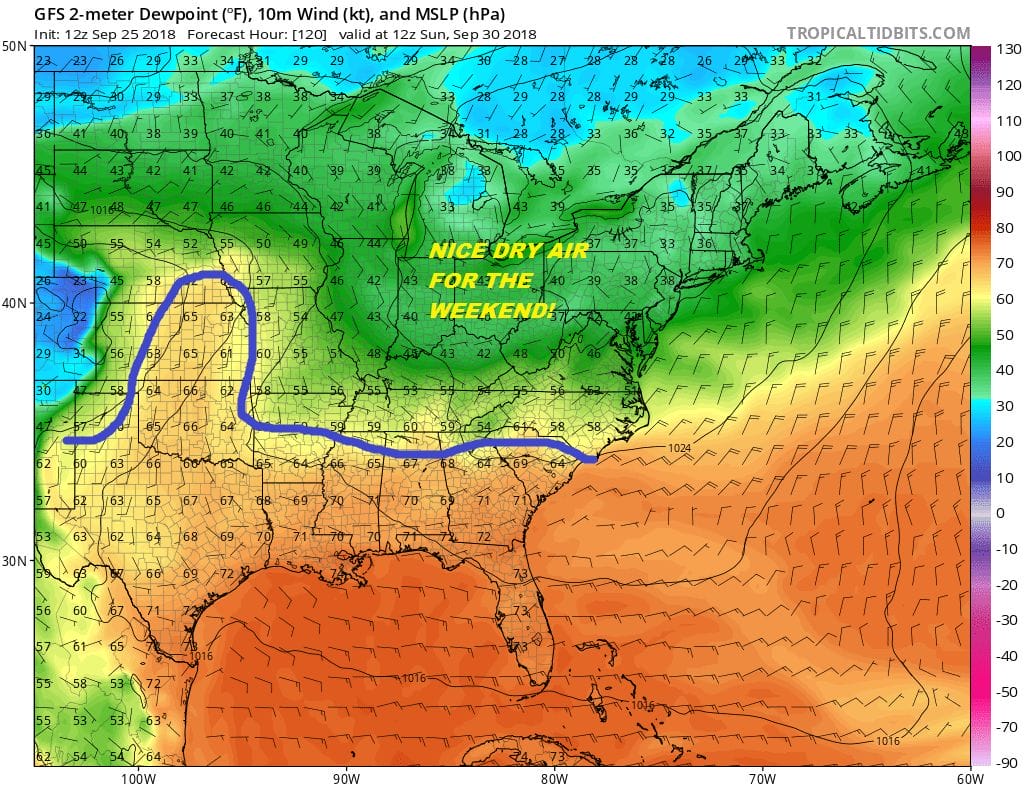
The payoff for all this comes this weekend as a nice dry high builds in and doesn’t build to the north but to the west of us. This means no onshore flow and a really strong push of dry air. Dew points on the GFS fall to the 30s in many areas by Sunday morning. We are looking at sunshine for Saturday and Sunday with just some passing clouds and highs into the 70s both days. It will be a well deserved nice weekend.
SUBSCRIBE TO PATREON FOR A WEATHER EXPERIENCE FREE OF ADS, EXCLUSIVE VIDEOS FOR MEMBERS ONLY AND MUCH MORE…STARTS AT $2 A MONTH..MESSAGE ME AT ANY TIME

MANY THANKS TO TROPICAL TIDBITS FOR THE USE OF MAPS
Please note that with regards to any tropical storms or hurricanes, should a storm be threatening, please consult your local National Weather Service office or your local government officials about what action you should be taking to protect life and property.
LATEST JOESTRADAMUS ON THE LONG RANGE

