DOWNLOAD MY NEW FREE JOESTRADAMUS WEATHER APP FOR ANDROID
THE APP IS ABSOLUTELY FREE TO ALL BUT CONSIDERING SUBSCRIBING TO PATREON FOR A WEATHER EXPERIENCE FREE OF ADS, EXCLUSIVE VIDEOS FOR MEMBERS ONLY AND MUCH MORE…STARTS AT $2 A MONTH..MESSAGE ME AT ANY TIME
Flood Watch Heavy Rain Much Colder Friday Weekend
Polar Vortex Drops Into US Next Week Bitter Cold Returns
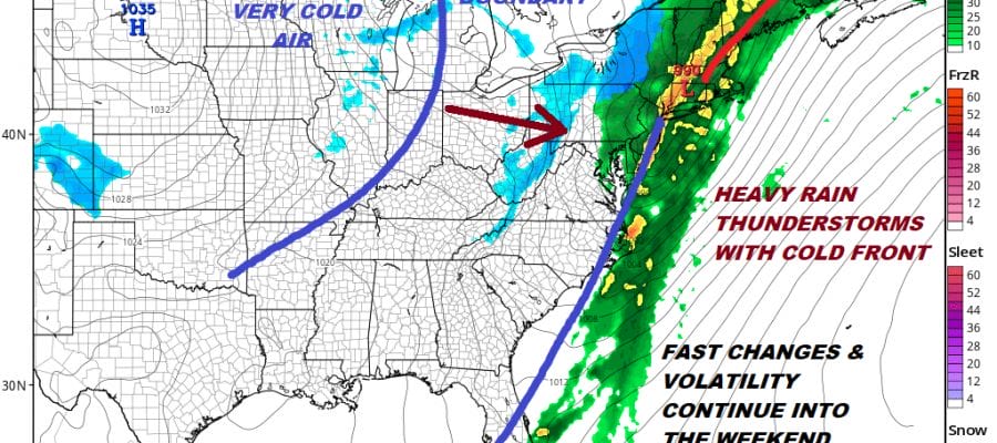
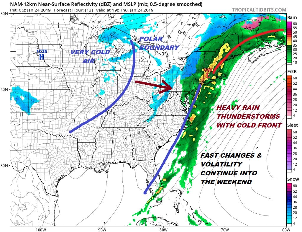
Flood Watch and Wind Advisories are on the table today with the wind advisories along the coast. Winds from the south to southwest could gust to 50 mph today ahead of a strong cold front. Rain on the order of 1 to 2 inches is also in the cards and there is the chance for a thunderstorm around midday to early afternoon as a cold front begins to pass. All of this coming with temperatures in the 50s completes the huge swing in temperatures that we have seen since Monday when lows were from -5 to 10 and highs didn’t make it much above 15 in most places. Today some areas could see 60!. The heaviest rain will be from now until the cold front passes this afternoon.
EASTERN SATELLITE

REGIONAL RADAR

Radars are loaded both on the regional and local radar views. The area of rain is generally moving to the northeast with the back edge not quite yet into Pennsylvania. Watch for some isolated thunderstorms that could develop around lunchtime that could make the especially heavy for a short time.
LOCAL RADAR NEW YORK CITY

LOCAL RADAR PHILADELPHIA


This all comes to an end during the mid to late afternoon from west to east. Then weather conditions improve as skies clear out. There is an outside chance it could end as a bit of wet snow well north and west of the coast but it will have no impact at all.
Winds shift to the west and then it is windy and colder into Friday with temperatures by day break in the 20s and highs just back into the 30s. A second front will pass early Friday afternoon with the chance for some snow showers. Other wise we will have clouds with some breaks of sun ahead of it and skies should clear behind it on Friday. That takes us into the weekend with highs Saturday in the 20s to near 30 after morning lows in the teens. We will have a dry weekend with some sunshine. Look for a little temperature recovery into the 30s on Sunday.
POLAR VORTEX LOOMS FOR NEXT WEEK
Next week brings the another bitter cold air mass. This time we are going to see the vortex in Canada or what is called the polar vortex drop well south of its normal position and enter the US. This is not something you normally see. When it does this the result is brutal cold from the Northern Plains to the Great Lakes and eventually to US.
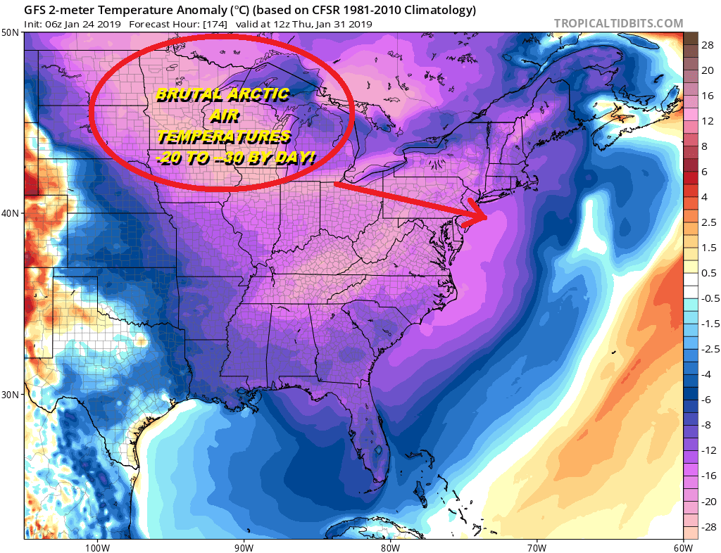
The question is whether we will will see any snow either before the bitter cold air arrives or perhaps on the arrival of the bitter air. Weather models have thrown a bit of uncertainty into the equation overnight over the snow issue and we will address the snow issue later today. Temperatures in the single digits (and possibly sub single digits) are coming for later next week.
MANY THANKS TO TROPICAL TIDBITS FOR THE USE OF MAPS
Please note that with regards to any tropical storms or hurricanes, should a storm be threatening, please consult your local National Weather Service office or your local government officials about what action you should be taking to protect life and property.


