Fireworks Weather Just About Perfect Happy 4th of July

It is the 4th of July, the height of the summer and the signature summer holiday. We are happy to report that we are seeing about as nice a day as you can see this time of year with the minor inconvenience that the humidity is on the high side. We have deep blue skies and lots of sunshine for today with a light east wind that will keep temperatures from getting out of control. Highs will be in the mid to upper 80s with 70s at the beaches. No thunderstorms are forecast and the only place we might see an isolated thunderstorm will be well inland west of the New Jersey Pennsylvania state line. Enjoy the day and enjoy the fireworks shows tonight with temperatures in the 70s to near 80 after 9pm.
SATELLITE

REGIONAL RADAR

The satellite picture shows most areas free of clouds and the radars are very quiet across the Northeast. Other than those pop up storms well inland, the radars are free and clear for today and tonight. The next cold front is not due until Saturday so we have Friday which will be a day of clouds and sun. There is a slightly higher chance for late afternoon and evening thunderstorms but for most it will be another day where you won’t see any. Highs will be in the mid to upper 80s with temperatures a few degrees cooler at the shore.

Saturday we see the next cold front and that brings the best chance for late afternoon and evening thunderstorms. Before that it will be a hot and humid day with some sunshine and highs in the upper 80s to lower 90s. The best chance for thunderstorms will be in the late afternoon and evening. Some of those thunderstorms could be strong though the Storm Prediction Center does not have us at risk for severe weather at the moment.
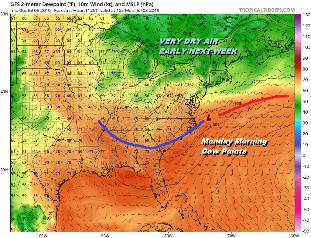
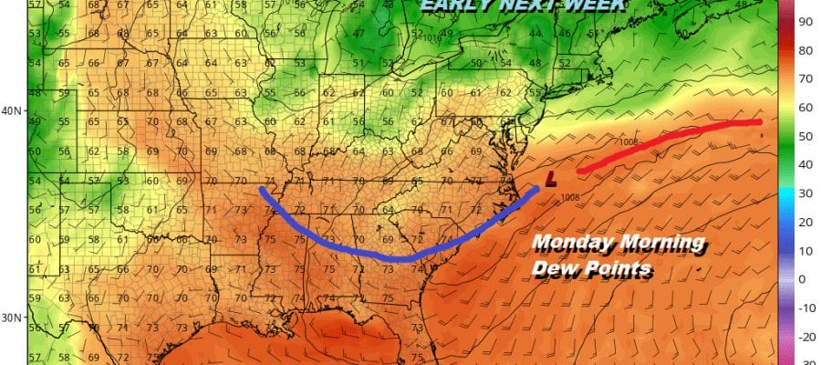
The front should keep moving southward on Sunday. There could be some leftover clouds around and maybe an afternoon shower pops up. There will also be some sunshine as well with highs in the 80s. The dry air you see on the map above across the Great Lakes and New England pushes southward so that Monday and Tuesday of next week look like two nice days with sunshine, reasonable humidity and most highs between 80 and 85.
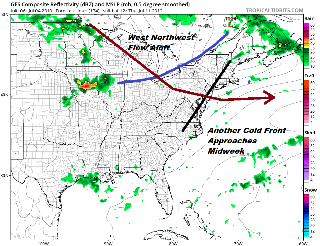
It is somewhat unusual to have a west northwest flow aloft as persistent as this one for this time of year. This allows cold front to move through every couple of days. Nothing really changes for next week as yet another front approaches later Wednesday into Thursday. We will warm up ahead of it Wednesday with highs in the 80s to near 90 with sunshine and higher humidity. Thursday likely brings the chance for a few thunderstorms when the front passes. Then it is a matter of whether the front keeps moving after it passes or gets hung up for awhile. Otherwise we are pretty much on cruise control weather wise for the next week or so.
MANY THANKS TO TROPICAL TIDBITS FOR THE USE OF MAPS
Please note that with regards to any tropical storms or hurricanes, should a storm be threatening, please consult your local National Weather Service office or your local government officials about what action you should be taking to protect life and property.


