
Euro Model Strong Winds Sunday Morning

MENTION JOE CIOFFI AND GET A 5% DISCOUNT
Euro Model Shows Strong Storm Developing Saturday Night
Strong Winds Saturday Night Into Sunday Morning
Strong winds are a characteristic of early Spring. The atmosphere is dealing with strong temperature contrasts. Spring sunshine is heating up the atmosphere. Cold air is still close by in Canada. The ocean water temperatures are warming much more slowly than the land. All of this plays into a mix than can cause tight pressure gradients between low and high pressure. The atmosphere redistributes these disparities with wind, and sometimes it does it strongly.
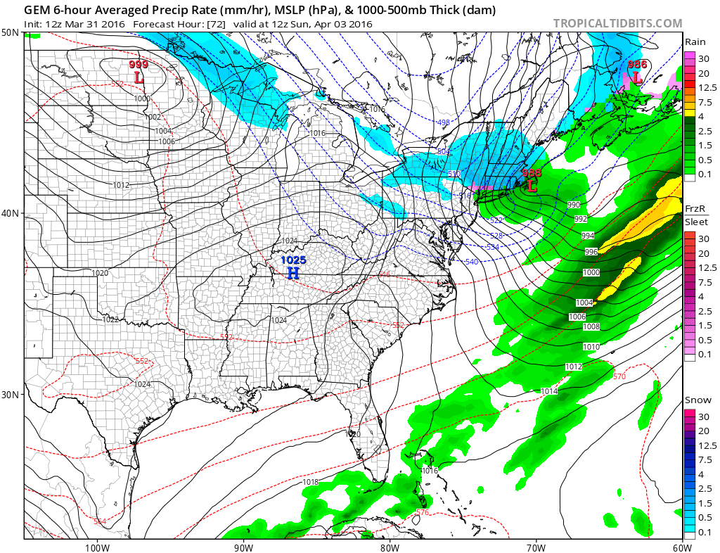
Such will be the case this weekend. The Euro model and the Canadian model show this best as they both point to strong low pressure developing Saturday night just to our east. Very cold air will be drawn southward. The pressure difference will be quite large over a relatively small distance. Gusts to 50 mph or more will be coming with the greatest concentration occurring across Coastal New Jersey and Long Island. Winds will be gusty but not as fierce as you head further north and west from these areas.
Euro Model Strong Winds Sunday Morning Canadian Model Sunday Morning
Euro Model Strong Winds Sunday Morning Euro Model Forecast Sunday Morning
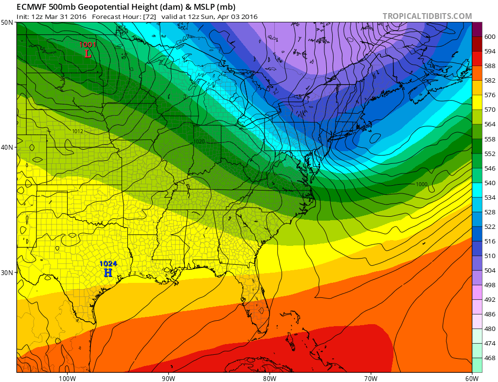
The Euro model is extremely aggressive with the strong piece of the polar vortex that drops down over Western Long Island. The strong depth of the upper low and the extremely cold air shown aloft argues for a burst of snow possibly during the early morning hours up until daybreak. A coating to an inch or two would not be out of the question for parts of Northern New Jersey and the Hudson Valley and even along the coast it is not impossible. However it will be variable in nature.
EURO SNOWFALL FORECAST FOR SUNDAY MORNING

The bigger issue will be the wind. Because the tightest pressure gradient is southwest of the surface low center, the Euro model is forecasting gusts to 60-70 mph along the New Jersey shore with 30 to 40 mph winds up to Long Island and Northern New Jersey with less wind as you move north and west. If the magnitude of the piece of the polar vortex is correct, then the resulting wind would not be a surprise.
Euro Model Strong Winds Sunday Morning Upper Air Forecast Sunday Morning

As to the second weather system for Monday night and Tuesday, the Euro model is taking a surface low and redeveloping just to our south. All of the precipitation falls Monday night into Tuesday morning. It has a cheap thrill idea of a coating to an inch or 2 as rain changes to snow overnight as the low goes by. I continue not to get to worked up over this as it looks like a weak system at best at the moment. I will address the issue later this evening on a separate post.
FiOS1 News Weather Forecast For Long Island
FiOS1 News Weather Forecast For New Jersey
FiOS1 News Weather Forecast For Hudson Valley
NATIONAL WEATHER SERVICE SNOW FORECASTS
LATEST JOESTRADAMUS ON THE LONG RANGE

NOMINATED FOR AN APPY AWARD FOR BEST WEATHER APP!!
Weather App

Don’t be without Meteorologist Joe Cioffi’s weather app. It is really a meteorologist app because you get my forecasts and my analysis and not some automated computer generated forecast based on the GFS model. This is why your app forecast changes every 6 hours. It is model driven with no human input at all. It gives you an icon, a temperature and no insight whatsoever.
It is a complete weather app to suit your forecast needs. All the weather information you need is right on your phone. Android or I-phone, use it to keep track of all the latest weather information and forecasts. This weather app is also free of advertising so you don’t have to worry about security issues with your device. An accurate forecast and no worries that your device is being compromised.
Use it in conjunction with my website and my facebook and twitter and you have complete weather coverage of all the latest weather and the long range outlook. The website has been redone and upgraded. Its easy to use and everything is archived so you can see how well Joe does or doesn’t do when it comes to forecasts and outlooks.
Just click on the google play button or the apple store button on the sidebar for my app which is on My Weather Concierge. Download the app for free. Subscribe to my forecasts on an ad free environment for just 99 cents a month.
Get my forecasts in the palm of your hand for less than the cost of a cup of Joe!
![]()

