Dry Air Moving Southwestward Onshore Flow
Dry Air Moving Southwestward Onshore Flow
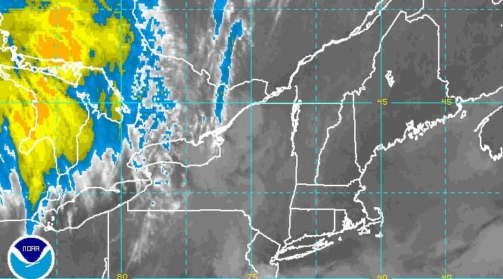
Stay long enough in an onshore flow and sometimes you run out of moisture. Looking at the satellite loop this morning you can see clear skies over most of New England. Dry air actually moved southwestward overnight and pushed its way into Northern New Jersey. There are still clouds across Eastern Pennsylvania and over Central & South Jersey and I suspect those clouds will be an issue today as they push back a bit more to the west. However where it is sunny today along coastal areas and areas northeast across NYC, it is really a nice day shaping up with temperatures in the 70s.
SATELLITE LOOP

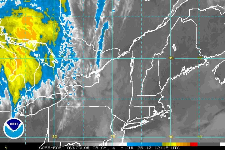
REGIONAL RADAR

LOCAL RADAR NEW YORK CITY

LOCAL RADAR PHILADELPHIA


Expect the radars to be relatively quiet today though a stray shower inland i suppose can’t be ruled out. Tonight should be clear to the east with clouds to the west and lows in the comfortable 60s.
Thursday brings a return flow and higher humidity with temperatures reaching into the 80s. A cold front is approaching and there could be some thunderstorms with the front Thursday evening with the Storm Prediction Center raising the prospects for severe weather over a large area.
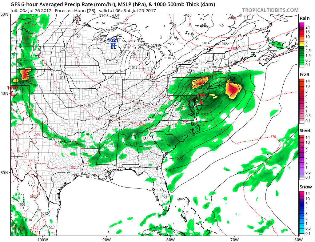
Then the onshore flow comes back on Friday with low pressure to the south and some rain developing during Friday especially over Central and South Jersey and Southeastern Pennsylvania, which has been the bulls eye for rain lately.Temperatures Friday will be in the 70s and once the rain gets going it will drop into the 60s again. Saturday the rain should move out in the morning with improving weather conditions in the afternoon. Highs in the 70s. Sunshine is the forecast for Sunday with highs in the 70s to near 80.
READ MORE ABOUT THE FRIDAY AND WEEKEND OUTLOOK
 GET JOE A CIGAR IF YOU LIKE

LANDSCAPE COMPANIES FOR YOUR NEEDS
LONG ISLAND ROCKLAND COUNTY Connecticut

![]()

ROCKLAND COUNTY TRI STATE SNOW REMOVAL JOHNSTOWN PA


FiOS1 News Weather Forecast For Long Island
FiOS1 News Weather Forecast For New Jersey
FiOS1 News Weather Forecast For Hudson Valley
NATIONAL WEATHER SERVICE SNOW FORECASTS
LATEST JOESTRADAMUS ON THE LONG RANGE
Weather App

Don’t be without Meteorologist Joe Cioffi’s weather app. It is really a meteorologist app because you get my forecasts and my analysis and not some automated computer generated forecast based on the GFS model. This is why your app forecast changes every 6 hours. It is model driven with no human input at all. It gives you an icon, a temperature and no insight whatsoever.
It is a complete weather app to suit your forecast needs. All the weather information you need is right on your phone. Android or I-phone, use it to keep track of all the latest weather information and forecasts. This weather app is also free of advertising so you don’t have to worry about security issues with your device. An accurate forecast and no worries that your device is being compromised.
Use it in conjunction with my website and my facebook and twitter and you have complete weather coverage of all the latest weather and the long range outlook. The website has been redone and upgraded. Its easy to use and everything is archived so you can see how well Joe does or doesn’t do when it comes to forecasts and outlooks.
Just click on the google play button or the apple store button on the sidebar for my app which is on My Weather Concierge. Download the app for free. Subscribe to my forecasts on an ad free environment for just 99 cents a month.
Get my forecasts in the palm of your hand for less than the cost of a cup of Joe!


