Dry Air About to Arrive Very Warm Thursday Beautiful Weekend
Yesterday’s severe weather was another widespread outbreak that we have seen this summer. Fronts keep moving along and here comes the next one for late today. However you may notice today that while it is still a bit humid outside it is not quite as humid as yesterday. That is because yesterday’s weather system has basically zapped all the juice out of the atmosphere. Today’s cold front will have much less to work with. It will be a very warm somewhat humid day with sunshine as temperatures reach for the 80s to near 90. There could be a pop up thunderstorm or two this afternoon and then maybe another scattered shower or thunderstorm this evening when the cold front comes through. However no widespread severe weather is expected.
SATELLITE

REGIONAL RADAR

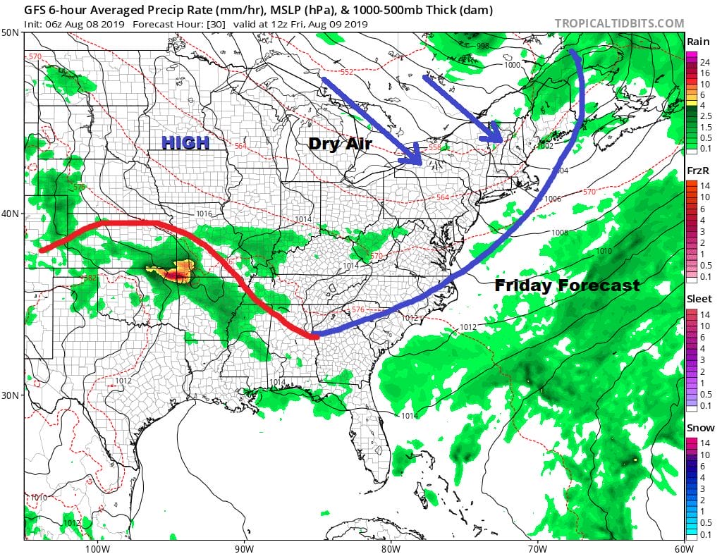
Satellite and radar don’t show much here with showers and storms in New England as yesterday’s wave of low pressure and cold front move along to the east. Nothing is going on at the moment locally or anywhere to the west and south.
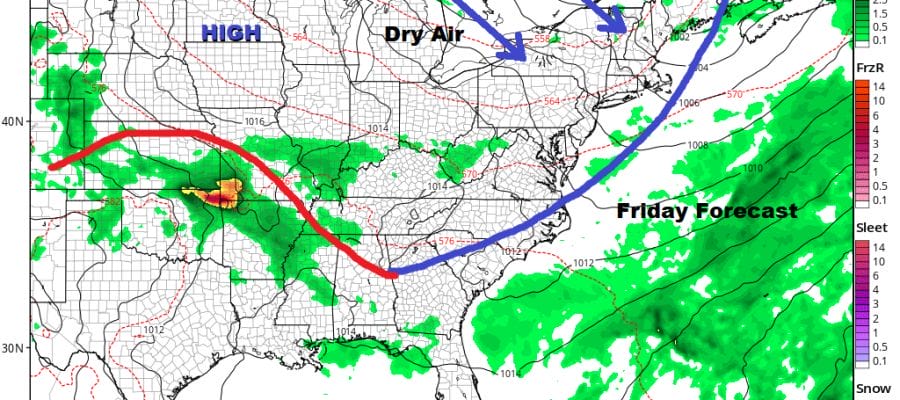
Friday the cold front is offshore and it is all about the high pressure area in Southern Minnesota which is going to take all weekend to build into the east. That means for the Northeast southward into Virginia low dew points take over for 3 days. We will see sunshine for Friday with most highs in the low to mid 80s as the humidity disappears.

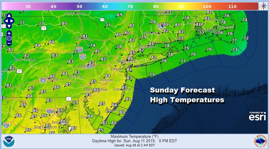
Saturday and Sunday will be two terrific days with the dry air mass moving overhead. Look for sunshine both days with nothing more than some occasional passing clouds. Highs Saturday will be in a range between 78 and 84 for most of the area and Sunday looks about the same. This could be the best weather weekend of the entire summer and we have had quite a run of nice weekends.
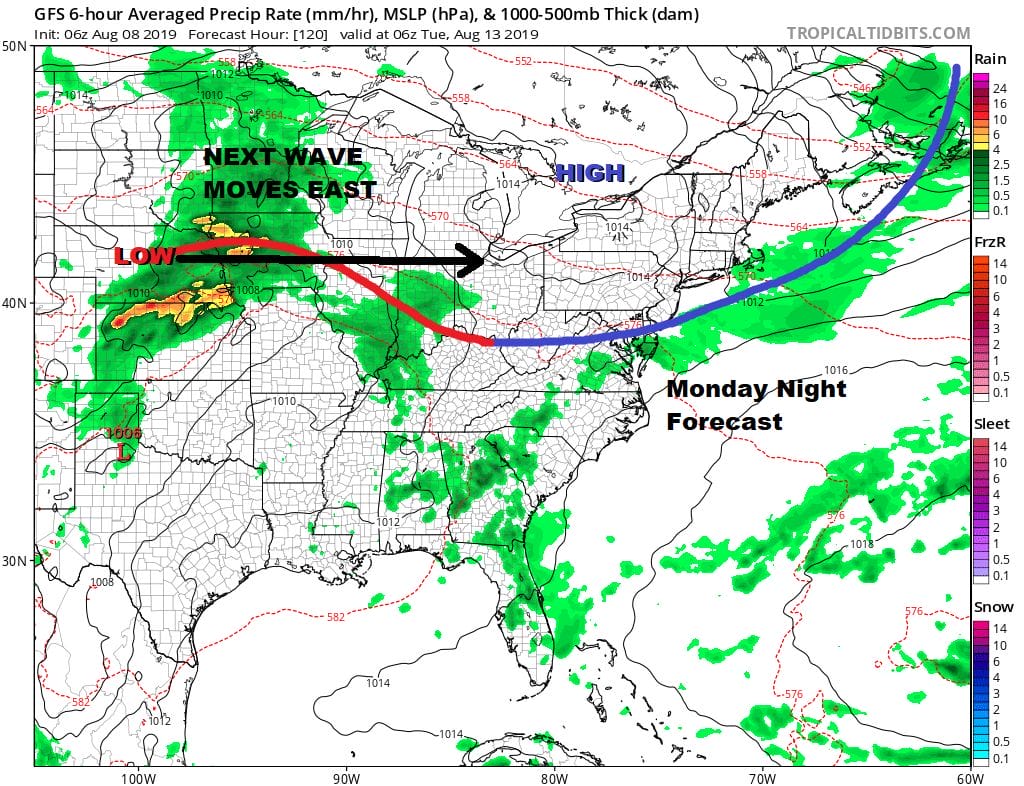
This fast flow of cold fronts coming through continues on Monday with another cold front moving through. Humidity will go up briefly before coming back down Monday night into Tuesday. This is a quick shot of dry air because the next wave of low pressure will be moving eastward.
Since weather patterns tend to repeat and while never exactly they do have a sense of rhyming, we are seeing the possibility of another cold front and another round of showers and thunderstorms with severe weather potential. This will of course depend on timing of yet another cold front set to arrive Tuesday night into Wednesday morning. Then another dry air mass follows. For this time of year it is a rather nice pattern to be in because it just can’t get too hot for too long.
MANY THANKS TO TROPICAL TIDBITS FOR THE USE OF MAPS
Please note that with regards to any tropical storms or hurricanes, should a storm be threatening, please consult your local National Weather Service office or your local government officials about what action you should be taking to protect life and property.


