Flash Flooding Heavy Rains Continue Through Part of Tonight, The Weekend Looks Terrific
We still have some more weather to get through tonight even though the severe thunderstorm part of the threat has now come to an end. There is still the matter of some rain and heavy downpours that are on the western flank of this complex cloud mass covering the Northeast. The southern end of that cloud mass shows a very intense line of thunderstorms moving off the coast of Northeastern North Carolina. This was one very impressive upper trough that moved through and it had a ripe air mass to play with. Numerous severe thunderstorm warnings and 1 confirmed tornado was reported; an EF-0 which is the weakest on the scale..winds gusting to 75 mph in Springfield New Jersey.
SATELLITE

REGIONAL RADAR

There is still some rain and heavy downpours on the regional and local radars. Much of the thunderstorm activity is now offshore and out to the east as it continues to move away yet we can also so the moderate to heavy rain on the back side that is over New Jersey. The back edge is making eastward progress so this should all be out in the next few hours. Leftover clouds will be with us for the remainder of the night with lows in the 60s to near 70.
LOCAL RADAR NEW YORK CITY

LOCAL RADAR PHILADELPHIA 

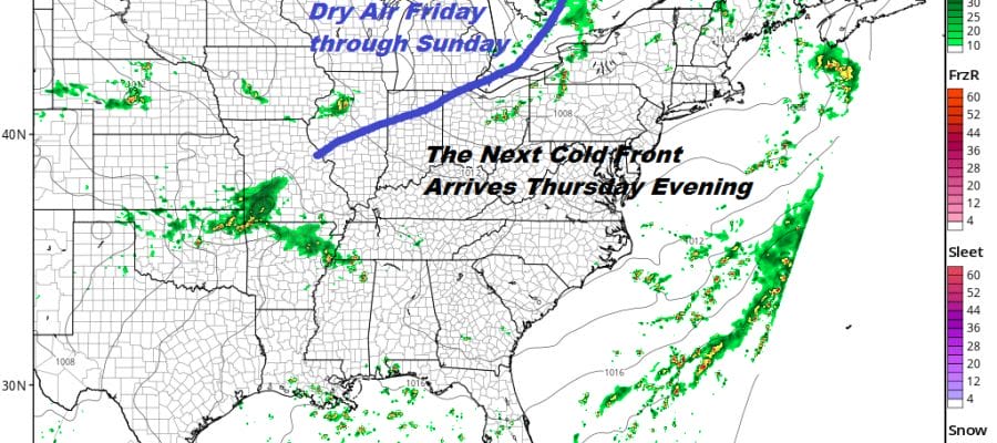
The next front arrives Thursday evening so ahead of it we will see some sunshine. The atmosphere won’t be nearly as juiced up as it was today so only a scattered shower or thunderstorm is indicated. Highs will be in the very warm 80s to near 90 though the humidity will be a shade lower than to day. Once the front passes it is on the the dry air for Friday and the weekend. We see sunshine with highs in the low to mid 80s on Friday and in the upper 70s to lower 80s Saturday and Sunday. The humidity will be low especially on Saturday. This looks to perhaps be the best weekend of the summer so far.
MANY THANKS TO TROPICAL TIDBITS FOR THE USE OF MAPS
Please note that with regards to any tropical storms or hurricanes, should a storm be threatening, please consult your local National Weather Service office or your local government officials about what action you should be taking to protect life and property.


