A Few Pop Ups This Evening Dry Air Arrives Friday Best Weekend of the Summer
Yesterday’s cold front left us with high humidity today and there are a few pop up thunderstorms showing up around the area but they are just that. Yesterday’s system got rid of most of the instability. Today’s cold front will take care of the rest and it comes through tonight with not too much fanfare. An isolated shower or thunderstorm threat holds in until about midnight and the we clear out later tonight. You can see the arc of the clouds from the cold front on the satellite view to our west but most of the action with this as far as showers are concerned are going to pass to our north. Most lows tonight will be in the 60s to near 70.
SATELLITE

REGIONAL RADAR

Regional radar shows a line of strong thunderstorms moving eastward. The southern extent of the line reaches into Northern Pennsylvania. Pop ups are showing up on the local radars below and as usual with these types of storms they are not organized and lack staying power. The vast majority of you won’t see a thing.
LOCAL RADAR NEW YORK CITY

LOCAL RADAR PHILADELPHIA 

Lower humidity arrives Friday with sunshine and clouds. Dew points will be falling all day. Temperatures will still be a bit on the warm side with highs in the low to mid 80s. There is a small chance for a pop up shower or two but they will be isolated. Then the core of the dry air moves in Friday night and lasts all weekend.

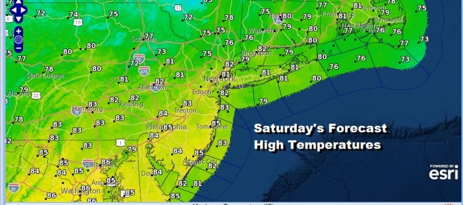
Saturday’s forecast is simple. Sunshine will be accompanied by low humidity and pleasant temperatures. Most highs will be in the upper 70s to lower 80s with a light northwest breeze that will go onshore at the beaches. There are no pop up shower issues whatsoever.
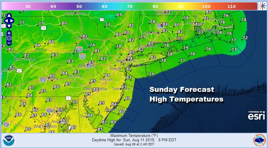
Sunday will be just as nice and still quite dry. Sunday morning will be nice and cool in some places with lows in the 50s to low 60s. Highs will reach the upper 70s to some middle 80s as temperatures tick up slightly. However once again there are no weather issues with even isolated pop up thunderstorms. This could be the best weather weekend of the summer. There are only 4 summer weekends left including the Labor Day weekend.
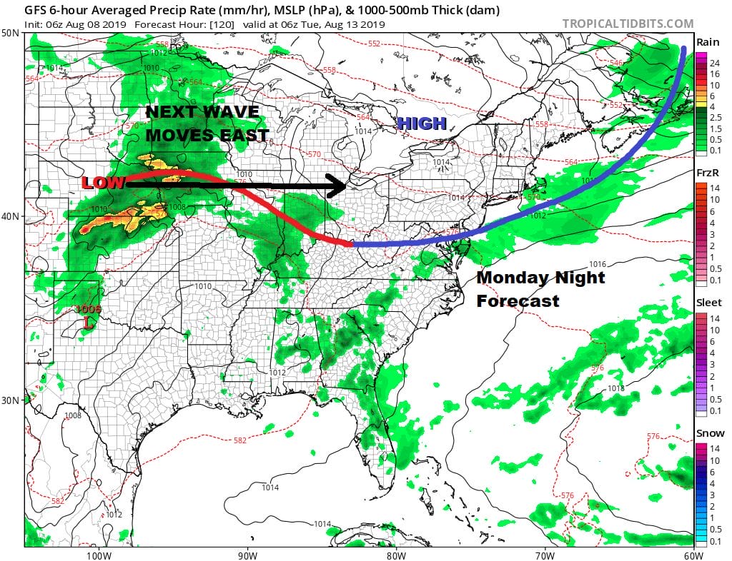
Monday turns more humid and temperatures rise with a mix of sun and clouds. Highs will be in the 80s to near 90 in some spots. The cold front doesn’t have much with it so other than some scattered thunderstorms inland we shouldn’t have a repeat of severe weather. A weak high builds in for Monday night and Tuesday and then we look to the west as a wave of low pressure moves east across the Ohio Valley and then heads into the Northeast.

Models seem to want to track this low to our south at the moment but we had a case like this a few weeks ago where the surface low wound up tracking just to our north and put us in line for a severe weather outbreak. It is too early to tell how this one plays out. For now we will go with sunshine with some arriving clouds on Tuesday with highs into the 80s. Then look for a chance for showers and thunderstorms Tuesday night into Wednesday, followed by another shot of dry air for the second half of next week though how far south the dry air gets remains to be seen.
MANY THANKS TO TROPICAL TIDBITS FOR THE USE OF MAPS
Please note that with regards to any tropical storms or hurricanes, should a storm be threatening, please consult your local National Weather Service office or your local government officials about what action you should be taking to protect life and property.


