Downpours Underway Weather Improves Tuesday Wednesday
The warm front is moving northward and we are seeing downpours in an east west band centered over NYC and increasing in coverage and intensity. Some of the downpours are heavy. If you are on the road you will notice them approaching from a distance as a wall of rain with restricted visibility so be cautious if you are driving this afternoon and evening. To the west we have lots of clouds as the cold front approaches and there are some downpours and a few thunderstorms with this. Those will be moving through tonight.
SATELLITE

REGIONAL RADAR

Radar shows the first area of showers from Lake Ontario southeast to off the Jersey and Long Island coast lines moving nrotheast. Other showers are moving out of Maryland and into Southern Pennsylvania. On the left the showers with the cold front will start to organize later this afternoon in Pennsylvania as they head east tonight and then offshore during the early morning hours.
LOCAL RADAR NEW YORK CITY

LOCAL RADAR PHILADELPHIA


Tuesday we will see weather conditions improve rather quickly as high pressure builds in so you can look for lots of sunshine. Highs will reach the upper 70s to a few lower 80s as humidity drops. Wednesday will be a good day too with sunshine and slightly cooler temperatures in the 70s. Some high clouds will likely show up late in the afternoon and evening.
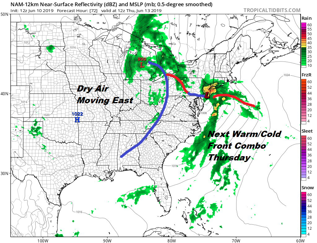
Thursday morning downpours will be back thanks to another warm front moving northward as a strong trough swings across the Great Lakes. A frontal wave develops that will move very close to us so there could be some heavy rain with this area as it moves through. Rains will move through from south to north during the morning hours. The afternoon will be humid with a round of thunderstorms possible Thursday evening. Highs will reach the 70s but some 80s are possible South Jersey and Southeast Pennsylvania.

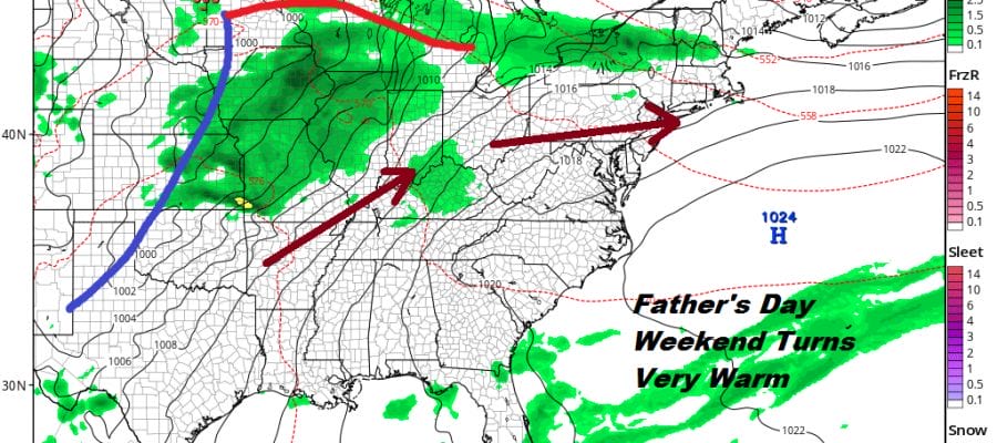
We are close enough to the Father’s Day weekend to get a good idea of what is going to happen. Friday high pressure builds in with lots of sunshine and highs in the 70s to near 80. Then the high moves off the Mid Atlantic States so we begin a west southwest flow. Warmer air and progressively more humid air starts to arrive over the weekend. Look for lots of sunshine on Saturday with highs in the 80s.
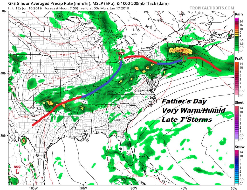
Sunday which is Father’s Day brings a very warm to hot day with highs in the 80s to near 90 and a chance for late day thunderstorms as a frontal boundary nears. The frontal boundary will struggle through Sunday night and Monday. The vast majority of the weekend though will be fine for outdoor activities.
MANY THANKS TO TROPICAL TIDBITS FOR THE USE OF MAPS
Please note that with regards to any tropical storms or hurricanes, should a storm be threatening, please consult your local National Weather Service office or your local government officials about what action you should be taking to protect life and property.


