Downpours Thunderstorm Threat Continues Heat Arrives Sunday
Downpours Thunderstorm Threat Continues Heat Arrives Sunday
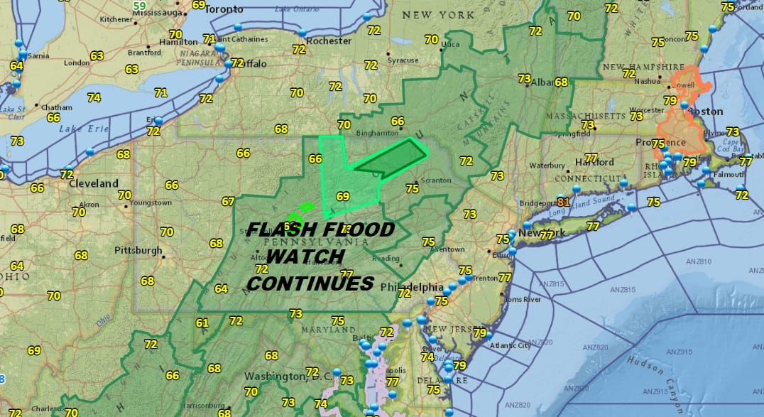
We have another day of high humidity with downpours & thunderstorms threatening again. As usual it doesn’t rain all the time and the main threat time comes after some daytime heating. Look for downpours and thunderstorms to develop during the afternoon and last into the evening. Eastern Pennsylvania, Northern New Jersey, the Hudson Valley, & Connecticut have been the areas most at risk lately so look for a repeat performance today. Much of the Eastern Seaboard has a flash flood watch posted and this watch area has grown every day this week as the rain totals continue to mount inland.

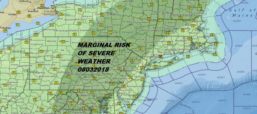
We also have a marginal risk of severe weather that exists for much of the same area that has the flash flood watch though the severe weather area actually extends into Northwest New Jersey and the Hudson Valley. We had some strong to severe thunderstorms spin up last night in areas around NYC to Long Island and even a tornado warning was issued briefly around 10:30pm last night for Eastern areas of NYC and Western Long Island. These thunderstorms can blow up quickly and weaken just as fast so beware of this possibility while we continue to sit deep in this tropical air mass.
EASTERN SATELLITE

REGIONAL RADAR

We basically wake up to the same satellite and radar loops every day with downpours to our west and south moving northeastward. Look for downpours to start firing up locally after lunchtime though there could be some scattered cells this morning that will pop up in a few places.
LOCAL RADAR NEW YORK CITY

LOCAL RADAR PHILADELPHIA


Temperatures today will be in the 80s. One upside this week is that with the clouds and downpours, temperatures have been limited in how high they get. It doesn’t take away from the fact that it is extremely uncomfortable outside. That has remained constant all week and the humidity will remain high into next week even though we will see a bit of a pattern adjustment on Sunday. Saturday will be one more day of downpours and thunderstorms as a weak weather front moves through and basically falls apart as it does so.
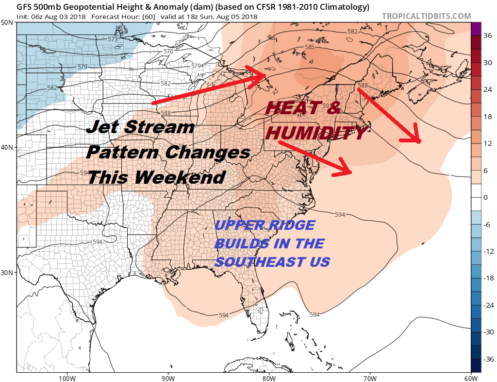
The jet stream pattern changes this weekend from a trough in the East to a ridge in the East. This means that we go from a pattern of humid with downpours to humid with heat and very few downpours. At least it will be a relief from rainfall but temperatures will now respond to more sunshine which means we are headed for 90 degree highs.

The one positive from the rainfall is the high moisture content of the ground will help to hold temperatures in check a bit. 90 or low 90s seems to be the limit here on the upside. The hot weather lasts into Tuesday before a cold front approaches. Late Tuesday some thunderstorms come back into play offering some slight relief from the oppressive humidity later this week. We want to emphasize slight.
While the Atlantic tropics remain quiet, the Pacific has gotten rather busy and Hurricane Hector is moving westward. This hurricane is likely to become a major hurricane this weekend and could be Hawaii bound next week. More on the Joe & Joe Weather Show from last night.
Please note that with regards to any tropical storms or hurricanes, should a storm be threatening, please consult your local National Weather Service office or your local government officials about what action you should be taking to protect life and property.
 GET JOE A CIGAR IF YOU LIKE

LATEST JOESTRADAMUS ON THE LONG RANGE


