Downpours Heavy Rain Threaten All Week
Downpours Heavy Rain Threaten All Week
One of the frustrating things about a pattern like this is trying to figure out who gets the downpours because every day the target area changes. Overnight we saw the development of downpours on the radar and they are moving north northwestward. Across much of the Eastern half of Pennsylvania southward the ground is saturated so Flood Watches are posted probably until further notice this week. The southerly flow is strong so expect more waves of downpours all day long with dry periods in between and some areas in between the waves on the radar won’t see much at all.
EASTERN SATELLITE

REGIONAL RADAR

The regional and local radars are busy this morning thanks to the deep trough to the west and the strong upper high to the east. You can see the gaps in between the waves of rain. Radar echos are moving mostly from southeast to northwest which is unusual and reflecting the tropical nature of the pattern.
LOCAL RADAR NEW YORK CITY

LOCAL RADAR PHILADELPHIA


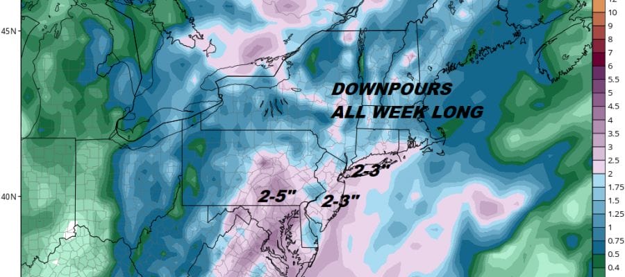
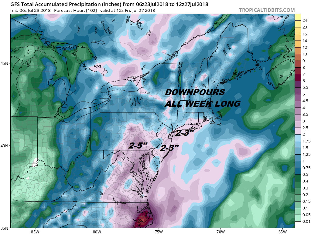
You can expect this continue at least into Thursday before we get a bit of a break Friday & Saturday with fewer downpours and perhaps more in the way of sunshine. As for rainfall totals this week another 2 to 5 inches of rain is likely to fall on top of whatever has fallen so far.
GFS RAINFALL FORECAST THROUGH FRIDAY MORNING
Day to day it will be pretty much the same temperature wise with high humidity and highs into the 80s and nighttime lows mostly in the upper 60s to middle 70s. The sun might poke through in between rounds of downpours which will only make even more uncomfortable.
Please note that with regards to any tropical storms or hurricanes, should a storm be threatening, please consult your local National Weather Service office or your local government officials about what action you should be taking to protect life and property.
 GET JOE A CIGAR IF YOU LIKE

LATEST JOESTRADAMUS ON THE LONG RANGE


