Flash Flooding Possible Through Wednesday A Bit Better Late Week
Flash Flooding Possible Through Wednesday
A Bit Better Late Week
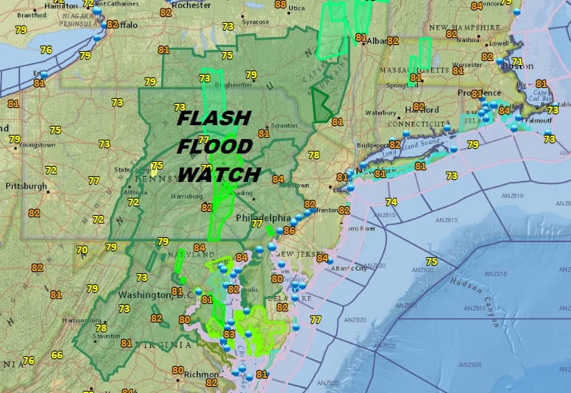
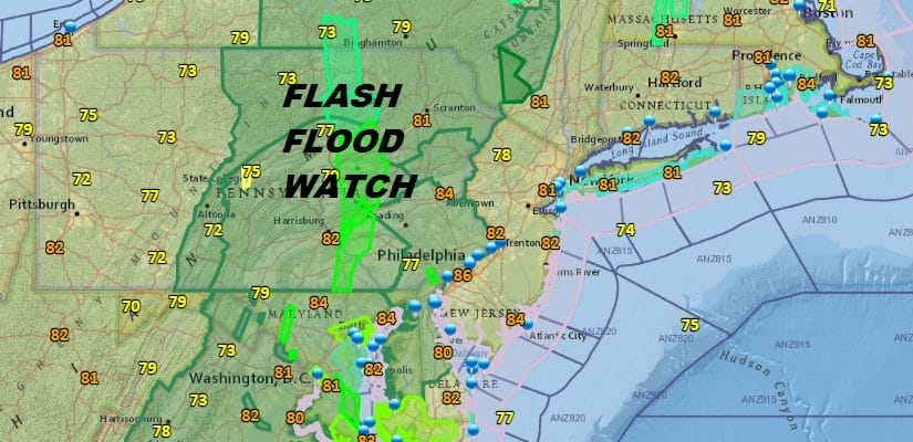
The rain has been heavy in some areas and less so in others. Flash Flooding will remain a risk at least into Wednesday in the Flash Flood Watch zone. That area could be expanded eastward depending on how the downpours behave for the rest of today and tonight. We are in the depths of a very tropical air mass that is locked off the East Coast with a trough to the west which creates and almost endless southerly flow of moisture. Typically in these situations downpours vary from day to day and from place to place so be prepared to dodge them in your travels.
EASTERN SATELLITE

REGIONAL RADAR

Satellite and radar loops show a south south east flow of moisture laden air. The nature of the downpours is that they tend to cluster at times and there are also gaps in between. When the sun occasionally breaks through it just makes it feel that much more humid.
LOCAL RADAR NEW YORK CITY

LOCAL RADAR PHILADELPHIA


Weather models all have the same general idea of about 2 to 5 inches of rain through Wednesday though they vary on who gets the 2 inches and who gets 5 inches.The best approach is know that the risk is there even in areas where there is no Flash Flood Watch at this time.

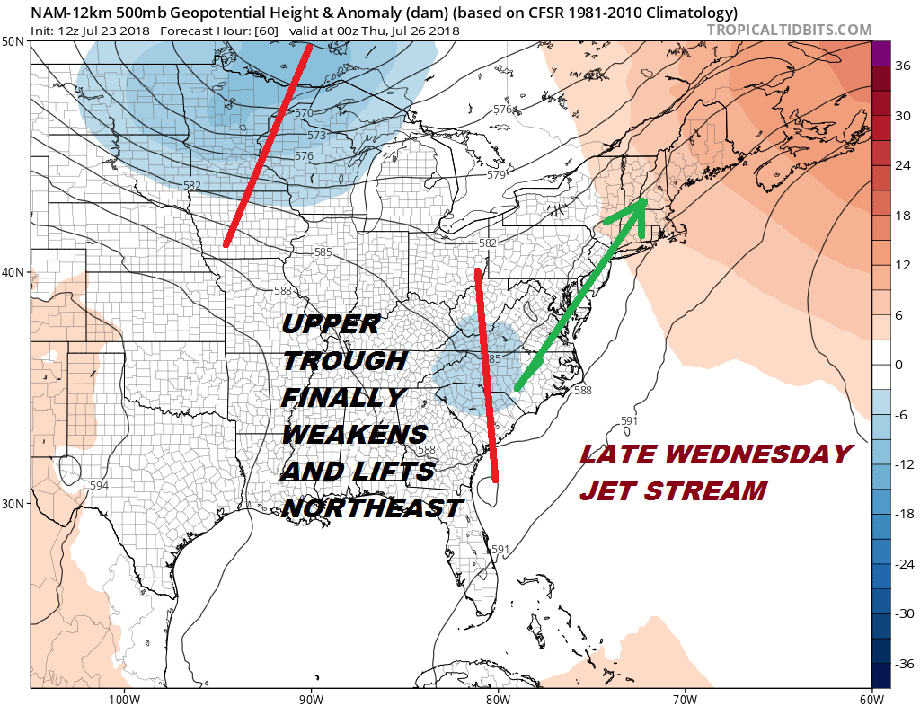
There is some positive news in that the upper trough to the west weakens and lifts out to the Northeast on Wednesday. While this suggests that Wednesday we could see downpours all over the place, the trough lifting out will lead to perhaps better weather conditions late in the week though it will still be humid and there will still be the chance for thunderstorms running around.
In the meantime we sit in clouds, humidity, and downpours. At least we can shut sprinklers off and let nature do the watering for free. At least the tropics continue to remain quiet and there isn’t anything out there that poses any threat for development into midweek.
Please note that with regards to any tropical storms or hurricanes, should a storm be threatening, please consult your local National Weather Service office or your local government officials about what action you should be taking to protect life and property.
 GET JOE A CIGAR IF YOU LIKE

LATEST JOESTRADAMUS ON THE LONG RANGE


