DOWNLOAD MY NEW FREE JOESTRADAMUS WEATHER APP FOR ANDROID
THE APP IS ABSOLUTELY FREE TO ALL BUT CONSIDERING SUBSCRIBING TO PATREON FOR A WEATHER EXPERIENCE FREE OF ADS, EXCLUSIVE VIDEOS FOR MEMBERS ONLY AND MUCH MORE…STARTS AT $2 A MONTH..MESSAGE ME AT ANY TIME
Colder Weekend Polar Vortex Bitter Air Awaits Later Next Week
Yesterday’s soaking rain is long gone and now we are going to take the second step down in the temperature decline today. We have some sun to start but clouds will be developing as another cold front is approaching from the northwest today. Behind the front is a second surge of cold dry air so we are basically going from dry air mass to drier air mass as we head into the weekend. There are some snow showers showing up on the regional radar in upstate NY as the lake effect snow machine goes to work but in an especially big way. Highs today will be mostly in the 30s. We could see some scattered snow showers pop up on the regional and local radars later today but for the most part it is a non event.
EASTERN SATELLITE
REGIONAL RADAR
Skies will clear out tonight and it will be cold as we head down into the teens to near 20. Saturday will be a cold but mainly sunny day with highs in the 20s to near 30. Then we have another weak cold front approaching for Sunday. Look for clouds and a rebound in temperatures with highs reaching the 30s to near 40. The front doesn’t do much as it goes through.
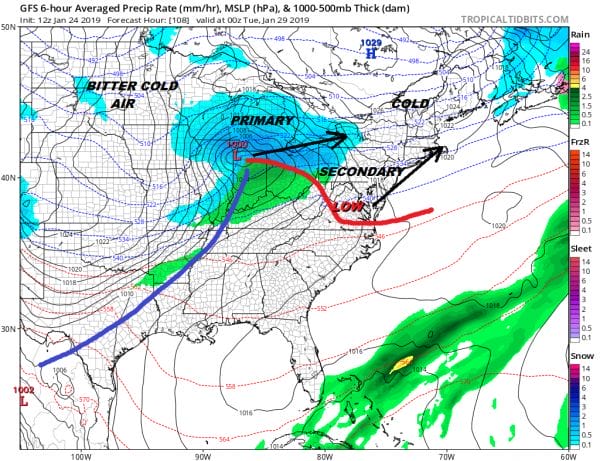
Monday our attention turns to the next low and the arctic front that will usher in a bitter cold shot of air for Wednesday through Friday of next week. We see sunshine giving way to arriving clouds Monday with highs in the 30s. The low will head up into Southeastern Canada with a trailing arctic boundary that will move through here later on Tuesday. I don’t expect much to happen Monday night or on Tuesday other than clouds and perhaps some showers and highs in the 40s.
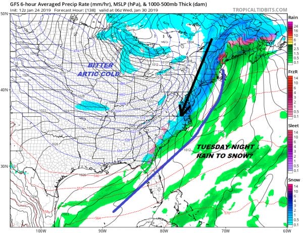
The question about the arctic boundary is that it will move through slowly Tuesday night and there will likely be another wave on the front of some sort with a bit of overrunning after the front goes by. That might give us the chance for some snow on the back side of the front but most times in scenarios like this the snow doesn’t amount to much. Temperatures will fall quickly into the teens and 20s by Wednesday morning so for now we are going to mention snow in the forecast for Tuesday night. Some models actually develop a fairly solid wave on the front and a more robust snowfall. We are skeptical at this stage of the game.
it isn’t often that you see the polar vortex drop much further south than James Bay but there it is in Central Michigan on Wednesday which will bring utterly brutal air from Siberia into the US. Daytime temperatures in some areas in the Plains and Midwest will be in the range of -20 to -30 even by day! Obviously we won’t be that cold but we will see temperatures head to single digits to near zero Wednesday night into Thursday morning. This should the coldest period and then a slow rebound will begin on Friday of next week.
MANY THANKS TO TROPICAL TIDBITS FOR THE USE OF MAPS
Please note that with regards to any tropical storms or hurricanes, should a storm be threatening, please consult your local National Weather Service office or your local government officials about what action you should be taking to protect life and property.


