DOWNLOAD MY NEW FREE JOESTRADAMUS WEATHER APP FOR ANDROID
THE APP IS ABSOLUTELY FREE TO ALL BUT CONSIDERING SUBSCRIBING TO PATREON FOR A WEATHER EXPERIENCE FREE OF ADS, EXCLUSIVE VIDEOS FOR MEMBERS ONLY AND MUCH MORE…STARTS AT $2 A MONTH..MESSAGE ME AT ANY TIME
Polar Vortex Drops Into Great Lakes Snow Chances As Cold Air Arrives
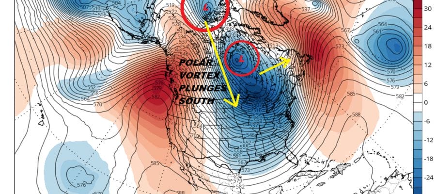
You don’t see this very often but the polar vortex is dropping into the Great Lakes Wednesday of next week. This is going to be one of those times where you are going see ridiculous cold coming into the Northern Plains and Great Lakes. Chicago for example could be in for several days of double digit below zero temperatures in this upper air regime.
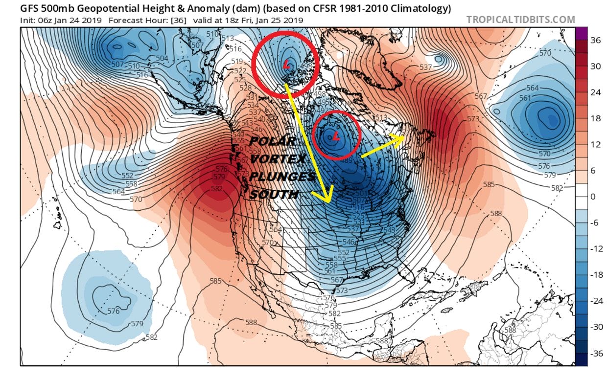
The vortex in question is at the top of the map in the center. The first vortex will pull out over the next few days and we watch that polar vortex literally plunge southward on the back side of the upper low in Canada. It is rather dramatic looking on the full North America loop.
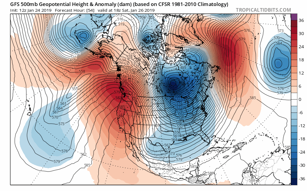
The vortex drops and strengthens as it swings across the Great Lakes and into the Northeast late next week. All the models and the ensembles have it. In fact the ensembles have it even more dramatically than the operational runs.

This is how it looks on the temperature map from overnight uesday night into late Thursday. That is impressive with the minus multiple double digits for 2 or 3 days straight in some places.
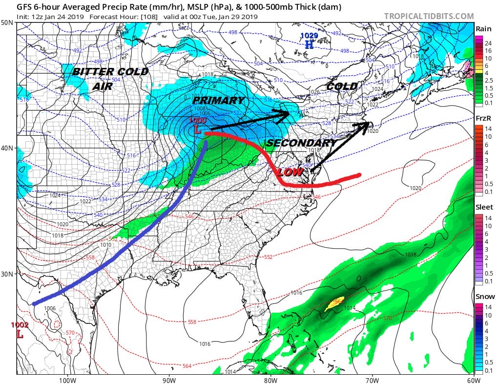
Now somewhere in all of this is whether any of this comes with any snow at all. The arctic front arrives Tuesday. Low pressure swings east and on some of the models the lower pressures appear more on the southern end of the frontal trough then in the north. Models suggest either an arctic front with a weak wave going by later Tuesday into Tuesday night…or some sort of a combination of of a dying primary moving into the Ohio Valley/Western Pennsylvania and some sort of secondary development off the Carolina’s that moves northward.
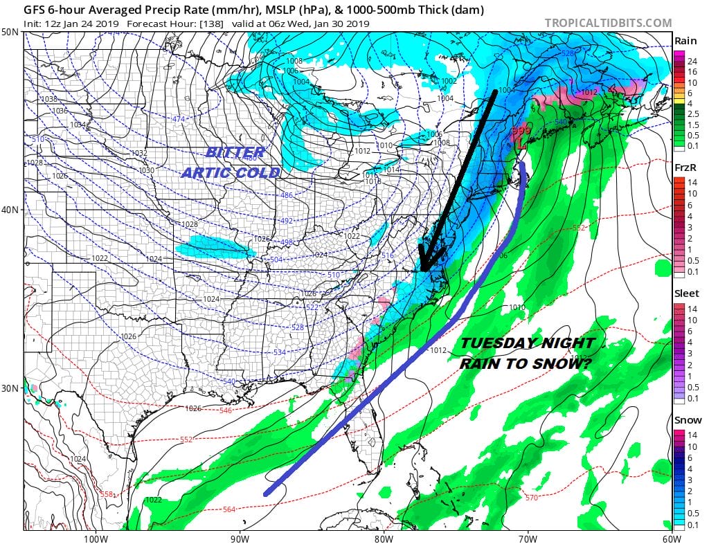
Given the magnitude of what is occurring in the atmosphere it would be hard to imagine we could have all this bitter cold air and not see anything from it. Given the winter it wouldn’t be a shocker if this all came in snow-less but I think there is enough energy running around that models are still grappling with an outcome..and will likely continue to grapple with it. Snow or no snow, we are going to see another arctic adventure unfold where it hurts to go outside.
MANY THANKS TO TROPICAL TIDBITS FOR THE USE OF MAPS
Please note that with regards to any tropical storms or hurricanes, should a storm be threatening, please consult your local National Weather Service office or your local government officials about what action you should be taking to protect life and property.