DOWNLOAD MY NEW FREE JOESTRADAMUS WEATHER APP FOR ANDROID
THE APP IS ABSOLUTELY FREE TO ALL BUT CONSIDERING SUBSCRIBING TO PATREON FOR A WEATHER EXPERIENCE FREE OF ADS, EXCLUSIVE VIDEOS FOR MEMBERS ONLY AND MUCH MORE…STARTS AT $2 A MONTH..MESSAGE ME AT ANY TIME
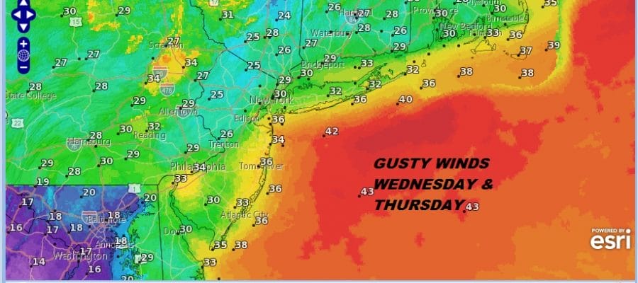
Colder Air Gusty Winds Weekend Snow Questions Continue
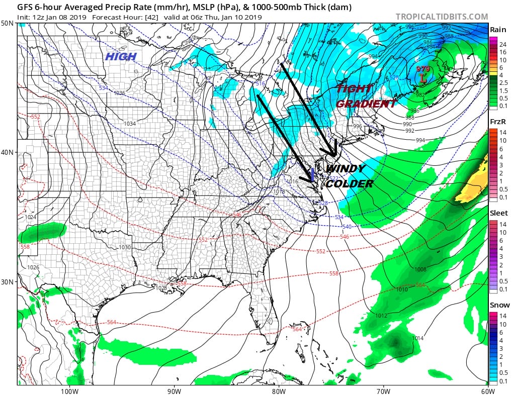
We now await the arrival of a cold front this evening with a few showers. Then we will watch a strengthening low in Maine take control and high pressure to the west dropping into Minnesota to create a strong gusty wind environment and cold air advecting southward. The next few days are going to be windy and colder in a stair step decline that will hit bottom Friday and for the weekend. Winds on Wednesday and Thursday will be gusting to 30 to 35 mph and temperatures will be on a downtrend.
We still have a lot of cloudiness around with dense fog in some areas as the warm front is having a very difficult time getting through. Visibilities are restricted to under 1/4 mile in many areas and it did impact temperatures today. as some areas are struggling just to get back into the 40s.
EASTERN SATELLITE

REGIONAL RADAR

The cold front with showers is moving its way across Pennsylvania and this should be passing through this evening with the odd heavier downpour. Then once the front passes we will get rid of the fog and weather conditions will improve overnight though clouds are likely to linger.
LOCAL RADAR NEW YORK CITY

LOCAL RADAR PHILADELPHIA


On to Wednesday where we will have gusty winds and a mix of clouds and sun. Temperatures will settle in the lower 40s for highs as colder air starts to take over. The core of the cold air will still take a few more days to move in and the storm to the northeast will be hanging around for awhile. We could still have breezy conditions on Friday. As temperatures drop the wind chill will become evident as whatever the thermometer says, you might want to subtract 10 to 15 degrees.

Thursday morning lows will be in the 20s to near 30 with highs just in the 30s. Then it is down into the teens to near 20 Friday morning with highs just in the upper 20s to lower 30s. The same holds for Saturday. It will be dry through Saturday with some sunshine and clouds Thursday. Sunshine is forecast for Friday. Saturday we will see sunshine giving way to arriving clouds as we turn our attention to the next weather system coming across the south.
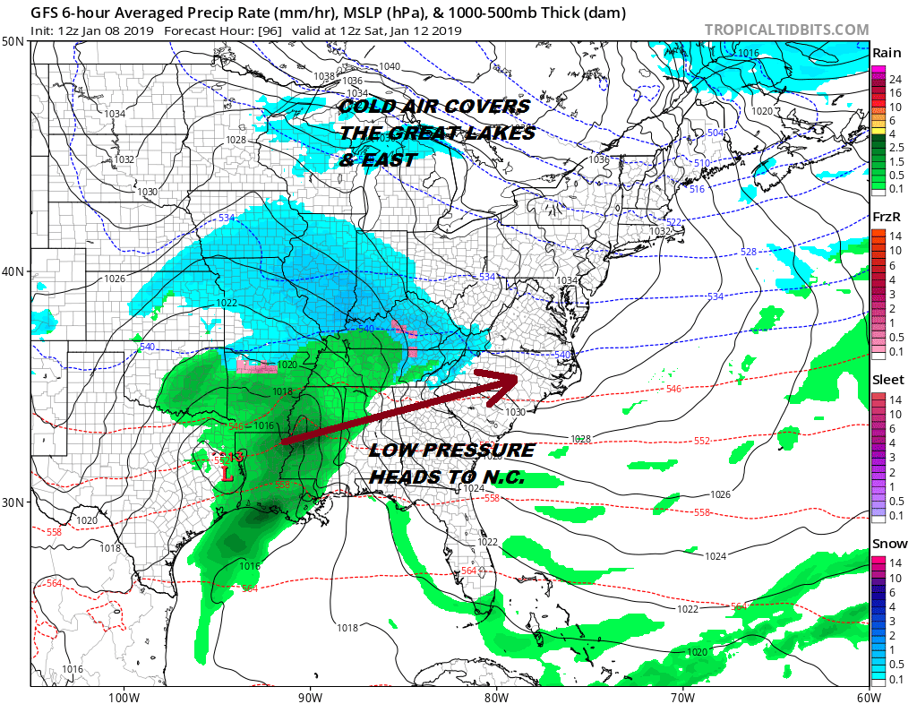
The same issues that were around the last few days remain today. The surface pattern says snow if this system gets far enough north. That remains the question and has to do with the upper air split flow in the jet streams (2 separate jets) and whether there will be room for this to move up the East Coast. Models continue their differences. Some are more suppressed to the south than others. We won’t have clarity on this for another day or two so we continue to watch.
MANY THANKS TO TROPICAL TIDBITS FOR THE USE OF MAPS
Please note that with regards to any tropical storms or hurricanes, should a storm be threatening, please consult your local National Weather Service office or your local government officials about what action you should be taking to protect life and property.


