Cold Tuesday Temperatures Rebound Into Friday Cold Rain Weekend Snow Inland
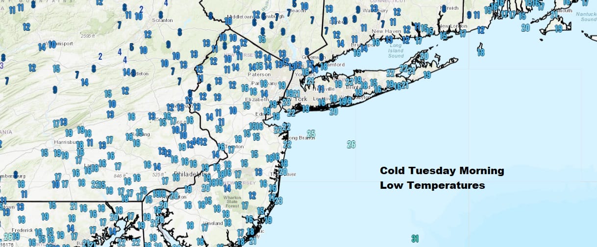
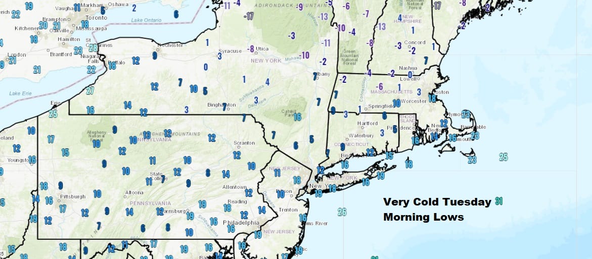
This was a very cold morning across the Northeast and Northern Mid Atlantic states as temperatures around the urban corridor from Washington to NYC bottomed out in the low to mid teens in many areas. The warmer urban centers were in the upper teens to near 20. However snow covered areas to the north and northeast of NYC were especially cold with lows in the single digits and below zero in some areas.
It is another cold day for Tuesday though we should see a good deal of sunshine with highs reaching into the low 30s in most places, mid 30s in Southern New Jersey and Southeastern Pennsylvania..while we top in the upper 20s to near 30 inland north and northwest of NYC. Skies are mainly clear on the satellite view with clouds well inland and confined to the areas closer to the Great Lakes. There is a little bit of lake effect action going on in Southwestern NY this morning but that should fade later today.
SATELLITE

REGIONAL RADAR

Tonight will be cold and clear again with lows in the teens inland to low to mid 20s in warmer urban settings and that sets us up for a slow rebound in temperatures for the rest of the week. High pressure moves offshore. However the warm up won’t be a big one. Wednesday’s highs will be in the 30s and highs Thursday and Friday will be into the 40s. We should see sun on Thursday and arriving clouds on Friday.

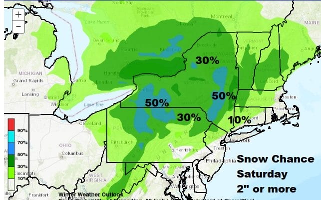
Saturday brings the next storm system to impact the Northeast and Northern Mid Atlantic. The amount of cold air around is minimal but it may be enough to produce a significant snowfall for areas inland north and west of the immediate coast. The Weather Prediction Center has it’s very early view of the chance for at least 2 inches of snow. 30 to 50% probabilities 4 days out is actually rather high but the map has the look of a situation where cold air is minimal and the snows may wind up being elevation driven. This could be a storm where places like the Catskills and the Northern Poconos do well with snow. For the immediate coast south of Route 84 in the Hudson Valley down to New Jersey (except the northwest) it may wind up being mostly a raw cold rain. We will focus on this closely later today.
BE SURE TO DOWNLOAD THE FREE METEOROLOGIST JOE CIOFFI WEATHER APP &
ANGRY BEN’S FREE WEATHER APP “THE ANGRY WEATHERMAN!
MANY THANKS TO TROPICAL TIDBITS FOR THE USE OF MAPS
Please note that with regards to any severe weather, tropical storms, or hurricanes, should a storm be threatening, please consult your local National Weather Service office or your local government officials about what action you should be taking to protect life and property.


