UPPER AIR PATTERN FAVORS COLD AIR & FIRST SNOWS FOR INTERIOR NORTHEAST NEXT WEEK
COLD AIR (FOR THIS TIME OF YEAR) WILL MOVE INTO THE EASTERN HALF OF THE US
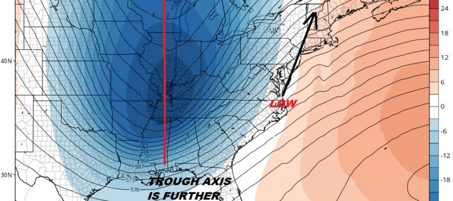
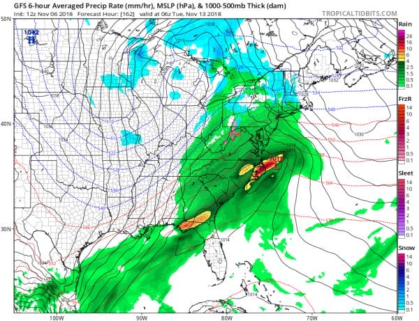
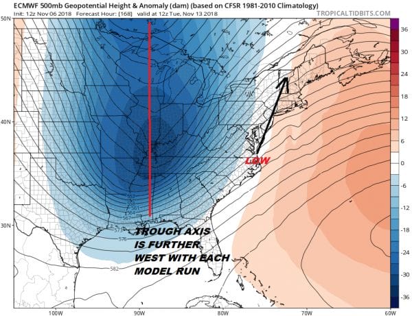
We continue to look ahead toward next week and a shot of very cold air coming into the Eastern US. The question is whether or not another storm system develops on the approaching deep trough that is digging southeastward from Canada into the Midwest. Today’s weather models have grown more bullish on the idea It gets a bit more complicated because of the cold shot this weekend which is weaker than the one for the middle of next week. A month from now and we would probably be looking at a bigger snow threat here for parts of the Northeast but it is mid November and you work with what you have. That said it would seem plausible that snow could develop well inland in NY State and Central New England. The low off the North Carolina coast will move northward and track will be important for areas in Western Pennsylvania and Upstate NY and New England.
Each model run is shifting the trough axis further west with the European model the furthest west of all the models. It doesn’t mean that it is right but the shift does show up on all the models today so we are growing confident that we will have another round of rain to deal with Monday night and Tuesday of next week.
The Euro with the more inland track shows snows well north and west and it does crank up the lake effect machine. The GFS with the low a bit further to the east has a more robust snowfall indicated. Note that the GFS snowfall is from Monday 1pm through Tuesday 1pm so it only covers 24 hours.
At this stage models are still adjusting to the upper trough and the westward track so look for more adjustments going forward. The takeaway here is that it looks as if something is going to happen early next week before the coldest air of the season arrives on the backside of this for late Tuesday through Friday morning. The further west the trough axis is, the coldest of the cold air will also be to the west. It is still early here so lets see where this all goes.
SHOP THE JOESTRADAMUS STORE
MANY THANKS TO TROPICAL TIDBITS FOR THE WONDERFUL USE OF THE MAPS
FiOS1 News Weather Forecast For Long Island
FiOS1 News Weather Forecast For New Jersey
FiOS1 News Weather Forecast For Hudson Valley
NATIONAL WEATHER SERVICE SNOW FORECASTS
LATEST JOESTRADAMUS ON THE LONG RANGE


