Cold Air Arrives Thursday
Cold Air Arrives Thursday
We see to getting nickled and dimed with weather systems lately as far as snow goes for areas north and west of the coast. 3 have moved through so far. Now we get a bit of a break from that and the next change will be on Thursday with a cold front moving through. This will usher in the arrival of the first of 3 cold air masses from Canada. First off for today we have no weather issues other than some leftover clouds that should give way to some sun later today. Temperatures will be moving up to the 40s to around 50 this afternoon.


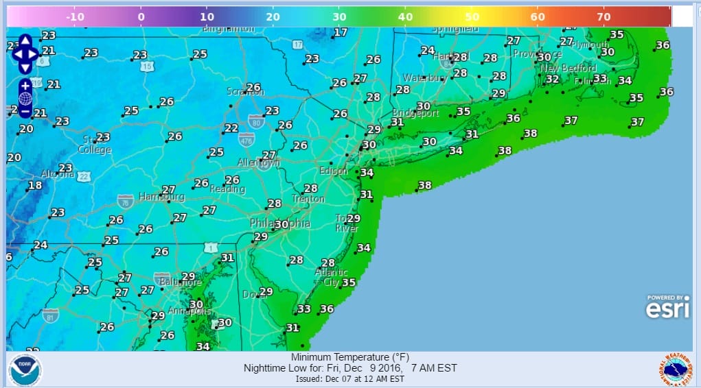
Radars will be calming down a bit. The front that comes through is weak. The NAM model wants to produce a few rain showers when it passes through on Thursday while the other models simply overwhelm us with dry colder air. The lake effect snow machine gets turned on in upstate NY. We see temperatures in the 40s on Thursday but we will be down in the 20s everywhere by Friday morning.
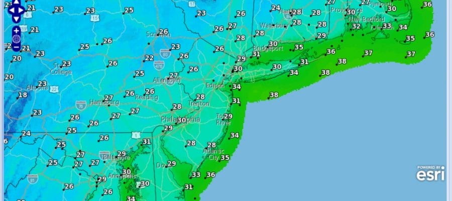
COLD AIR FRIDAY MORNING LOWS
COLD AIR SATURDAY MORNING LOWS
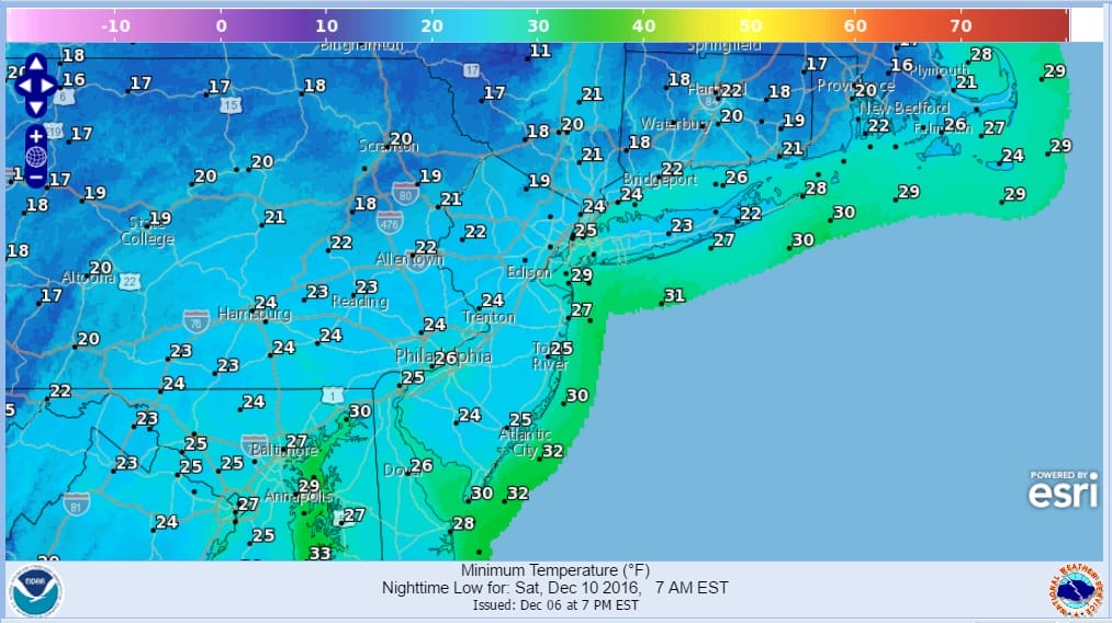
Saturday morning will be even colder with lows in the teens to mid 20s and highs just in the 30s. We will see sunshine both Friday and Saturday. The next weather system approaches on Sunday with sunshine giving way to arriving clouds. We will start to warm up ahead of it as a low goes by to our north. We could see a little snow at the start of precipitation Sunday evening before we go to rain and then after this system goes by another cold shot next week. Next week could be cold all week and into the following weekend as cold air from Canada comes pouring in. We will have more on this when we discuss the long range later today.
SNOW REMOVAL COMPANIES FOR YOUR WINTER NEEDS
LONG ISLAND ROCKLAND COUNTY Connecticut

![]()

FiOS1 News Weather Forecast For Long Island
FiOS1 News Weather Forecast For New Jersey
FiOS1 News Weather Forecast For Hudson Valley
NATIONAL WEATHER SERVICE SNOW FORECASTS
LATEST JOESTRADAMUS ON THE LONG RANGE
Weather App

Don’t be without Meteorologist Joe Cioffi’s weather app. It is really a meteorologist app because you get my forecasts and my analysis and not some automated computer generated forecast based on the GFS model. This is why your app forecast changes every 6 hours. It is model driven with no human input at all. It gives you an icon, a temperature and no insight whatsoever.
It is a complete weather app to suit your forecast needs. All the weather information you need is right on your phone. Android or I-phone, use it to keep track of all the latest weather information and forecasts. This weather app is also free of advertising so you don’t have to worry about security issues with your device. An accurate forecast and no worries that your device is being compromised.
Use it in conjunction with my website and my facebook and twitter and you have complete weather coverage of all the latest weather and the long range outlook. The website has been redone and upgraded. Its easy to use and everything is archived so you can see how well Joe does or doesn’t do when it comes to forecasts and outlooks.
Just click on the google play button or the apple store button on the sidebar for my app which is on My Weather Concierge. Download the app for free. Subscribe to my forecasts on an ad free environment for just 99 cents a month.
Get my forecasts in the palm of your hand for less than the cost of a cup of Joe!


