NEW WEEK STALE PATTERN, CLOUDS AROUND ONSHORE FLOW
WARMER & HUMID INTO THURSDAY
MICHAEL LOOKS TO TRACK UP EAST COAST LATE WEEK
Columbus day completes a holiday weekend and we are sitting in a lot of cloud cover today. A weather front past through last night with just a few scattered showers. Now we sit in lots of cloud cover for the entire day. Some spotty drizzle is around this morning along with one or two widely scattered pop up showers but that really is about it. Temperatures will likely hold in the 60s to some lower 70s today. Don’t look for much change tonight with cloudy skies and some patchy drizzle. Temperatures overnight will be in the 60s.
EASTERN SATELLITE
REGIONAL RADAR
We don’t see too much on the radars this morning and the drizzle is so low to the ground that the radars often times have difficulty picking up on it. Overall it is just a gray gloomy day but not much wet weather to get in the way.
LOCAL RADAR NEW YORK CITY
LOCAL RADAR PHILADELPHIA

Gradually the cold front from last night comes back up as a warm front Tuesday so we will see a lot of clouds again with some drizzle and fog but some warmer air will try to push northward. Highs will be in the 70s. Then Wednesday will be a very warm and humid day with some sunshine with highs in the upper 70s to lower 80s.
WATCHING MICHAEL & A POTENTIAL TRACK UP THE EAST COAST
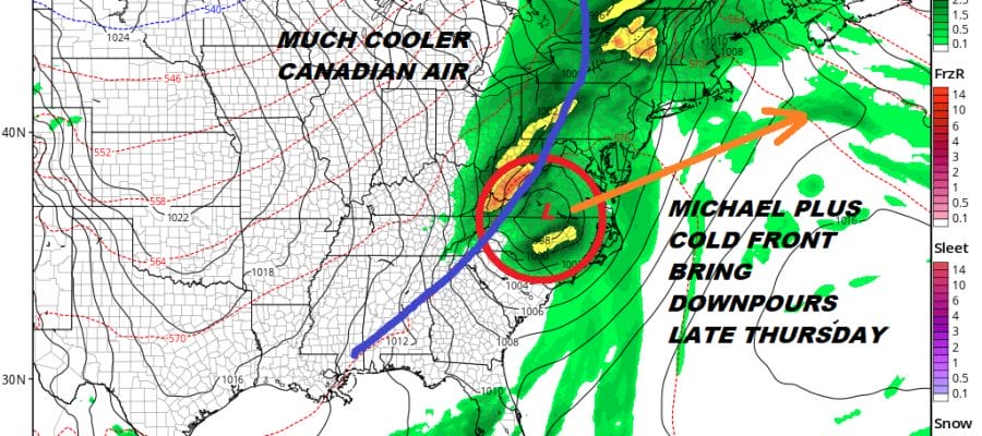
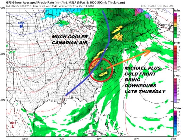
The outlook for late this week will hinge on a cold front arriving on Thursday and Michael which will be tracking northeastward along the frontal boundary and bringing rain up the East Coast. The GFS model has the furthest inland and west track of Michael with the remnant system while most of the weather models have it further east and closer to the coast. This will allow Michael to maintain tropical storm strength as it moves northeastward and it will like bring some rains to areas from Eastern Pennsylvania to Southern New England with the heaviest rains along the immediate coast. Rainfall amounts could be on the order of a couple of inches or more but this is just an early estimate. We will have to work out the details in the coming days once we have a handle on the final track. We can tell you that this will be manageable for the most part and it is completely different from a system that takes a track up the coast and offshore with a landfall. The good news here is that this system will be moving at a pretty good clip so the rains will be in later Thursday and long gone by Friday morning. Cooler Canadian air arrives for Friday and the weekend.
PATREON MEMBERS LIVESTREAM BEGINS AT 9:30AM
SUBSCRIBE TO PATREON FOR A WEATHER EXPERIENCE FREE OF ADS, EXCLUSIVE VIDEOS FOR MEMBERS ONLY AND MUCH MORE…STARTS AT $2 A MONTH..MESSAGE ME AT ANY TIME
MANY THANKS TO TROPICAL TIDBITS FOR THE USE OF MAPS
Please note that with regards to any tropical storms or hurricanes, should a storm be threatening, please consult your local National Weather Service office or your local government officials about what action you should be taking to protect life and property.
LATEST JOESTRADAMUS ON THE LONG RANGE


