Cheap Thrill Snow Showers Sunday Evening Before Warm Air Arrives
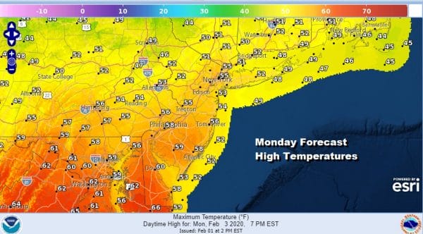
In a winter where you can’t even buy a snow flake let alone a line of snow showers or anything significant, we do have a warm front that will be passing through Sunday night ahead of the warm air coming in for Monday into Tuesday. Some snow showers are showing up on weather models ahead of the frontal passage and if they hold together some very cheap thrill snowflakes are possible late Sunday afternoon into Sunday night before we head to the 50s and even some 60s for Monday.
SATELLITE
Meanwhile it was another day of sitting in lots of clouds along with some drizzle and fog in coastal areas as well as a few other places inland. There is a weak area of precipitation streaming northeastward on the regional radar and that could cause a few showers to be scattered around tonight.
REGIONAL RADAR
The precipitation is light and won’t amount to much. Inland it may actually wind up being cold enough for a few wet snow flakes to get into the mix. Temperatures will likely settle in the 30s overnight.
LOCAL RADAR NEW YORK CITY
LOCAL RADAR PHILADELPHIA

Sunday will be another day with lots of clouds with highs just in the upper 30s to lower 40s. We have the warm front pushing through. Perhaps in colder areas where there is a bit of elevation a whitening of the ground is not impossible.
The warm front goes by and Monday we should see some sunshine. Highs will be in the 50s. We could some areas south of NYC and PHL reach into the 60s depending on how much sun we get.
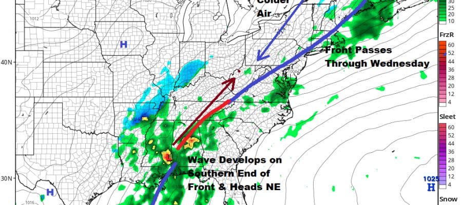
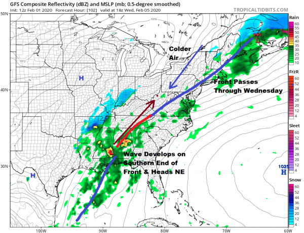
Tuesday brings a cold front with the chance for some passing showers later in the day and Tuesday night. The front will move through Wednesday morning and stall out. Then we have two waves of low pressure that will likely follow this for the second half of the week.
In spite of the GFS colder runs the amount of cold air behind this front is not that impressive. It may be colder for areas from Northern Pennsylvania northeast into New England for some sort of snow ice set up. Also the GFS seems to be a little confused on whether it is one wave or two that comes out of this southern part of the jet stream. It should also be noted that other models struggle to bring that first front through to begin with and that means any cold air will get pinned up much further northwest that what the GFS has. The European oddly enough is the colder model at least at the low levels for Wednesday night and Thursday bring snow sleet and freezing rain down to the coast. Skepticism of all the models here is the correct course of action until we can get a sense of how much cold air are we talking about here ahead of the next 2 waves for Wednesday night and Thursday. A final wave likely goes to our west for Thursday night into Friday which means it warms up and rains eventually. These are the cards we have been dealt with today. We will see what the next couple of days bring as far as figuring this all out. By the way Sunday is Groundhog Day. Any guesses on what the rodent will have to say? I wounder if he has a Super Bowl pick!
BE SURE TO DOWNLOAD THE FREE METEOROLOGIST JOE CIOFFI WEATHER APP &
ANGRY BEN’S FREE WEATHER APP “THE ANGRY WEATHERMAN!
MANY THANKS TO TROPICAL TIDBITS FOR THE USE OF MAPS
Please note that with regards to any severe weather, tropical storms, or hurricanes, should a storm be threatening, please consult your local National Weather Service office or your local government officials about what action you should be taking to protect life and property.


