Canadian Model Goes Off the Wall

Canadian Model Goes Off the Wall
We all know that the Canadian model has not been right since the Battle of Hastings however it does offer a rather interesting alternative to the other models. Actually when you look at the models closely they are very similar with regards to the storm system for early next week. All the models build a strong upper high into Eastern Canada. However the models handle the approaching strong trough differently.
WEATHER MODELS UPPER AIR FORECAST NEXT TUESDAY
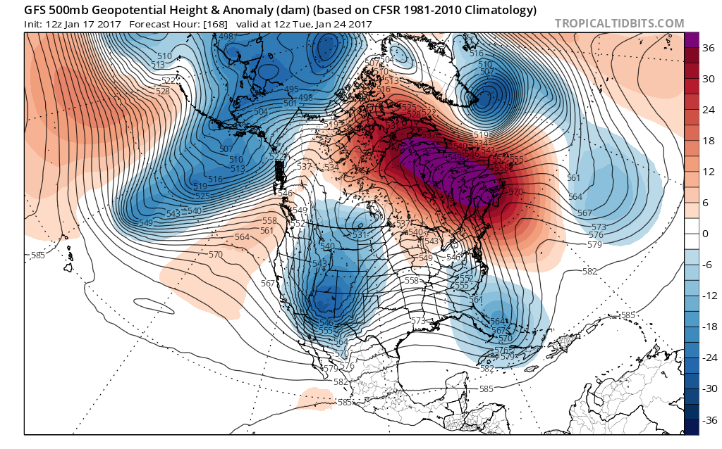
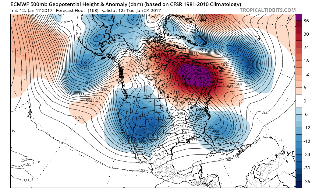
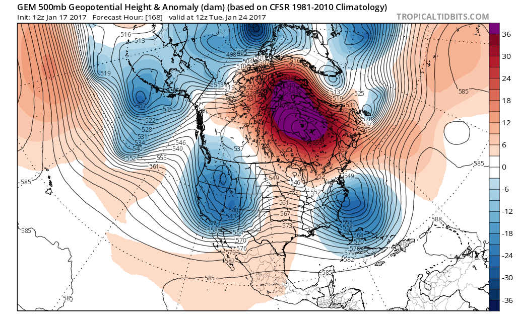
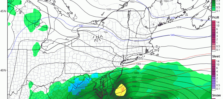
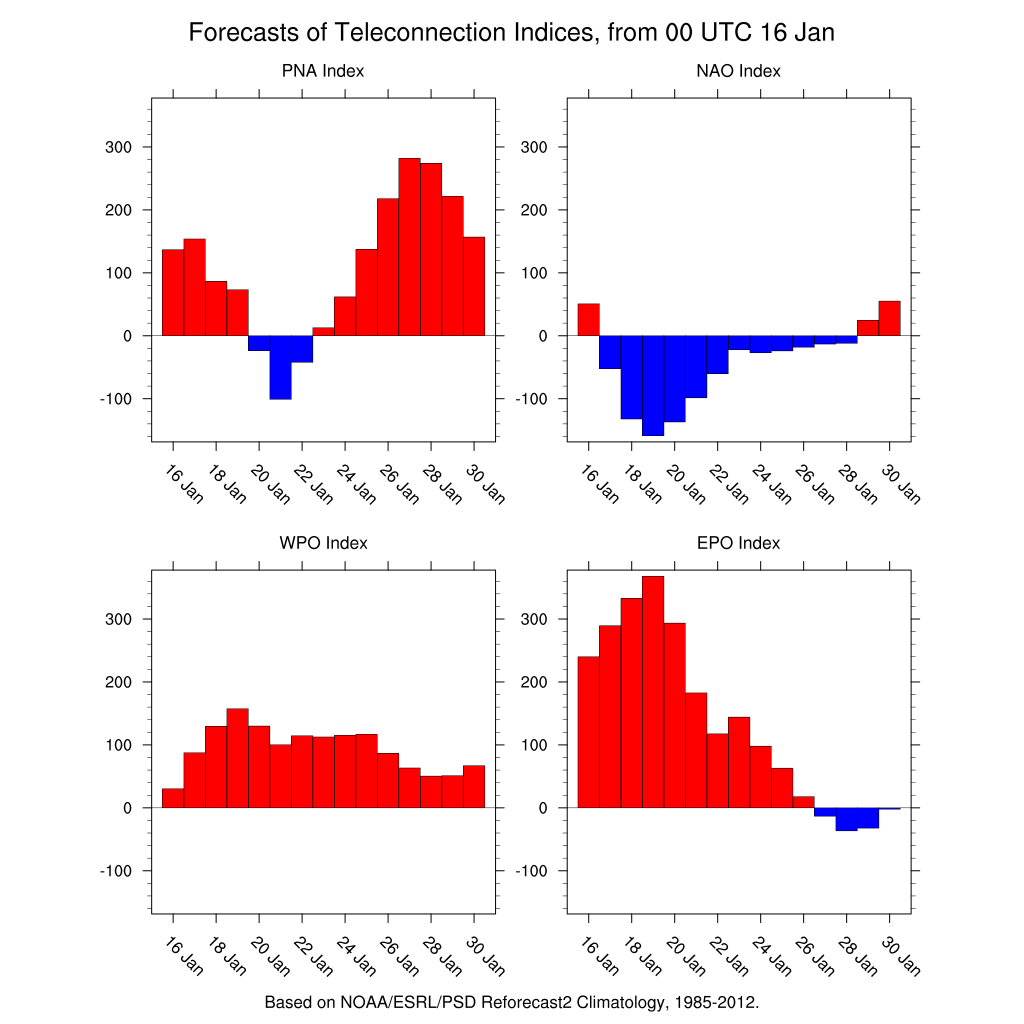
Where the difference lies is in the strength of the upper air storm that the Canadian vigorously cuts off along the Carolina coast. This allows cold air from the blocking high to drain south southward from the building high to the northeast. The European does this but to a lesser extent and only at low levels where it brings the 32 degree line down to New Jersey and Southern New England while the GFS has the trough but never cuts it off. It seems the Canadian responds to the crashing NAO (North Atlantic Oscillation) index which is forecasting strong blocking.
WEATHER MODELS LONG TERM INDICES
The Canadian translates this into a coastal wet snowstorm! Again the Canadian model has not been right since the Crimean War but it does offer a rather interesting and bizarre outlook. It also attempts to do it again 3 days later. Winter weather lovers can only hope and pray at this point.
CANADIAN MODEL SURFACE CLICK TO ANIMATE

For the latest on what other models show check out JOESTRAMUS and his long range post.
MANY THANKS TO TROPICAL TIDBITS FOR THE WONDERFUL USE OF THE MAPS
SNOW REMOVAL COMPANIES FOR YOUR WINTER NEEDS
LONG ISLAND ROCKLAND COUNTY Connecticut

![]()

ROCKLAND COUNTY TRI STATE SNOW REMOVAL JOHNSTOWN PA


FiOS1 News Weather Forecast For Long Island
FiOS1 News Weather Forecast For New Jersey
FiOS1 News Weather Forecast For Hudson Valley
NATIONAL WEATHER SERVICE SNOW FORECASTS
LATEST JOESTRADAMUS ON THE LONG RANGE
Weather App

Don’t be without Meteorologist Joe Cioffi’s weather app. It is really a meteorologist app because you get my forecasts and my analysis and not some automated computer generated forecast based on the GFS model. This is why your app forecast changes every 6 hours. It is model driven with no human input at all. It gives you an icon, a temperature and no insight whatsoever.
It is a complete weather app to suit your forecast needs. All the weather information you need is right on your phone. Android or I-phone, use it to keep track of all the latest weather information and forecasts. This weather app is also free of advertising so you don’t have to worry about security issues with your device. An accurate forecast and no worries that your device is being compromised.
Use it in conjunction with my website and my facebook and twitter and you have complete weather coverage of all the latest weather and the long range outlook. The website has been redone and upgraded. Its easy to use and everything is archived so you can see how well Joe does or doesn’t do when it comes to forecasts and outlooks.
Just click on the google play button or the apple store button on the sidebar for my app which is on My Weather Concierge. Download the app for free. Subscribe to my forecasts on an ad free environment for just 99 cents a month.
Get my forecasts in the palm of your hand for less than the cost of a cup of Joe!
![]()
