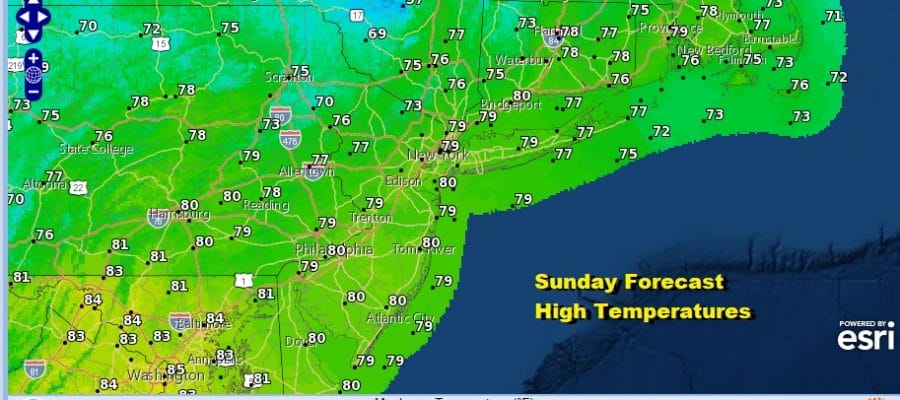
Beautiful Sunday Sunshine Week Ahead Sees No Major Issues Labor Day Weekend Outlook
Finally we have gotten rid of the tropical air, the high humidity, three days of severe weather risks and any showers or thunderstorms. Today is a day of blue sky, sunshine, low humidity, a few passing clouds, a gusty breeze at times, and temperatures in the 70s for highs. It is a perfect late summer day to do anything outdoors and nothing beats a cool breeze of dry air after days of high humidity. Enjoy your Sunday.
SATELLITE

REGIONAL RADAR

There are no issues tonight as we have high pressure overhead with mainly clear skies. Morning lows will be quite cool, mid 50s to lower 60s and even a few upper 40s in some cold spots well inland. Our dry high to the north moves to the east. There is a stalled frontal boundary off the coast. Low pressure over North Florida will move northeastward and stands a chance of developing into a tropical storm over the next few days. It is no threat here though some high clouds will come on Monday. Highs again will be in the 70s.
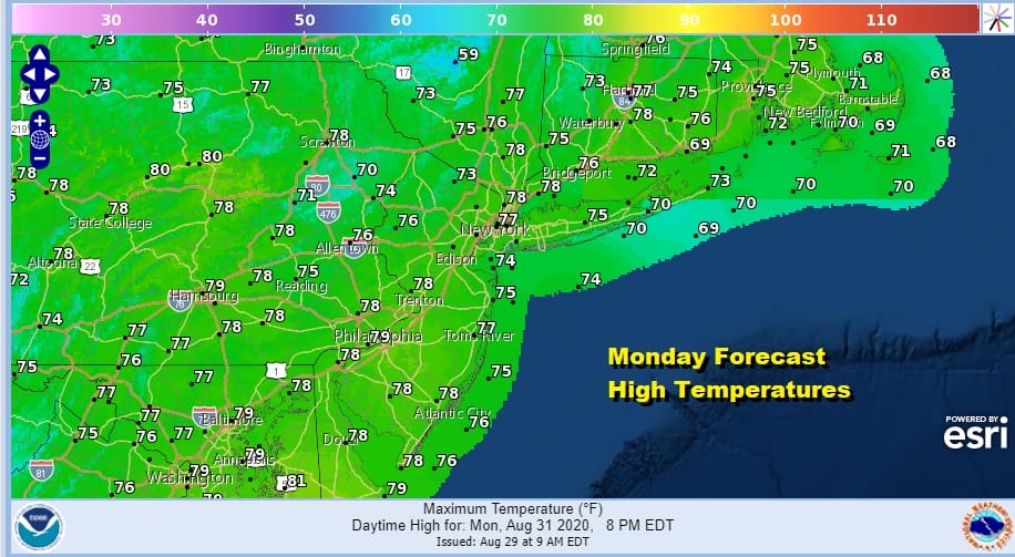
We will see some clouds here Monday night and some rain could briefly reach the coast from Delaware southward but that rain moves out. Weather on Tuesday should feature some sunshine. Highs will reach the upper 70s and lower 80s. The humidity will still be reasonable though it will be trending higher.

Wednesday Thursday and Friday it turns warm and humid and we see the chance for late day showers and thunderstorms popping up. They should be scattered Wednesday and Thursday and perhaps a bit more numerous on Friday as a cold front passes. Highs will be in the 80s and probably middle to upper 80s for Thursday and Friday.

If everything goes according to plan the Labor Day weekend is looking promising at least for the first 2 days and possibly for all three. Friday’s cold front moves offshore and high pressure builds in. Low humidity will be with us all three days with sunshine for the first two and maybe some sun and clouds for Monday Labor day. Highs by day will be in the 70s and nights in the 50s to lower 60s.
BE SURE TO DOWNLOAD THE FREE METEOROLOGIST JOE CIOFFI WEATHER APP &
ANGRY BEN’S FREE WEATHER APP “THE ANGRY WEATHERMAN!
MANY THANKS TO TROPICAL TIDBITS FOR THE USE OF MAPS
Please note that with regards to any severe weather, tropical storms, or hurricanes, should a storm be threatening, please consult your local National Weather Service office or your local government officials about what action you should be taking to protect life and property.


