Clouds Ahead Chance Showers Tonight Warmer More Humid Later This Week
Our dry air mass is overhead this morning and it will be pulling out to the east as the day wears on. This is going to allow clouds from the south to move in and slowly increase as the day wears on. Humidity levels are low today and should remain so as highs will be in the 70s. What sun we see should do a slow fade as a weak disturbance to the southwest edges northward.
SATELLITE

REGIONAL RADAR

There isn’t much on the radars this morning as it is quiet over us but some rain is moving northeastward into West Virginia and Virginia and that rain will nudge northward as the day wears on. As it moves northward it will hit the dry air overhead and start to weaken. The northern edge could reach areas in Southern Pennsylvania Maryland and Delaware but will struggle northward from there. We will throw in the chance for a shower or two tonight but it is quite possible that it never makes it to areas from Northeast Virginia to Southern New England.
Low pressure is developing off the Southeast US coast and heading northeastward out to sea. This system could become a tropical depression or tropical storm as it heads out. The high to the northeast holds in keep the flow onshore. This likely means clouds for Tuesday and we will throw in the chance for a passing shower. Highs will be in the 70s.
We will turn warmer and more humid Wednesday through Friday and in the process we could see some showers late Tuesday night into midday Wednesday as a weak warm front goes by. Some sun could break out in the afternoon with highs back into the 80s. Then we sit and wait for a cold front to arrive on Friday. Ahead of that Thursday and Friday will be warm and humid with some sun and the chance for a shower or thunderstorm on either day. Highs will reach the mid to upper 80s.

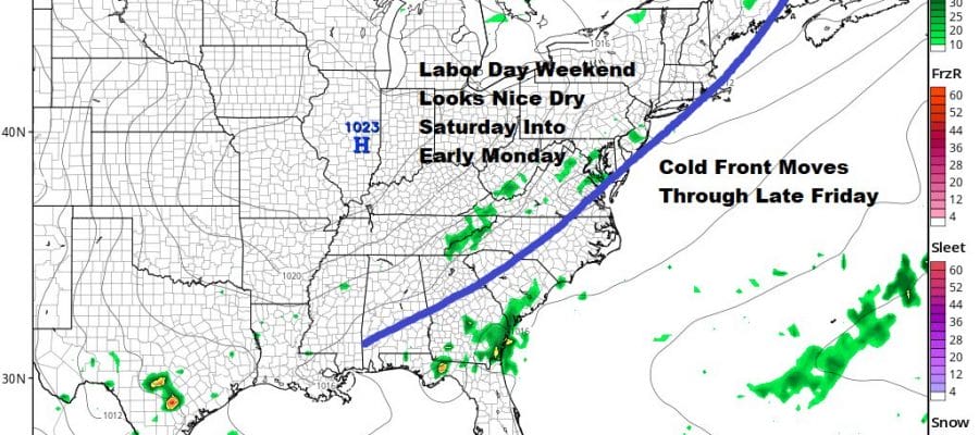
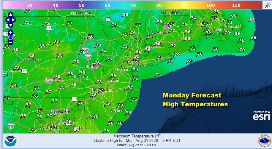
The Labor Day holiday weekend is shaping up to be a good one with sunshine, low humidity and temperatures in the 70s Saturday and Sunday. The dry air will last into early Monday before we start to see the impacts of another cold front that will be approaching Monday evening. Much of the day Monday should be fine with sun and clouds. Highs will be back into the 80s. There might be a shower or thunderstorm Monday evening.
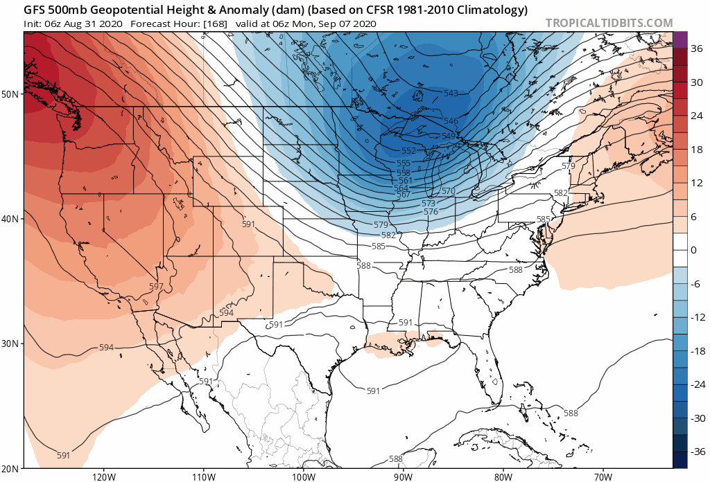
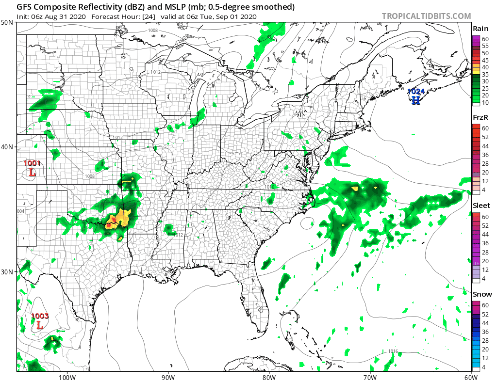
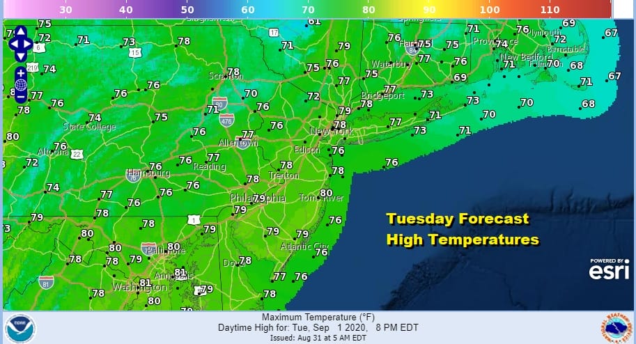
Next week gets complicated. A deep trough and upper low drops southward from the Great Lakes and creates a southerly flow along the east coast. This argues for the Monday front to stall out giving us unsettled weather for the middle part of next week. We also need to be cautious here with this type of upper air pattern if (and it is a big if) a tropical system were to develop and make its way to toward the Southeastern US. There are a number of waves out in the Atlantic that could make that an issue however bear in mind that for now there is no real concern.
BE SURE TO DOWNLOAD THE FREE METEOROLOGIST JOE CIOFFI WEATHER APP &
ANGRY BEN’S FREE WEATHER APP “THE ANGRY WEATHERMAN!
MANY THANKS TO TROPICAL TIDBITS FOR THE USE OF MAPS
Please note that with regards to any severe weather, tropical storms, or hurricanes, should a storm be threatening, please consult your local National Weather Service office or your local government officials about what action you should be taking to protect life and property.


