A Few Showers Overnight Tropical Depression 15 Forms Off North Carolina Coast
Clouds have been increasing all day long thanks to high pressure moving out to the east and an onshore flow that has taken over. We have a weak disturbance to the southwest that is pushing up an area of rain northward. This area will only get so far north before it gets pushed to the east and weakens. We will include the chance for some passing showers tonight though there could be a steadier rain for awhile in South Jersey and Southeastern Pennsylvania before the area moves offshore. Temperatures tonight probably won’t venture far and bottom in the 60s with a few 50s in the coolest spots north and northwest.
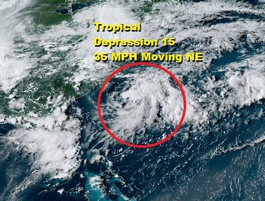
SATELLITE

REGIONAL RADAR

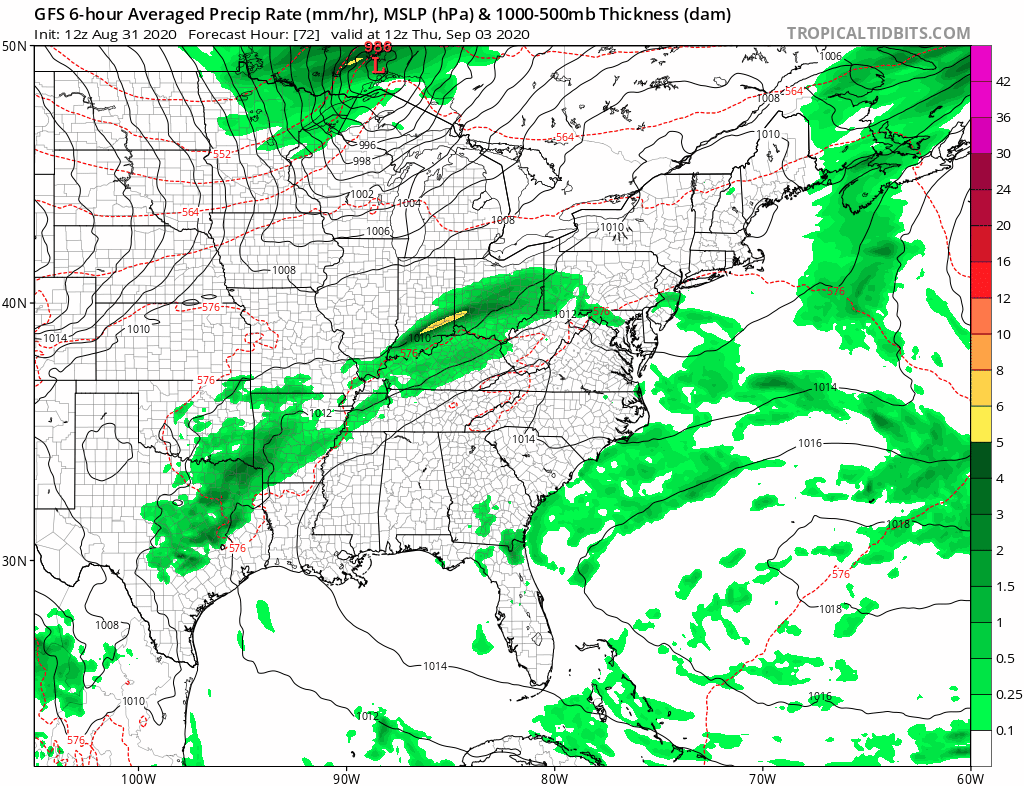
Regional and local radars are picking up on the rain with the heavier rain in Virginia and Maryland. Local radars are showing the impact of the dry air over us as the rain dries up a bit on the northern fringe.
LOCAL RADAR NEW YORK CITY

LOCAL RADAR PHILADELPHIA


Over the next few days the trend will be for warmer and more humid conditions but it really won’t be felt until Wednesday. Tuesday it will probably be cloudy for much of the day with temperatures in the 70s. Perhaps there could be a passing brief shower but we expect to see more widespread activity late Tuesday night into Wednesday morning as a warm front goes by. After that it will be warm and humid with some sun breaking through the clouds and the risk for an afternoon or evening thunderstorm Wednesday. Highs will be back into the 80s.
There isn’t much change in the forecast logic going forward. Thursday will be very warm and humid with the chance for a late thunderstorm. Highs will be in the mid to upper 80s. Friday we have a cold front moving through so we will do it one more time with the risk for a thunderstorm and highs will be in the 80s.

The Labor Day weekend looks good for the first two days with lots of sunshine and very low humidity with highs in the 70s for both Saturday and Sunday. Notice on the dew point loop above we see dew points forecast to drop into the 40s making for a delightful couple of days. The humidity comes back up Monday because another cold front approaches.

Monday will be very warm and humid with highs in the 80s and the likelihood for some afternoon and evening thunderstorms. That front stalls along the East Coast next week making for complications regarding a continuing threat for showers for much of next week.
TROPICAL DEPRESSION 15 FORMS OFF THE NORTH CAROLINA COAST

Low pressure off the North Carolina coast has developed into a tropical depression as advertised and it is moving northeast at 10 mph away from the Carolina coastline. It will be heading out to the northeast tonight and Tuesday and will probably become a tropical storm but no impact to land is forecast.
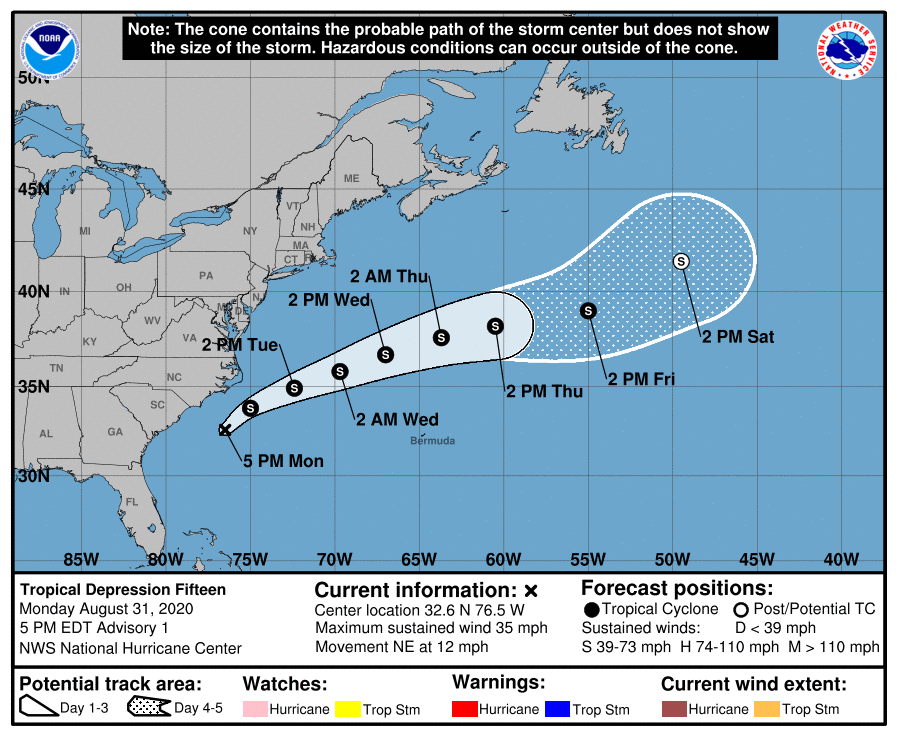
This system tracks well to the north of Bermuda per the National Hurricane Center forecast. The next name on the list is Nana and it will be the earliest “N” storm as this record breaking hurricane season continues.
BE SURE TO DOWNLOAD THE FREE METEOROLOGIST JOE CIOFFI WEATHER APP &
ANGRY BEN’S FREE WEATHER APP “THE ANGRY WEATHERMAN!
MANY THANKS TO TROPICAL TIDBITS FOR THE USE OF MAPS
Please note that with regards to any severe weather, tropical storms, or hurricanes, should a storm be threatening, please consult your local National Weather Service office or your local government officials about what action you should be taking to protect life and property.


