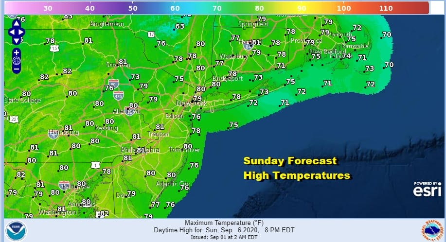
Warmer More Humid Into Friday Labor Day Weekend Looking Good
We are seeing clouds around the Northeast and Mid Atlantic states today. A warm front lies to our south and that front will start to push northward later today. Also on the satellite off the North Carolina coast is Tropical Depression 15. It is offshore and moving away to the northeast with no impact here other than it might kick up the surf a bit over the next day or so. We will have clouds around today and there could be the odd shower here and there however brief and however spotty. Temperatures today will be holding in the 70s as humidity levels start to climb.
SATELLITE

REGIONAL RADAR

Radar’s today aren’t picking up on much other than some scattered showers both regionally and on the local radars below. Activity could pick up a bit later today but it should remain scattered in nature.
LOCAL RADAR NEW YORK CITY

LOCAL RADAR PHILADELPHIA


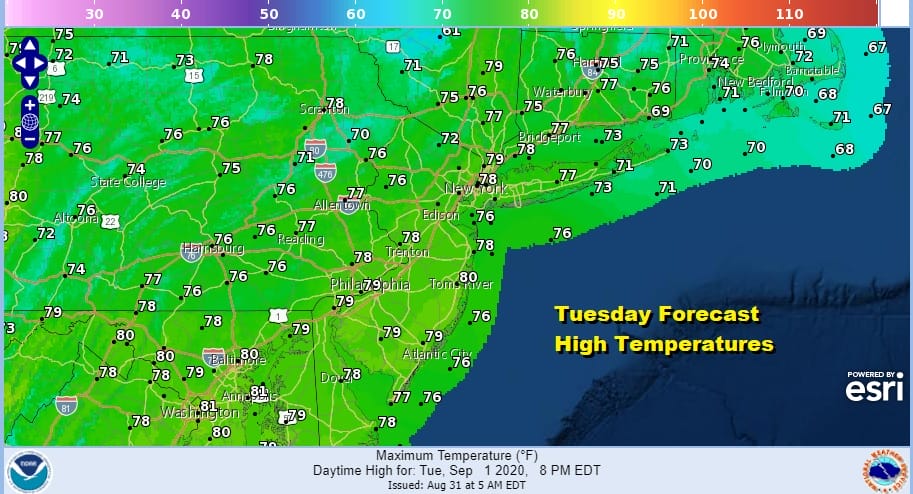
Let’s move along to tonight where it will be warmer and more humid. We are likely to see some showers and perhaps a thunderstorm very late tonight into Wednesday morning. This is our warm front passing through. After it goes by it will be humid and warm. Some sun should break through the clouds Wednesday and temperatures will be back into the 80s. Warm humid conditions continue Thursday with the risk for a shower or thunderstorm. Highs will be in the mid to upper 80s.
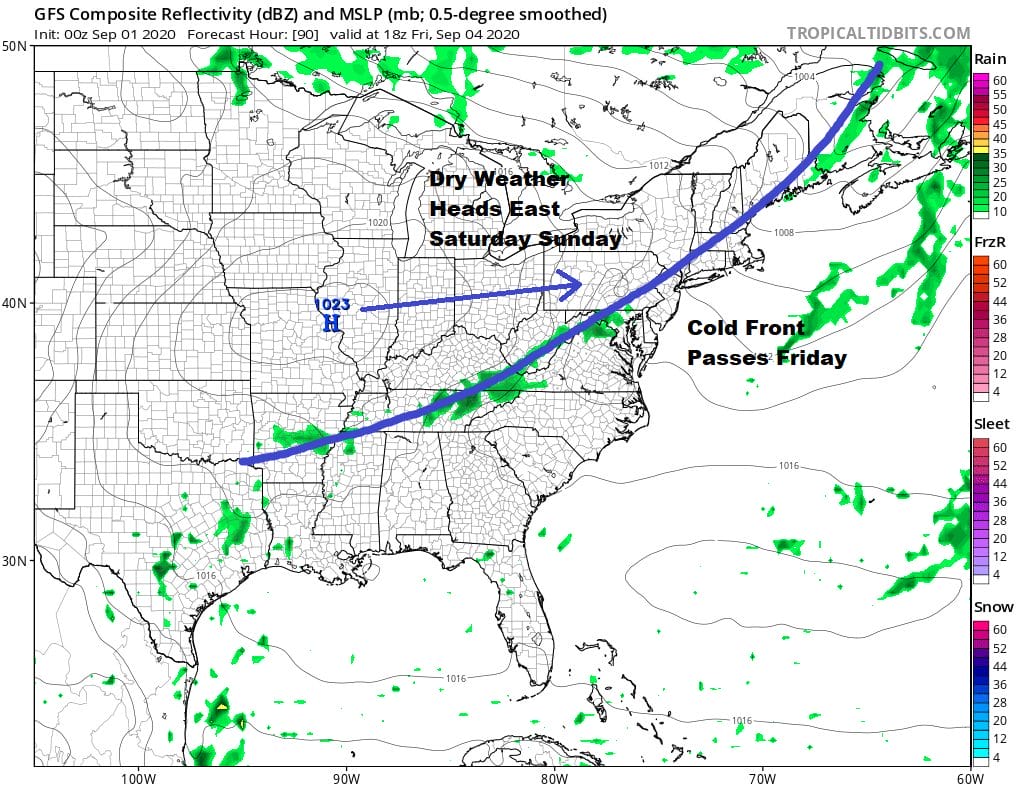
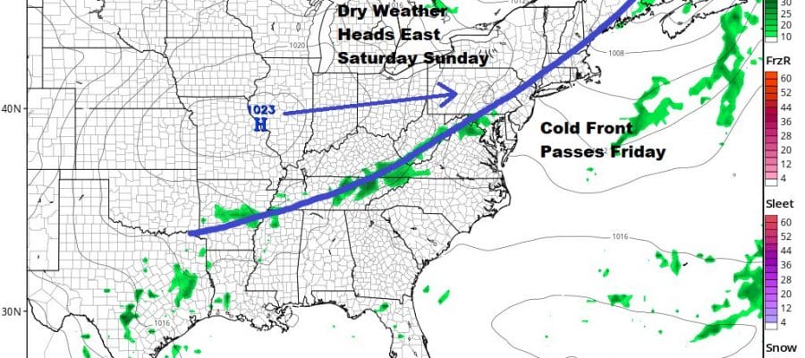
Our outlook for the weekend remains unchanged. We are looking at a cold front passing through on Friday with little consequence as it goes by. It will be warm and the day starts humid with highs in the 80s. Then in comes high pressure from the Middle Mississippi Valley with tons of dry air setting us up for a delightful Saturday and Sunday.
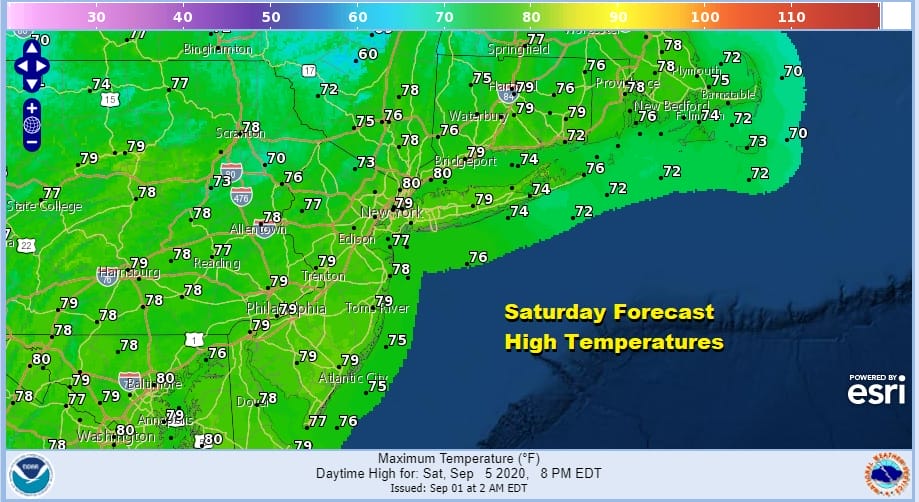
We are forecasting lots of sunshine for Saturday with highs mostly in the 70s and nighttime lows in the 50s to lower 60s. Sunday will be a repeat performance of low humidity and sunshine with highs in the 70s to near 80.
Monday Labor Day should be fine for most of the day though it will be warmer and more humid. Our high pressure area moves offshore and a cold front will be approaching. Showers and thunderstorms should hold off until late in the afternoon or evening. Highs will be in the 80s.
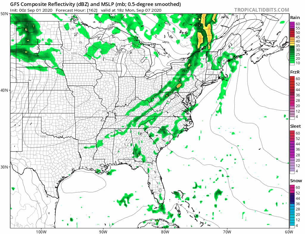
Much of next week looks unsettled with Monday’s cold front stalling out along the coast in a north south fashion and the potential for waves of showers and thunderstorms Tuesday into at least Thursday. It does look as if the heaviest rain will be to the west but it is close enough to prove problematic here from day to day. As long as we don’t have a tropical storm looming off the coast we should be able to manage through this.
BE SURE TO DOWNLOAD THE FREE METEOROLOGIST JOE CIOFFI WEATHER APP &
ANGRY BEN’S FREE WEATHER APP “THE ANGRY WEATHERMAN!
MANY THANKS TO TROPICAL TIDBITS FOR THE USE OF MAPS
Please note that with regards to any severe weather, tropical storms, or hurricanes, should a storm be threatening, please consult your local National Weather Service office or your local government officials about what action you should be taking to protect life and property.


