Bad Hair Weather Continues Into Wednesday
Bad Hair Weather Continues Into Wednesday
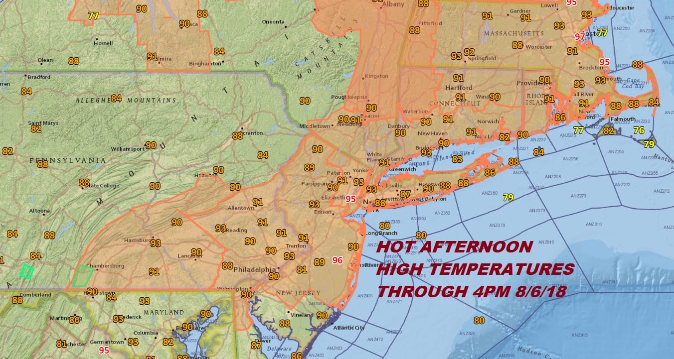
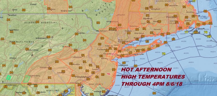
It was another absolutely hot and and steamy day with most highs between 90 and 95 degrees. Even coastal areas made it well into the 80s to near 90 with an ineffective sea breeze. This time of year ocean water temperatures are approaching their seasonal highs in the mid 70s to near 80 so the sea breeze has little impact. There were a couple of pop up isolated thunderstorms that developed thanks to the daytime heating in parts of Ocean and Burlington Counties in New Jersey. It came and went very quickly. Also some isolated pop ups are still appearing on the radar but the vast majority of you are just in the steam bath. High humidity insures bad hair weather continues into Wednesday as we wait for a slow moving cold front to move through.
EASTERN SATELLITE

REGIONAL RADAR

Any pop up thunderstorms that show up on the regional or local radars this evening will disappear by sunset. Tonight should just be another very warm humid night with most lows in the low to mid 70s.
LOCAL RADAR NEW YORK CITY

LOCAL RADAR PHILADELPHIA


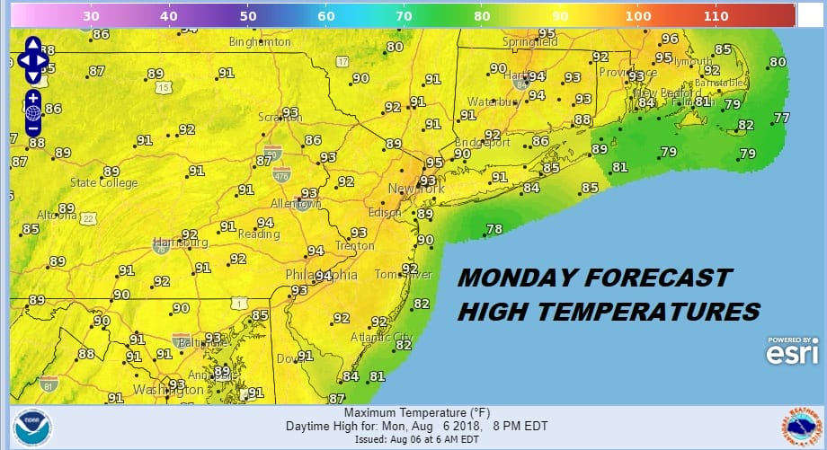
Tuesday will be much like today except that there will be a better chance for thunderstorms late in the day and in the evening. It will be another day with highs reaching above 90 degrees though if thunderstorms form soon enough they could limit the upside.
Wednesday will be another very warm to hot and humid day with thunderstorms running around especially late in the day. Highs will be in the 80s to near 90. Then finally on Thursday we will get a slight break in the humidity as the dew points edge down somewhat. However this is not going to be anything worth celebrating about. It will still be a bit uncomfortable though at least we can get a break from oppressive humidity. This will be short lived as the next front approaches this weekend. Showers seem likely Saturday and Sunday looks like we could be dry with some sunshine. We will speculate more on the weekend as we get closer to it.
Please note that with regards to any tropical storms or hurricanes, should a storm be threatening, please consult your local National Weather Service office or your local government officials about what action you should be taking to protect life and property.
 GET JOE A CIGAR IF YOU LIKE

LATEST JOESTRADAMUS ON THE LONG RANGE


