Autumn Weekend Cool Temperatures Warmer Next Week
SHOP THE JOESTRADAMUS STORE

Autumn Weekend Cool Temperatures Warmer Next Week
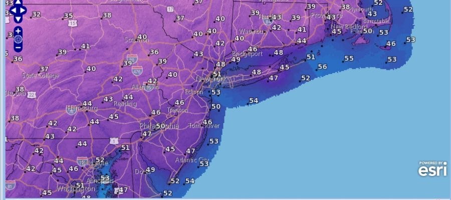
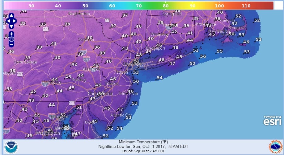
We have a rather nice cool autumn weekend underway however we do have an upper air disturbance moving through today that could trigger off a few instability showers later this morning and this afternoon. They should be scattered in nature and not everyone will see showers. There will be some sunshine in the mix in between Temperatures today will be in the 60s just about everywhere and it sets us up for a cool night tonight into Sunday morning with lows in many areas in the 40s.
There really isn’t too much going on across the Eastern US. We do see clouds and showers off the Southeast coast of the US and across Florida as low pressure will try and develop in that area but the chances for tropical storm development are fairly low as conditions are not all that favorable aloft.
SATELLITE LOOP

REGIONAL RADAR

Watching the radars this morning we can see come scattered showers around and even a few thunderstorms have developed offshore. Look for some of this pop up activity to continue into this afternoon before it all shifts to the east and the atmosphere stabilizes.
LOCAL RADAR NEW YORK CITY

LOCAL RADAR PHILADELPHIA


Sunday looks nice and sunny with highs in the 60s to near 70. The new week will bring another warming trend as an upper high builds into the east but this probably won’t last much beyond midweek nor will the heat be as extreme. We should be back into the 70s Monday and Tuesday and perhaps near 80 or so Wednesday. The longer range weather pattern looks to be undergoing some sort of transition and we will address this later today.
 GET JOE A CIGAR IF YOU LIKE

FiOS1 News Weather Forecast For Long Island
FiOS1 News Weather Forecast For New Jersey
FiOS1 News Weather Forecast For Hudson Valley


