Thunderstorms Scattered Around On Radar
\SHOP THE JOESTRADAMUS STORE

Thunderstorms Scattered Around On Radar
We are seeing an upper air disturbance and secondary cold front move through at the moment and it is producing some scattered heavy downpours and a few thunderstorms are in the mix as well. It is funny how we seem to be getting more activity in this cool air mass then we did in some of the summer systems that moved through but such is weather sometimes. The satellite loop shows a definable twist in the cloud cover moving southeast from Upstate NY. We will probably see some scattered downpours and thunderstorms into the afternoon until the disturbance moves to the east.
SATELLITE LOOP

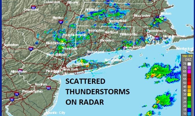
REGIONAL RADAR

At the moment the cluster of storms is moving across Southeast NY, parts of Long Island & Southern New England but there is little going on at the moment across New Jersey and Eastern Pennsylvania.
LOCAL RADAR NEW YORK CITY

LOCAL RADAR PHILADELPHIA


Once the disturbance passes skies should clear out tonight and it will be quite cool with lows in the 40s just about everywhere except for the warmer urban locations that will be in the lower 50s. Sunday’s highs with sunshine should probably not get out of the 60s.
 GET JOE A CIGAR IF YOU LIKE

FiOS1 News Weather Forecast For Long Island
FiOS1 News Weather Forecast For New Jersey
FiOS1 News Weather Forecast For Hudson Valley


