Autumn Arrives Saturday
Autumn Arrives Saturday
Even though Autumn technically arrives Thursday, by the standpoint of our weather it will arrive on Saturday. We are still in a summery pattern here with a ridge in the east. Clouds remain this evening and humidity is high however dry air and clouds should finally push through tonight and skies should clear out. The problem is the remnant low of Tropical Storm Julia which is swriling about along the Virginia coast. It should begin to drop southward tonight and that should allow the dry air to the north to finally get in here.

The satellite loop also shows Tropical Storm Karl coming into the picture. You can also see to the west of Karl is an upper low which continues to create shearing issues. This is the reason why Karl has not strengthened into a hurricane and it may not until that upper low gets out of the way. Regardless, Karl is going to turn northeastward before it gets anywhere close to the east coast. Bermuda could see something from Karl depending on its final track.


Wednesday Through Friday Outlook
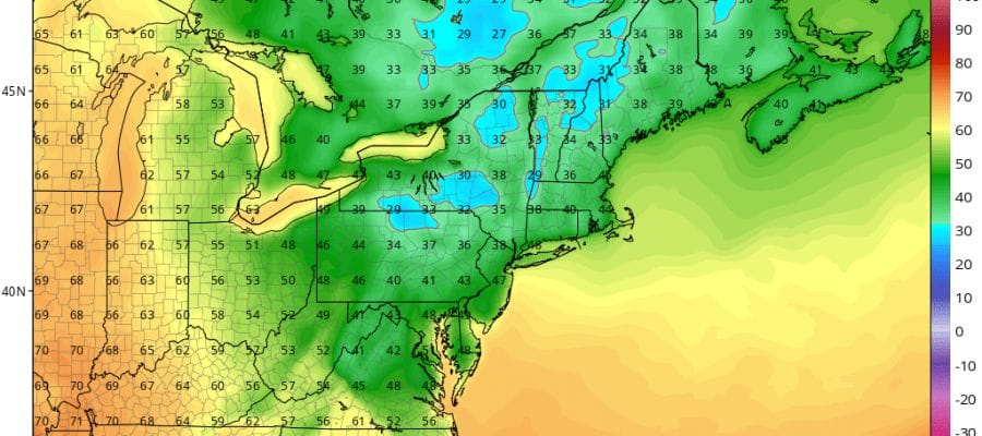
The next 3 days should feature a good amount of sunshine with highs in the low to mid 80s. Humidity levels should be lower for the next 2 days. The next weather front arrives Friday night with a shower. Then in comes cool air for the weekend and the first part of next week. The weekend will be dry. Highs Saturday will be in the low to mid 70s but Sunday and Monday inspite of sunshine highs will only be in the 60s. Nights will be very cool. Saturday and Sunday night we should see lows in many areas down in the 40s!
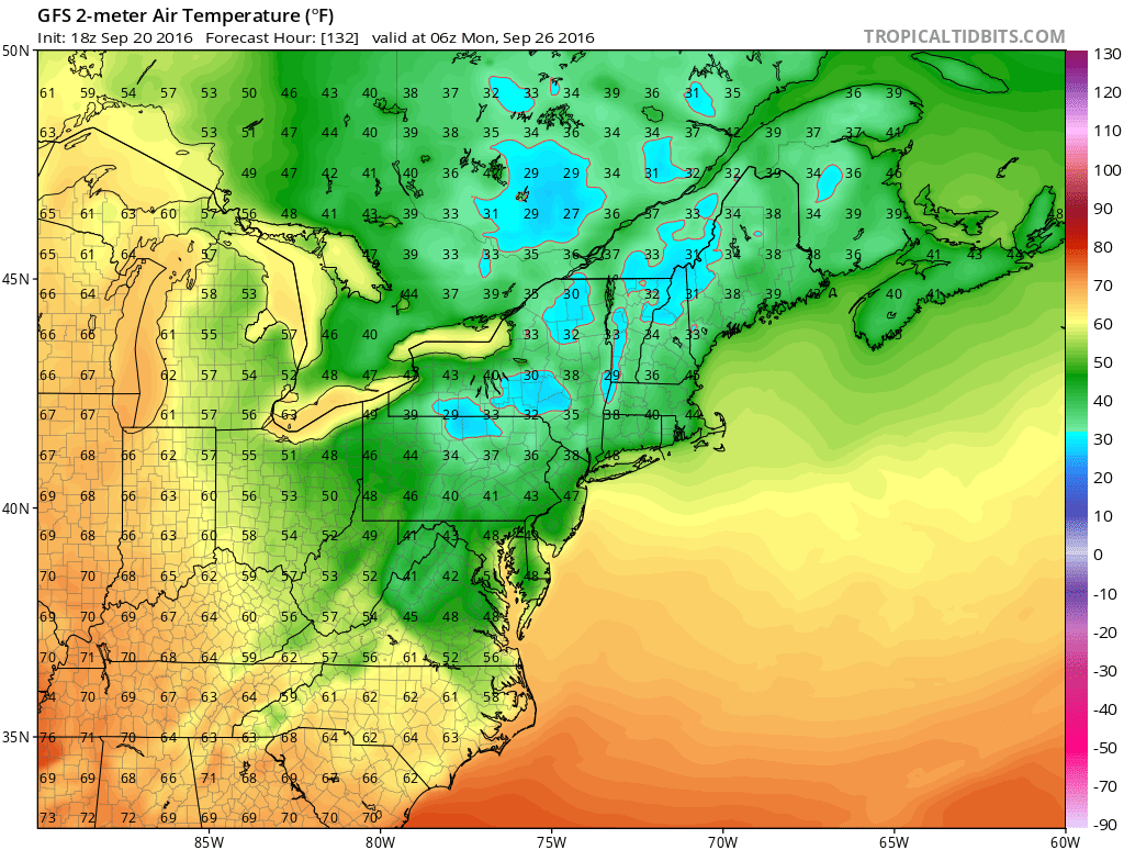
Sunday night we will see parts of Northern Pennsylvania, upstate NY, and New England see their first frosts and freezes! Another shot of cool air will come in behind this one on Tuesday before it warms up again later next week. No big storms and no rain is in the forecast for the next 7 days. Happy Autumn!
WINTER WEATHER OUTLOOK VIDEOS
In case you missed them I’ve been previewing the upcoming winter in a series of posts and videos. Here are the first 2. More will be coming along. Links to the latest posts are below.
NEW JERSEY
LONG ISLAND AND NEARBY
WINTER 2016-2017 PART 3 NEW JERSEY
WINTER 2016-2017 PART 1 OCEAN WATER TEMPERATURES
WINTER 2016-2017 PART 2 ARCTIC SEA ICE AND SIBERIAN SNOW COVER
FiOS1 News Weather Forecast For Long Island
FiOS1 News Weather Forecast For New Jersey
FiOS1 News Weather Forecast For Hudson Valley
NATIONAL WEATHER SERVICE SNOW FORECASTS
LATEST JOESTRADAMUS ON THE LONG RANGE

Weather App

Don’t be without Meteorologist Joe Cioffi’s weather app. It is really a meteorologist app because you get my forecasts and my analysis and not some automated computer generated forecast based on the GFS model. This is why your app forecast changes every 6 hours. It is model driven with no human input at all. It gives you an icon, a temperature and no insight whatsoever.
It is a complete weather app to suit your forecast needs. All the weather information you need is right on your phone. Android or I-phone, use it to keep track of all the latest weather information and forecasts. This weather app is also free of advertising so you don’t have to worry about security issues with your device. An accurate forecast and no worries that your device is being compromised.
Use it in conjunction with my website and my facebook and twitter and you have complete weather coverage of all the latest weather and the long range outlook. The website has been redone and upgraded. Its easy to use and everything is archived so you can see how well Joe does or doesn’t do when it comes to forecasts and outlooks.
Just click on the google play button or the apple store button on the sidebar for my app which is on My Weather Concierge. Download the app for free. Subscribe to my forecasts on an ad free environment for just 99 cents a month.
Get my forecasts in the palm of your hand for less than the cost of a cup of Joe!

MENTION JOE CIOFFI AND GET A 5% DISCOUNT


