Another Day of Great Weather Last Weekend of Summer Will Be Summer Like
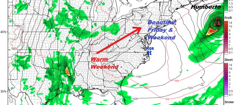
We woke up to a chilly start to the day as lows bottomed in the 40s and lower 50s. Deep blue sky and sunshine cover the Northeast and Middle Atlantic states though we do see a little bit of coastal cloudiness from New Jersey southward but that won’t last long. Clouds are lining the coastal waters as we see cool air over the very warm ocean. Far to the east we have the western edge of Hurricane Humberto with 125 mph winds. Humberto is beginning its transition into a post tropical cyclone.
SATELLITE

REGIONAL RADAR

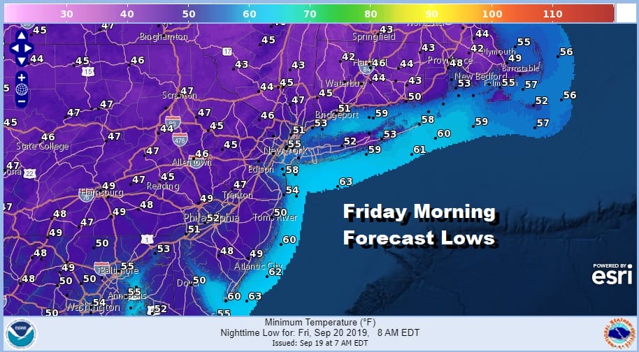
The stretch of rain free weather continues with nothing on the radar and we won’t be seeing anything on the radars at least into the start of the weekend. Lots of sunshine today will take highs up into the low 70s in most places. Tonight will be another cool night with most lows in the 40s to low 50s.
Friday we have high pressure settling to our south with another day of lots of sunshine. Temperatures will be rising as high pressure moves to Virginia and our winds go from northeast to west and then southwest. Highs will be in the 70s to near 80 degrees.

Saturday and Sunday will be a warm weekend for the last weekend of the summer season. It will be a beach weekend with sunshine both days, no rain, and highs will be in the low to mid 80s. It is an easy forecast and except for rough ocean seas that still may be around on Saturday, it is a great way to finish the summer with one or both days at the beach.
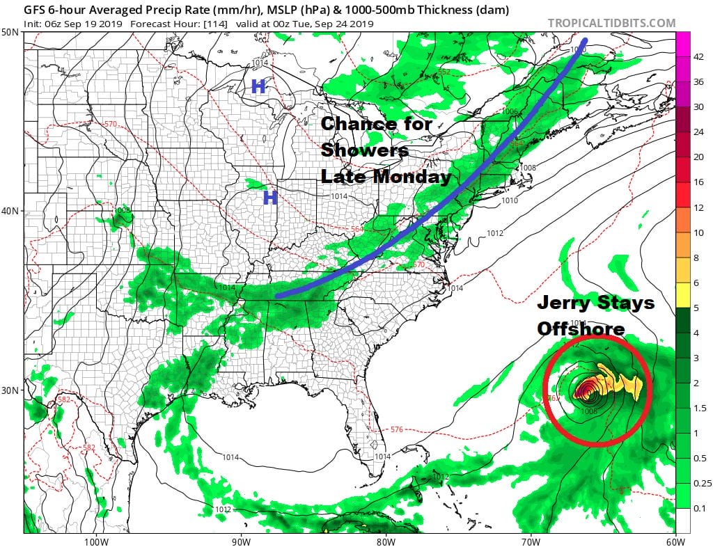
The next cold front finally arrives on Monday with sun and arriving clouds with highs into the 80s. We may see a few showers as the front goes by late in the day into Monday night. We will also see Tropical Storm or Hurricane Jerry well off the Southeast coast. The upper flow will be from the west with another trough moving off the east coast so Jerry will recurve to the north and then to the northeast over the open waters of the Atlantic with no impact here though we could see a close pass to Bermuda again. Monday is the first day of Autumn. Cooler dry air returns for Tuesday and Wednesday with seasonal temperatures and sunshine returning.
MANY THANKS TO TROPICAL TIDBITS FOR THE USE OF MAPS
Please note that with regards to any tropical storms or hurricanes, should a storm be threatening, please consult your local National Weather Service office or your local government officials about what action you should be taking to protect life and property.


