
Active Weather Pattern Continues Into Next Week

Active Weather Pattern Continues Into Next Week
The weather pattern across North America appears to remain very active into next week. One of the things forecasters need to be careful of is one or two runs that show radical changes that more often than not don’t wind up happening. It is probably wiser to just let the trend be your friend until such time that mounting evidence suggests something changing.
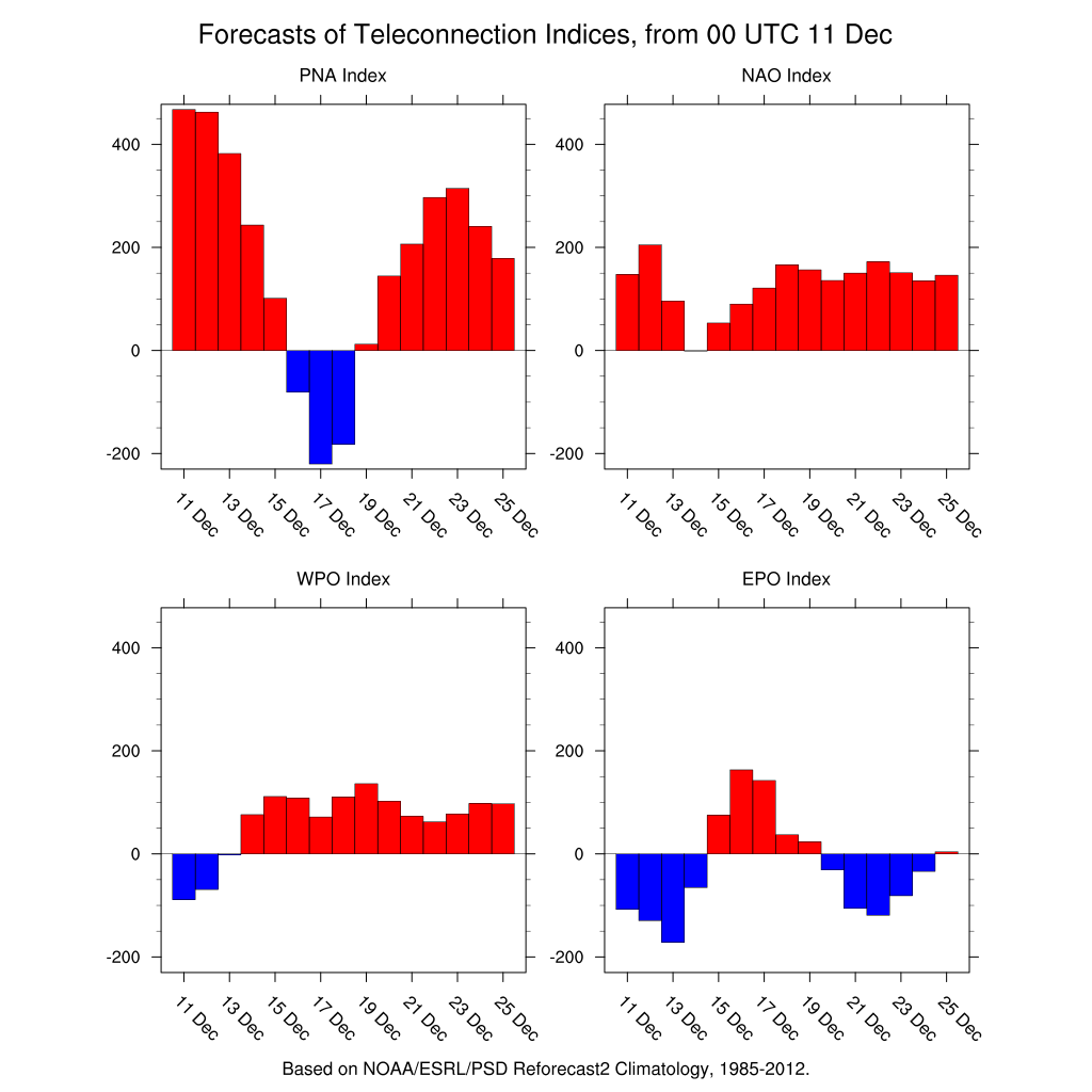
The teleconnections would suggest a minor interruption in the overall weather pattern for a few days beginning this weekend, however today’s weather models are suggesting something a bit different. The Pacific North America index goes negative briefly before shooting back positive again. The East Pacific Oscillation index goes positive before it drops negative again. The combination of a strong positive PNA and a strong negative EPO are usually strong indicators for cold and possibly snowy weather in the Eastern US.
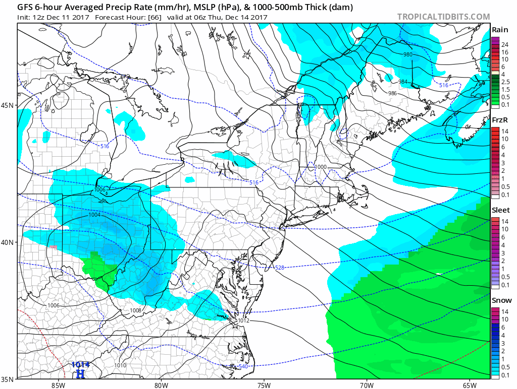
The persistent deep trough in the East will produce several systems dropping southeast out of Canada. The first one Tuesday goes by to our north and bring heavier snows to upstate NY to New England. We here could see temperatures run toward 50 on Tuesday before the cold front passes and cold air comes in late in the day. The arrival of the cold air could come with a burst of snow tomorrow evening. The next system comes on Thursday and this looks weak but there could be a period of snow with this when it goes by.
GFS FORECAST THURSDAY CLICK TO ANIMATE
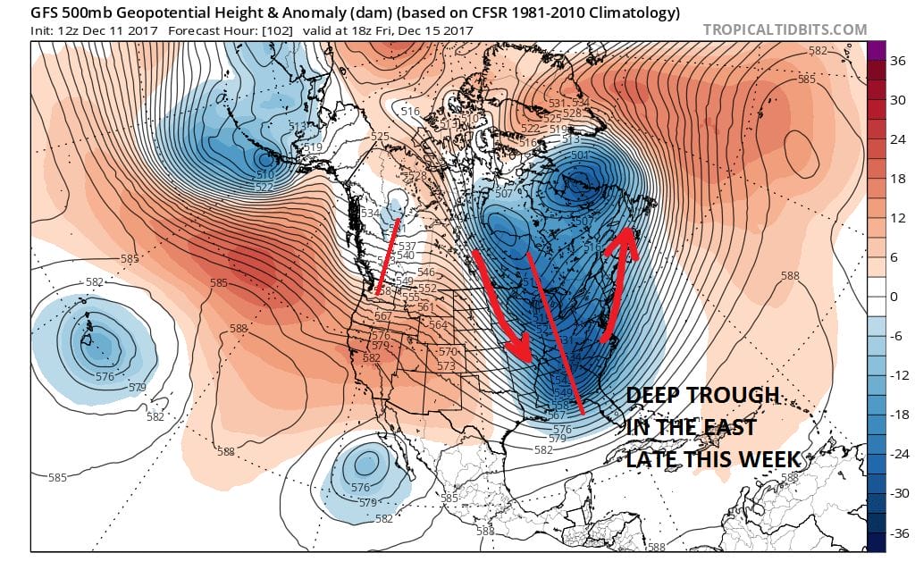
The GFS takes this weak low to the south Thursday but the European & Nam are a shade further north with this. It is certainly worth the mention for some snow on Thursday. The more important possibility lies for later Friday and Friday night as the upper trough sharpens. This in some ways is like what we just went through with the GFS model phasing the two jet streams while the European keeps it flatter.
GFS JET STREAM FORECAST FRIDAY DECEMBER 15, 2017
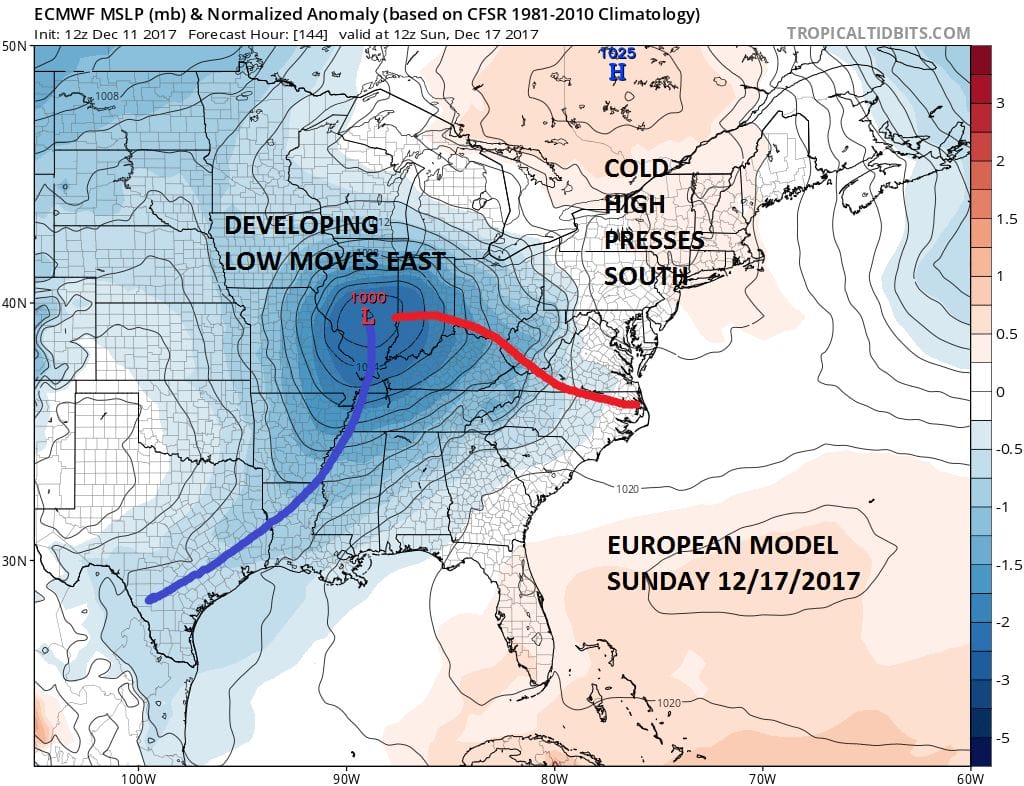
Given that we just experienced how weather models can miss the boat on what is actually happening, we need to keep all possibilities open with this until it becomes clear whether this system will phase together or will the southern part of the trough get left behind. Models also point to another possibility and here the European is showing a colder pattern into next week.
EUROPEAN MODEL SUNDAY DECEMBER 17 2017
First things first will be Thursday with the lead system which by Thursday morning on the NAM has some snow on our doorstep. The key to this will be whether there is enough room for it to hold together since there will still be a strong storm to the northeast.
MANY THANKS TO TROPICAL TIDBITS FOR THE WONDERFUL USE OF THE MAPS

GET JOE A CIGAR IF YOU LIKE!
FiOS1 News Weather Forecast For Long Island
FiOS1 News Weather Forecast For New Jersey
FiOS1 News Weather Forecast For Hudson Valley
NATIONAL WEATHER SERVICE SNOW FORECASTS
LATEST JOESTRADAMUS ON THE LONG RANGE
Weather App

Don’t be without Meteorologist Joe Cioffi’s weather app. It is really a meteorologist app because you get my forecasts and my analysis and not some automated computer generated forecast based on the GFS model. This is why your app forecast changes every 6 hours. It is model driven with no human input at all. It gives you an icon, a temperature and no insight whatsoever.
It is a complete weather app to suit your forecast needs. All the weather information you need is right on your phone. Android or I-phone, use it to keep track of all the latest weather information and forecasts. This weather app is also free of advertising so you don’t have to worry about security issues with your device. An accurate forecast and no worries that your device is being compromised.
Use it in conjunction with my website and my facebook and twitter and you have complete weather coverage of all the latest weather and the long range outlook. The website has been redone and upgraded. Its easy to use and everything is archived so you can see how well Joe does or doesn’t do when it comes to forecasts and outlooks.
Just click on the google play button or the apple store button on the sidebar for my app which is on My Weather Concierge. Download the app for free. Subscribe to my forecasts on an ad free environment for just 99 cents a month.
Get my forecasts in the palm of your hand for less than the cost of a cup of Joe!