
Snow Forecasts National Weather Service 12112017

GET JOE A CIGAR SO HE CAN RELAX!
Snow Forecasts National Weather Service 12112017
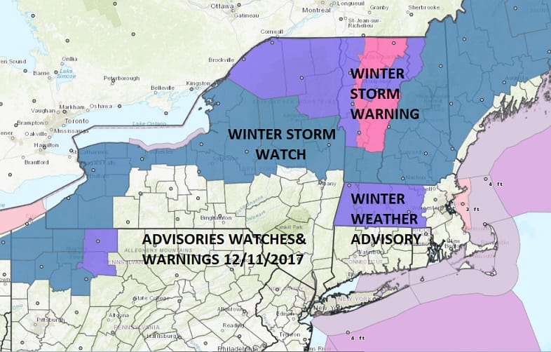
Low pressure is going to track across upstate NY and into New England tonight and Tuesday and this will bring some significant snows to upstate NY and Central & Northern New England. Winter Storm Watches are posted for a large part of this area. Winter Storm Warnings are already posted for most of Vermont. Snow amounts in these areas could be on the order of 6 inches or more. For our neck of the woods they seem to be covering for a coating to an inch or so with the approaching warm front tonight but I’m not exactly excited over the prospects here at this point. Later Tuesday and Tuesday night the lake effect snow machine will be revving up and some squalls from there might survive the trip south east and move through here Tuesday evening as the cold air arrives.
NEW YORK CITY AND VICINITY SNOW

NEW JERSEY & PARTS OF NE PA

SOUTHERN AND SOUTHEAST NEW ENGLAND

NORTHERN NEW ENGLAND

WESTERN NEW ENGLAND

MIDDLE AND UPPER HUDSON VALLEY

CENTRAL NEW YORK & NE PA

WESTERN NEW YORK

CENTRAL & SOUTH CENTRAL PA

VIRGINIA & MARYLAND

DAILY NORTHEAST SNOWFALL

Please be advised that these are National Weather Service Forecast Maps and they auto update. Each office may update at different times and some offices are slower to update then others. Maps are usually updated before 5am and & 5pm however they may be updated at other times depending on forecast conditions. These are not my forecasts. My forecasts can be found on the JOE’S SNOWFORECAST PAGE. Individual forecasts for specific areas may also be found when conditions warrant on the my area forecasts. Those can be found on the website menu. Click on forecasts and then select your specific area.