Snow Forecast 1211207 Storm Tracks North Tuesday

GET JOE A CIGAR SO HE CAN RELAX!
Snow Forecast 1211207 Storm Tracks North Tuesday
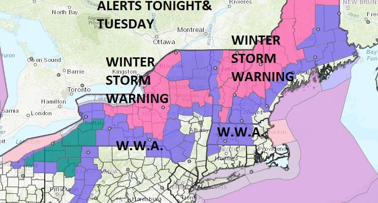
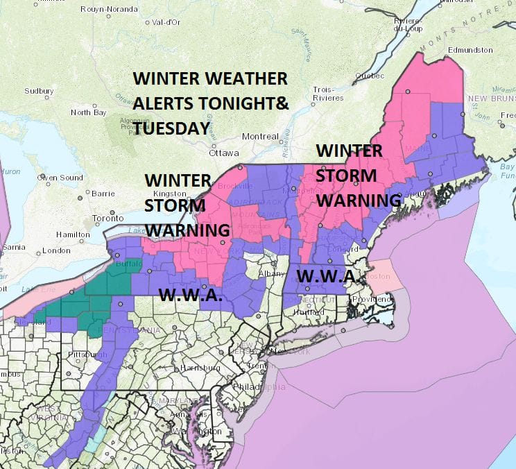
These are the late afternoon updated National Weather Service snow forecast maps for tonight and Tuesday as low pressure tracks to our north. The NAM model shows this quite well as do the other models. There might be a burst of snow in the Northern & Western Counties of New Jersey tonight and into the Hudson Valley before the warm front goes by. Then on Tuesday after a brief run at 50 degrees much colder air follows on strong northwest winds Tuesday night and Wednesday. There could be some snow showers or even a heavier snow squall tomorrow evening.
In upstate NY and Northern New England much of the area is under a Winter Storm Warning with a general 6 to 10 inch snowfall . Northeastern New England could see snow of 12 inches or more total as this storm intensifies Tuesday night into Wednesday morning.
NEW YORK CITY AND VICINITY SNOW

NEW YORK CITY & VICINITY ICE

NEW JERSEY & PARTS OF NE PA

SOUTHERN AND SOUTHEAST NEW ENGLAND

NORTHERN NEW ENGLAND

WESTERN NEW ENGLAND

MIDDLE AND UPPER HUDSON VALLEY

CENTRAL NEW YORK & NE PA

WESTERN NEW YORK

CENTRAL & SOUTH CENTRAL PA

VIRGINIA & MARYLAND

DAILY NORTHEAST SNOWFALL

Please be advised that these are National Weather Service Forecast Maps and they auto update. Each office may update at different times and some offices are slower to update then others. Maps are usually updated before 5am and & 5pm however they may be updated at other times depending on forecast conditions. These are not my forecasts. My forecasts can be found on the JOE’S SNOWFORECAST PAGE. Individual forecasts for specific areas may also be found when conditions warrant on the my area forecasts. Those can be found on the website menu. Click on forecasts and then select your specific area.