Winter Weather Advisory Snow Ice Forecast Monday 01082018
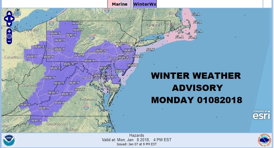
Winter Weather Advisory Snow Ice Forecast Monday 01082018
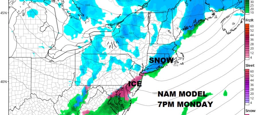
Winter Weather Advisory is posted for areas from Northern New Jersey (south of Route 78) south and west into Pennsylvania as well areas to the south in Maryland, Delaware & Northern Virginia. We have a snapshot of the NAM model at 7pm Monday as a weak weather front moves through.
NAM MODEL 7PM MONDAY 01082018
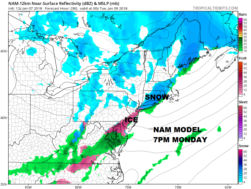
Precipitation develops in the late afternoon and just in time for the evening rush hour drive. The system is weak and the precipitation with it us under .15 inch of liquid. This is going to leave anywhere from a coating to 2 inches across the area with a large variation from place to place. Ice is going to be the main issue in areas to the south with the very cold ground slow to warm above freezing. It should all be over with long before midnight Monday night. Ice will be the bigger problem as it doesn’t take much to make roads slippery.

GET JOE A CIGAR SO HE CAN RELAX!
NEW YORK CITY AND VICINITY SNOW

NEW YORK CITY & VICINITY ICE

NEW JERSEY SE PA & VICINITY ICE
NEW JERSEY & PARTS OF NE PA

SOUTHERN AND SOUTHEAST NEW ENGLAND

NORTHERN NEW ENGLAND

WESTERN NEW ENGLAND

MIDDLE AND UPPER HUDSON VALLEY

CENTRAL NEW YORK & NE PA

WESTERN NEW YORK

CENTRAL & SOUTH CENTRAL PA

VIRGINIA & MARYLAND

DAILY NORTHEAST SNOWFALL

Please be advised that these are National Weather Service Forecast Maps and they auto update. Each office may update at different times and some offices are slower to update then others. Maps are usually updated before 5am and & 5pm however they may be updated at other times depending on forecast conditions. These are not my forecasts. My forecasts can be found on the JOE’S SNOWFORECAST PAGE. Individual forecasts for specific areas may also be found when conditions warrant on the my area forecasts. Those can be found on the website menu. Click on forecasts and then select your specific area.