Winter Weather Advisories Eastern Pa, Much of New Jersey, NYC, Hudson Valley, Connecticut

Weather in 5/Joe & Joe Weather Show Latest Podcast
Winter Weather Advisories Eastern Pa, Much of New Jersey, NYC, Hudson Valley, Connecticut
We can describe this as a low end winter weather advisory that is up for most of the area from the Northern Mid Atlantic to Southern New England. Areas to the south in Southern Pennsylvania and Southern New Jersey will see their snow this evening and the first part of tonight. The areas from Northeast Pennsylvania and Northern New Jersey to the Hudson Valley, NYC and the Catskills it will be more of a Tuesday into Tuesday night affair.
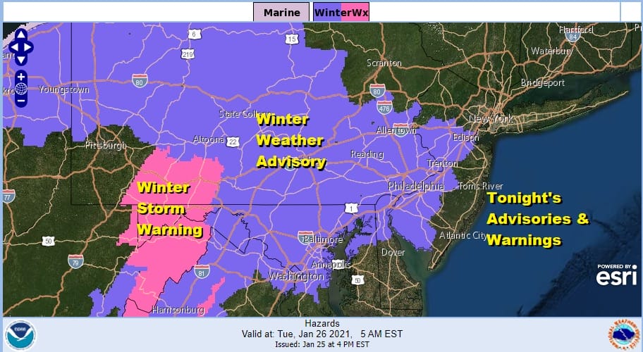
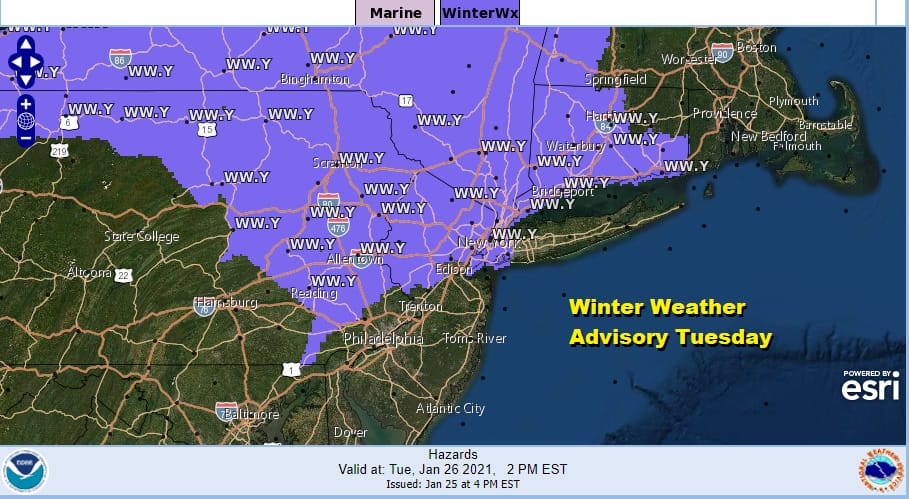
The map above shows the Winter Weather Advisories and Winter Storm Warnings that are up for tonight. The map below shows the Winter Weather Advisories that are up for the daytime Tuesday.
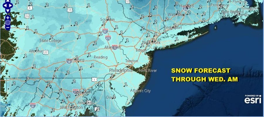
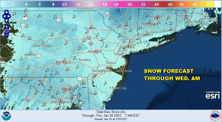
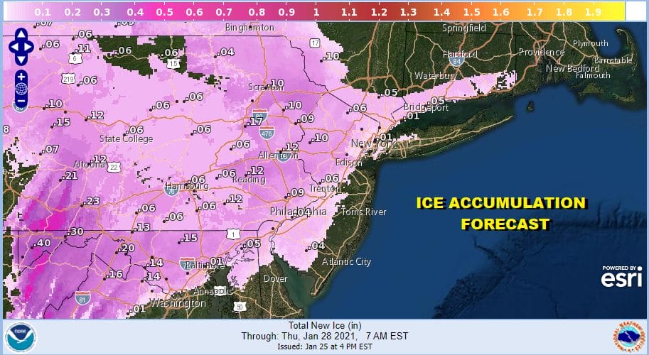
Snow and ice accumulation forecasts have not changed much from earlier. Most areas will be in a rage of 1 to 2 inches. Some places will wind up with a bit more and others will wind up with a bit less. There isn’t much upside to this weak system from what we have seen today.
In addition to any snow there will be a change to freezing rain in the Winter Weather Advisory zone for tonight. Freezing rain or freezing drizzle will also be an issue in the advisory area for Tuesday after a period of snow.
The satellite picture this evening shows clouds that have increased all day. Clouds are now moving into Northern areas from NYC northward where most of the day was spent in partly sunny skies. Clouds will continue to increase across upstate NY and New England.
SATELLITE

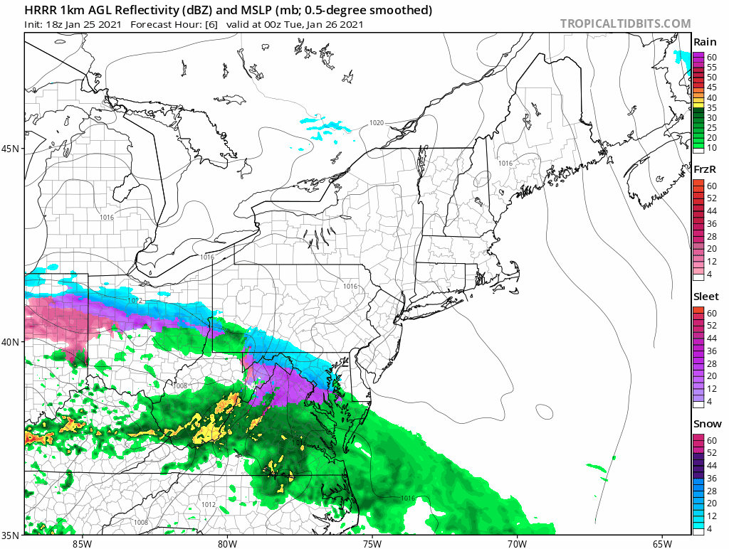
While the New England regional radar will be quiet for most of the night, the Mid Atlantic radar is busy and we are seeing snow breaking out across the northern edge of the precipitation shield across Maryland and Northern Virginia. The snow will spread into Southern Pennsylvania and Southern New Jersey later this evening.


Later tonight expect a change to freezing rain in those in the Winter Weather Advisory for tonight. It will taper off to freezing drizzle by day break. Roads will be slick all night so take extra care when travelling.
The action shifts northward to Northeastern Pennsylvania, Northern New Jersey, the Catskills, Hudson Valley, NYC, Connecticut and Long Island where we will see snow or a wintry mix of snow sleet and freezing rain making for a slick go of things. Tuesday night we need to watch for freezing rain or freezing drizzle that could glaze things up a bit. Temperatures will be in the 20s to lower 30s tonight and low to mid 30s on Tuesday. Weather conditions should improve later Wednesday. A new storm forming off North Carolina Wednesday night into Thursday will not come up here but it will pull down very cold air from Canada for late week and the weekend.
BE SURE TO DOWNLOAD THE FREE METEOROLOGIST JOE CIOFFI WEATHER APP &
ANGRY BEN’S FREE WEATHER APP “THE ANGRY WEATHERMAN!
MANY THANKS TO TROPICAL TIDBITS FOR THE USE OF MAPS
Please note that with regards to any severe weather, tropical storms, or hurricanes, should a storm be threatening, please consult your local National Weather Service office or your local government officials about what action you should be taking to protect life and property.


