Winter Storm Watches Southern New Jersey to Delaware Maryland,
Additional Warnings & Advisories Likely

Weather in 5/Joe & Joe Weather Show Latest Podcast
Winter Storm Watches Southern New Jersey to Delaware Maryland,
Additional Warnings & Advisories Likely

The first winter storm watches and winter storm warnings have gone up this morning with watches for Southern New Jersey, Delaware into Maryland and warnings for Western and Southwestern Virginia. We will likely see more watches, warnings and advisories go up later. If you have been following the progress of this system over the last few days, you may have noted that I was not particularly excited about this system figuring that the GFS model’s aggressive north track was way too far north and unlikely. I have a very uneasy feeling about this because there will be a sharp northern cut off to the snow.
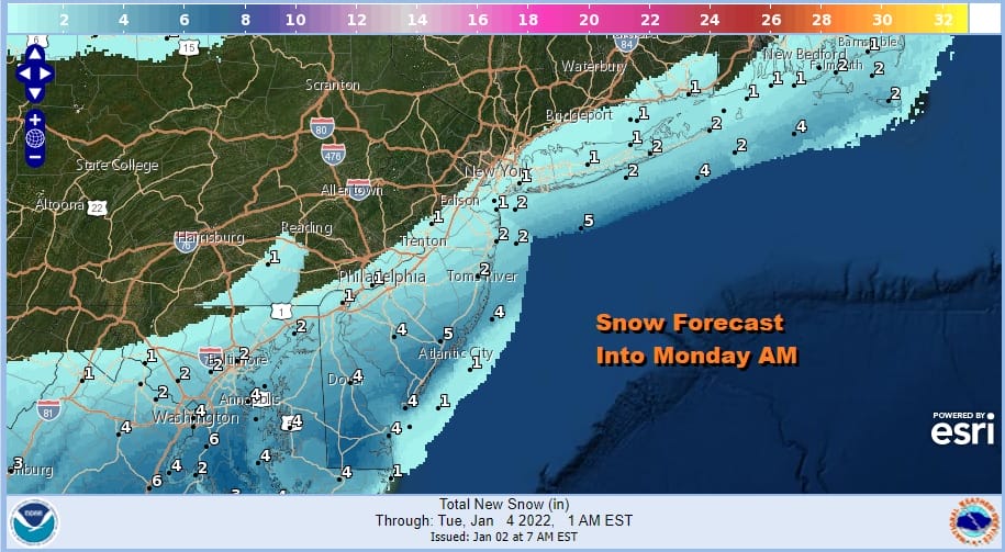
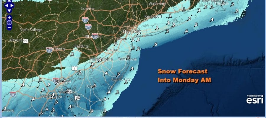
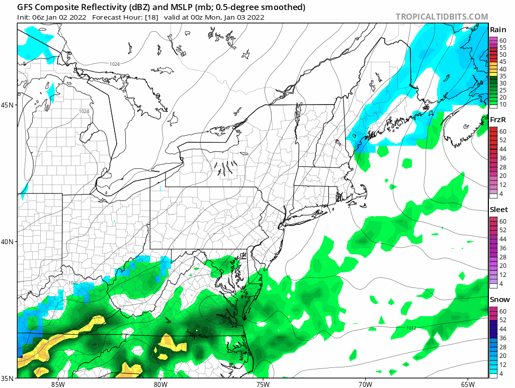
These are some of the early numbers from the NWS snow forecast map. The snow sharply cuts off at NYC and at Boston. No question that this is a very tough call for forecasters all the way around today. We have seen other global models go up with snow amounts and a more northerly track. The European model has probably made the biggest leap northward in the last few days since it was way south and until yesterday had no snow into New Jersey much less areas to the north.
SATELLITE

WEATHER RADAR

Meanwhile it is a cloudy day today with another round of gloom and doom with temperatures in the 50s. You can see the rain shield to the south. Colder air lies to the north and that should start bleeding southward later today and tonight. As the low develops, colder air will move southward and we should be near or below freezing after 4am. Snow develops on the northern fringe of this storm. Accumulations will start on colder surfaces and then by 7am it should be sticking to everything with temperatures in the 20s.
Again the big question will be the northern cut of snow. Will it be around NYC and Southern New England south of I-95 or are we going to see a push further north as some models suggest to a cut of north of Boston, to Hartford, to Route 84. That is a big forecast dilemma here and frankly my confidence on how this plays out is very low. Snow should end from west to east Monday afternoon and it will be cold for Tuesday into Wednesday. We could be setting up for another chance for snow Thursday night into Friday though I have not given that a close look as of yet. All the focus to day will be on this system for late tonight and Monday.
BE SURE TO DOWNLOAD THE FREE METEOROLOGIST JOE CIOFFI WEATHER APP &
ANGRY BEN’S FREE WEATHER APP “THE ANGRY WEATHERMAN!

MANY THANKS TO TROPICAL TIDBITS & F5 WEATHER FOR THE USE OF MAPS
Please note that with regards to any severe weather, tropical storms, or hurricanes, should a storm be threatening, please consult your local National Weather Service office or your local government officials about what action you should be taking to protect life and property.


