Winter Storm Warning Winter Weather Advisories Continue Today & Tonight
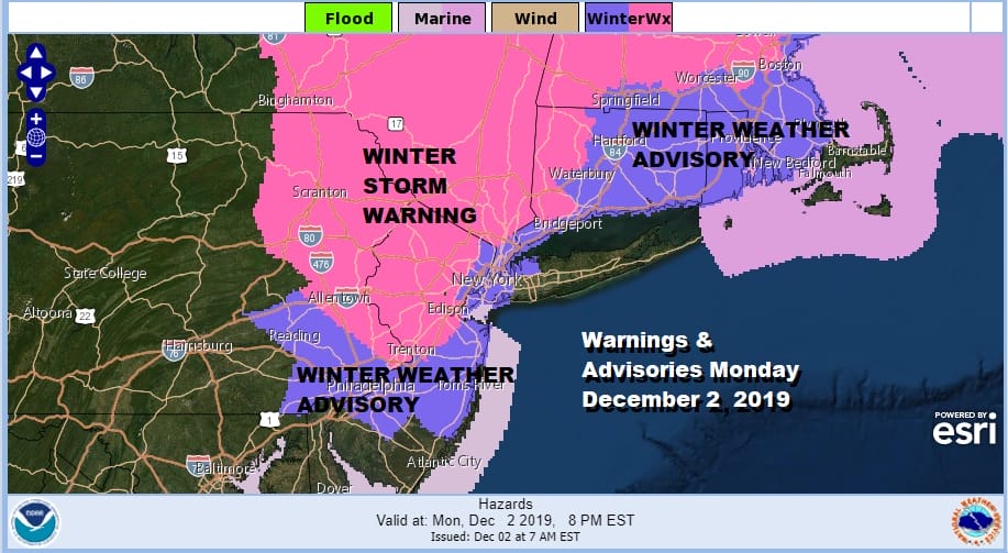
There wasn’t much change overnight nor was there much in the way of precipitation overnight of any time. We start the day with temperatures mostly in the low to mid 30s. Low pressure sits offshore stalled and so are we. Winter Storm Warnings remain in effect for much of Eastern Pennsylvania to just north of Philadelphia, northwest through much of New Jersey north and west of the NJ Turnpike and west of 287. Winter Weather Advisories cover much of the rest of New Jersey except the southernmost counties. Winter Storm Warnings continue in the Hudson Valley and NW Connecticut and points north while Winter Weather Advisories cover NYC, Western Long Island and much of the rest of Southern New England.
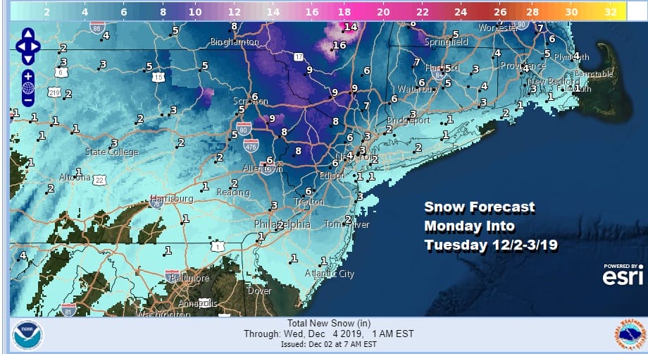
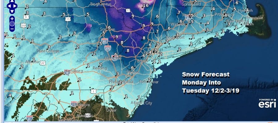
I wish that i had a clearer view of what is going to happen today and as I look at the overnight models and what is going on at the surface and radars this morning I thought it best to let the radars tell me later today who is going to get what. The map above is the National Weather Service snow forecast map. Below is my snow forecast map which i did last night and remains unchanged today.
There wasn’t anything overnight that leads me to believe any one area is at greater risk nor do i have any strong confidence in the outcome one way or the other. I think everyone will see something out of this though just exactly what is a bit of a mystery. If i had to lean one way or another i would say lean to the low end of these numbers and look for the possibility of some heavy bands in side those areas above that produce amounts closer to the high side. That is about the best anyone can do in a weather situation like this where you are waiting for the details to fill ion the radars and surface observations as the day wears on. They will tell us everything.
SATELLITE

REGIONAL RADAR

This morning the satellite and radars are all rather blotchy in clouds as well as what we are seeing on the radars. There is a huge gaping hole where we sit but the radars are starting to fill in a bit. I expect not much will happen until this afternoon and tonight with the main game between 1pm this afternoon and 4am Tuesday.
LOCAL RADAR NEW YORK CITY

LOCAL RADAR PHILADELPHIA


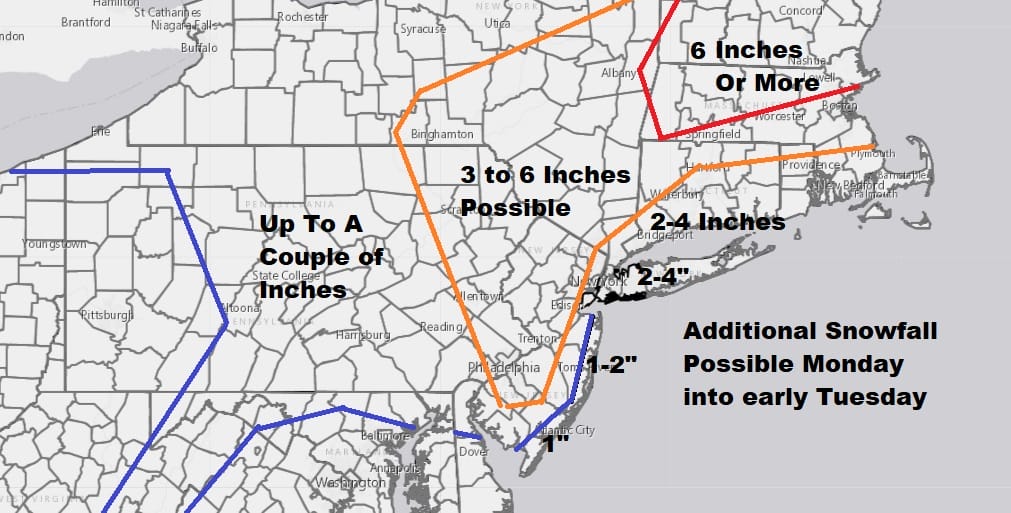
Low pressure is sitting offshore and a strong vigorous upper low is swinging around into Virginia and then will turn northeast tonight. Upper lows like this in the past have caused jackpot surprises for some folks and disappointment for others. They are tricky in that the snow will have a banded nature to it. Therefore if you are inside one of those bands you can get double the amount of folks sitting in between the bands.

The NAM model favors a more widespread view of snow today and tonight while other models have more snow from NYC west and south rather than north and east. The NAM model has been the most consistent through all of this so we will stay with it. 1pm Today until 4am Tuesday is prime time. Then weather conditions improve during Tuesday as this storm moves away from New England and we get back to some sunshine with highs in the mid 30s north and west of NYC to upper 30s and lower 40s everywhere else. It doesn’t appear as if much of anything happens for the rest of the week. We will take a look at the longer range after this system plays itself out.
BE SURE TO DOWNLOAD THE FREE METEOROLOGIST JOE CIOFFI WEATHER APP &
ANGRY BEN’S FREE WEATHER APP “THE ANGRY WEATHERMAN!
MANY THANKS TO TROPICAL TIDBITS FOR THE USE OF MAPS
Please note that with regards to any severe weather, tropical storms, or hurricanes, should a storm be threatening, please consult your local National Weather Service office or your local government officials about what action you should be taking to protect life and property.


