
Winter Storm Warning Winter Weather Advisories Continue Freezing Rain
We have Winter Storm Warnings continuing for Northwest New Jersey with Winter Weather Advisories southward to the NJ Turnpike. Winter Weather Advisories also continue for the Hudson Valley and Connecticut and we can add Long Island to the mix now where temperatures overnight settled near 32 and have caused some icing mainly inland.
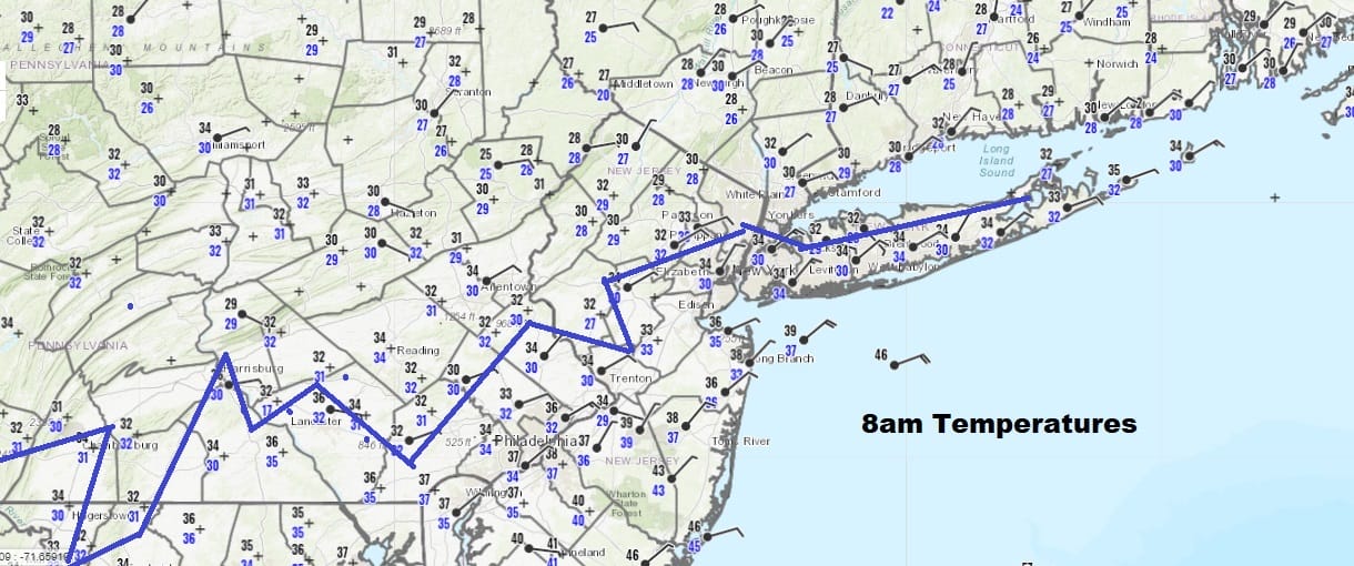
Snow and sleet were basically minimal from this system and now we spend the day dealing with more rain coming through and temperatures in many (but not all) areas at or below 32. The freezing line this morning as of 8am is zig-zagging its way across Long Island southwestward to Southern Pennsylvania.
SATELLITE

REGIONAL RADAR

The radars still remain active this morning with blotchy areas of rain moving northeastward and of course where temps are 32 or less we are seeing freezing rain. Upstate NY as you head toward I-90 it is mostly snow there as well as across interiror Central New England.
LOCAL RADAR NEW YORK CITY

LOCAL RADAR PHILADELPHIA


For the rest of today it will be on and off freezing rain perhaps mixing with some sleet or even a little wet snow late in the day as the precipitation comes to an end. Temperatures today will pretty much sit where they are not in the upper 20s to middle 30s. Low pressure is developing off the New Jersey coast and it will only very slowly pull away. Ice accretion continues in areas that hold below the freezing mark. Weather conditions will improve tonight as skies partially clear. Most lows will be in the 20s so we will likely see icing developing tonight as we may not have an opportunity to dry today.
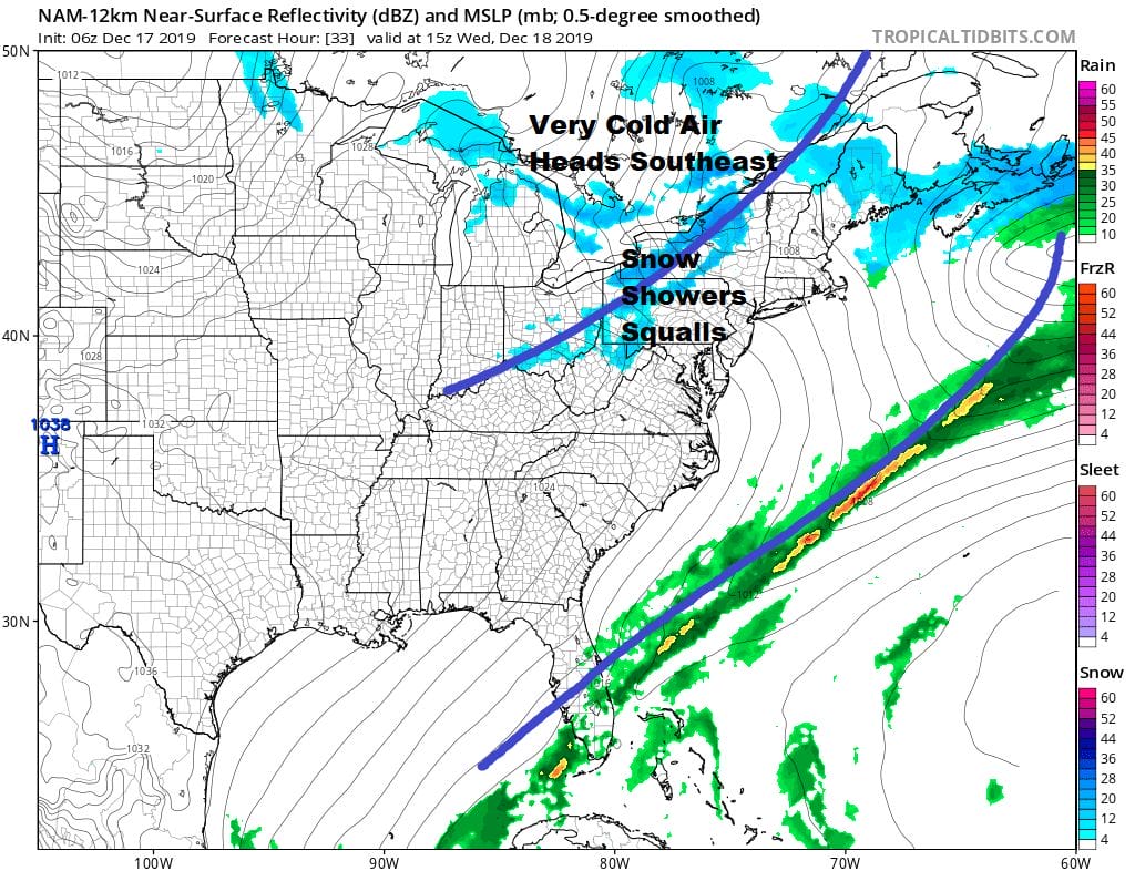
Very cold air is headed our way and it will be preceded Wednesday with an arctic front late in the day. We could see some snow showers and even a heavier snow squall is possible. Then it turns windy and very cold. Thursday morning lows will be in the teens and single digits with wind chills below zero. Sunshine Thursday will do little to bring temperatures up with highs not getting out of the 20s. Then it is down to the teens and a few single digits Thursday night into Friday morning. We see weather conditions calming down for Friday and the weekend. While Friday will be cold with some sunshine as highs get back into the 30s, Saturday we should reach the mid and upper 30s and Sunday will be back into the 40s. We see at least some sun each day for the weekend and little if any chance for rain or snow. Christmas is next Wednesday and we will take a look at prospects for the long range later today.
BE SURE TO DOWNLOAD THE FREE METEOROLOGIST JOE CIOFFI WEATHER APP &
ANGRY BEN’S FREE WEATHER APP “THE ANGRY WEATHERMAN!
MANY THANKS TO TROPICAL TIDBITS FOR THE USE OF MAPS
Please note that with regards to any severe weather, tropical storms, or hurricanes, should a storm be threatening, please consult your local National Weather Service office or your local government officials about what action you should be taking to protect life and property.


