
WINTER STORM WARNING SNOW DEVELOPING LATE SNOW MELTS SUNDAY
WINTER STORM WARNING SNOW DEVELOPING LATE
SNOW MELTS SUNDAY

This has to be the toughest forecast of the entire winter regarding the rain snow line which may or may not make it across Long Island into Southeast NY. There will be narrow band of heavy snow near the change over line as is always the case. It may wind up setting up just inland of the coast or it may wind up setting up just south of the south shore of Long Island and north and west of the New Jersey turnpike. This forecast is likely to bust for some portion of the region but you get the idea here. Numbers will skew higher if the atmosphere is as little as a degree colder.
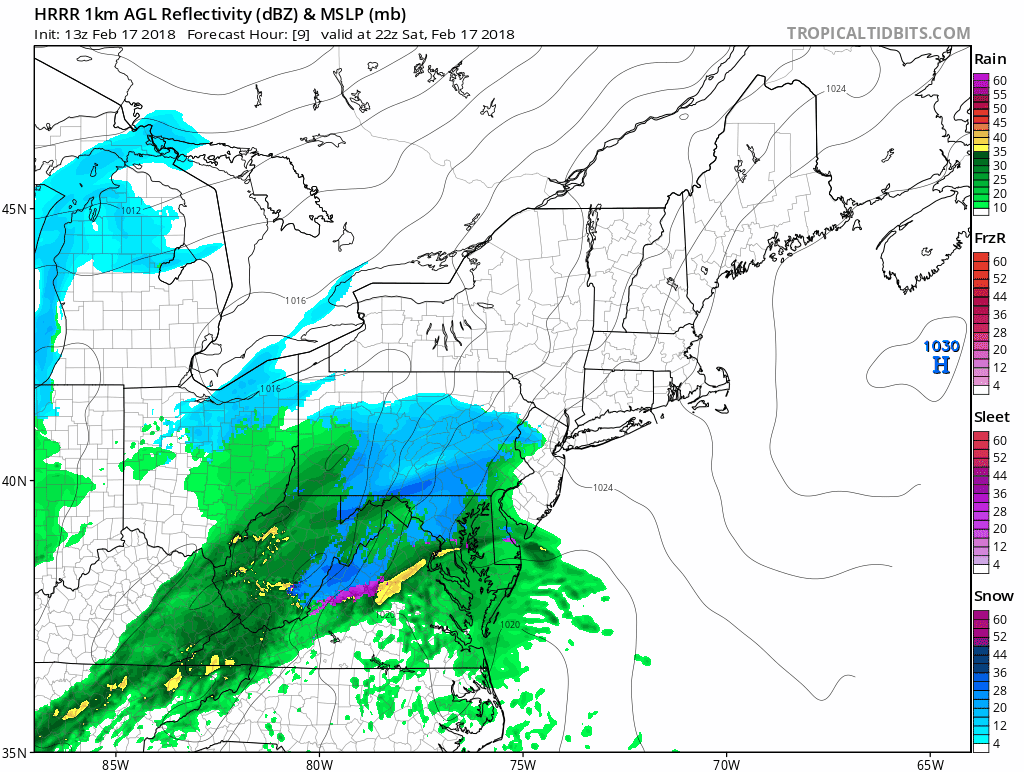
HRRR MODEL FOR THIS EVENING CLICK TO ANIMATE
NAM MODEL FOR THIS EVENING CLICK TO ANIMATE
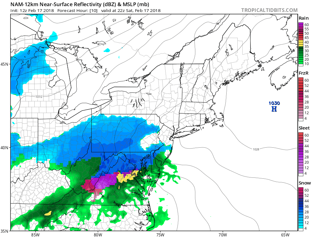
The map above is the HRRR model for this evening which keeps it all snow while the map below is the NAM model which now brings a change to rain along the immediate coast but barely. This really boils down to about a one degree shift in either direction in the temperatures aloft. For inland areas this is not a big forecast issue though it should be noted there are a few models that bring rain further inland of the coast. This is why I have basically left my snow forecast alone from last night.
SNOW FORECAST FOR SATURDAY AND SATURDAY NIGHT
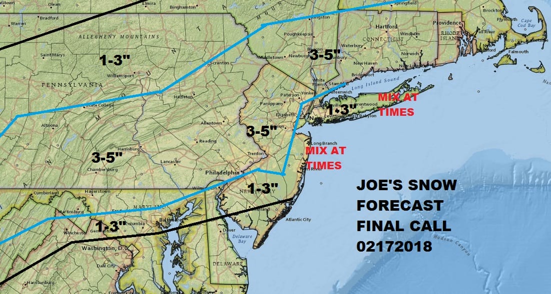
The coast has the greatest chance for error. National Weather Service forecasts are much higher as they are banking on the bottom of the atmosphere being cooled by the strong dynamics at play. The inland numbers have a good chance of happening but here too I did not go as high as the National Weather Service.
Meanwhile this morning we are starting with sunshine but clouds are rolling in now from the southwest and we should be completely overcast by midday in most of the area. Snow will develop this afternoon and continue into tonight. It will end from west to east between midnight and 5am. The sun will be out when you wake up Sunday morning.
US SATELLITE

REGIONAL RADAR

For now radars are quiet but we should see snow breaking out across Southern Pennslyvania in the early afternoon and it should be snowing just about everywhere except may for coastal and Southeast New Jersey where it will start as a mix or just rain.
Sunday temperatures will rise. There is absolutely no cold air to speak of behind this storm so highs will reach the 40s everywhere. Monday a warm front approaches with arriving clouds and highs in the upper 40s to mid 50s with an onshore wind. Some showers late Monday into early Tuesday morning. Then it is an early taste of spring Tuesday with breaks of sunshine and highs in the 60s with some spots approaching 70. Whatever happens today with the snow it will be gone by Monday at the latest in most places.
 GET JOE A CIGAR IF YOU LIKE

FiOS1 News Weather Forecast For Long Island
FiOS1 News Weather Forecast For New Jersey
FiOS1 News Weather Forecast For Hudson Valley


